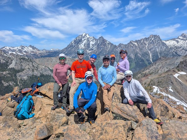
Policy Update: We're encouraged to share that public lands sell-offs were kept out of the final Senate budget reconciliation bill. Washington's public lands are now safe from the recent threat of public lands sell-offs. We appreciate the thousands of Mountaineers that took action to oppose this harmful provision. Our collective advocacy made a difference.
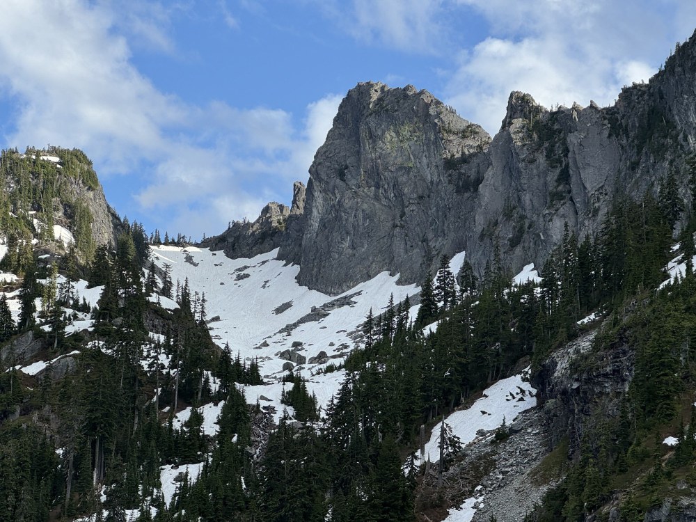
Last week, I led a climb of The Tooth - my fifth trip with Mountaineers students on this classic climbing route near Snoqualmie Pass. My favorite part of being a rope leader on these trips is when my follower arrives at the top of the second pitch, looks around at the 360-degree view, and beams a giant smile when they fully realize the joy of being in Washington’s alpine environment.
It’s not just the views and the rock that make The Tooth special.
An early morning approach via Snow Lake Trail offers the solitude to enjoy wildflowers, pikas, and birdsong in the boulder fields along the way. When you reach the terminus of the Source Lake Trail, the beauty of Great Scott Basin reveals itself, framed by Denny Mountain, The Tooth, and Chair Peak. This glorious sight in the early mountain light reminds me how special these outdoor experiences are for me and my Mountaineers community.
I arrived home from the trip to an action alert email from The Mountaineers detailing another round of proposed public lands sell-offs, this time on the Senate side, following House efforts last month. According to Mountaineers partner Outdoor Alliance, “nearly 300 million acres of public lands could be open for these proposed sales, an area that includes nearly 100,000 miles of trails, more than 45,000 climbing routes and boulder problems, and 3,405 river miles across the West.”
I clicked open the map that accompanied the alert, toggled over to the Evergreen State, and my heart dropped. Much of the route from our climb that morning is a part of Washington national forest lands at risk of being sold for development in Congress’ latest attempt to sell off public lands to raise revenue through the federal budgeting process.
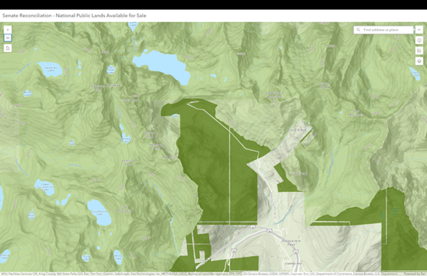 Image from Outdoor Alliance's map showing the Tooth and surrounding areas at risk of public lands sales through the Senate reconciliation bill. Image courtesy of Outdoor Alliance.
As I continued to explore the map, I saw more and more places where Mountaineers recreate. I decided to look up the proposal in the news and read a comment that the lands proposed to be sold off are “barren stretches next to highway billboards.” But, they aren’t! They’re the places where we climb, hike, trail run, and ski. We’re at a critical inflection point in public lands advocacy - these places need our collective voice.
On my pretty, mountain-filled drive up to Snoqualmie Pass that morning, I passed many parcels proposed for sale, including McClellan Butte - the backdrop for the first scramble my husband and I did together. Next along the drive was Humpback Mountain, where I did my first Mountaineers scramble and my final mentored lead to become a Scramble Leader.
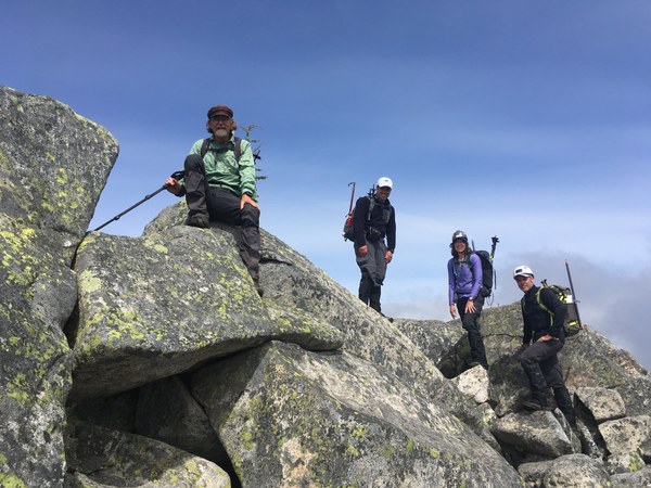 Scramblers on top of Humpback Mountain. Photo by Danielle Graham.
Just east of Humpback Mountain lie Annette Lake and Silver Peak, both on the map. Annette Lake is one of the most popular hikes in Snoqualmie Pass, and Silver Peak is a popular winter scramble and backcountry ski destination.
The area around Mt. Catherine, a popular hiking destination as well as cross-country ski route in the winter, was on the map as well. I try to ski the whole Mt. Catherine Loop, a groomed 10-mile trail that circles the peak, at least once a year. My finger followed I-90 east on the map to some other familiar places. Easton Ridge, a popular hike for the Mountaineers Naturalists group, was there.
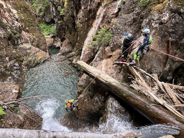 Mountaineers on a 2024 trip to Mineral Canyon. Access to Mineral Creek, an outstandingly beautiful destination for canyoning north of Little Kachess Lake, would be threatened by public lands sell-offs. Photo by Danielle Graham.
Going further east, I noticed that much of The Teanaway in Kittitas County was incorporated in the current proposal. This includes many popular scrambling, trail running, backpacking, and climbing destinations, as well as beautiful wildflower and larch hikes. Some of the peaks at risk are Koppen Mountain, South Ingalls, Esmeralda, Earls, Hawkins, and, saddest of all, Bean Peak. Bean is where generations of scrambling students have enjoyed grippy rock and beautiful views into The Enchantments while on their Experience Field Trips.
Mountaineers scrambling students on Bean Peak. Photo by Karen Wallace.
In addition to the larches, which are stunning in the fall, The Teanaway also hosts whitebark pines on many of its summits. This tree was listed as “threatened” in 2023 under the Endangered Species Act. We should be protecting its habitat rather than selling it off. Looking a bit further east on the map, I noticed backcountry ski and snowshoe destinations along Blewett Pass, including Diamond Head, were in the proposal.
It was getting late, and I was tired after the climb that day, but I wanted to look at one more of my favorite places before I went to sleep: the Middle Fork of the Snoqualmie. Long known as a hiking and backpacking locale, the recent growth in route development has created more recreation opportunities for climbers. According to American Whitewater, one of the most significant outdoor recreation areas close to metropolitan Seattle is the Middle Fork of the Snoqualmie River. Less than an hour drive from downtown, the valley is accessible to a population of over three million people and attracts visitors from across the country. Few places in the country can boast such an incredible resource that is so accessible. The river feels remote as it winds through a forested river valley largely in public ownership, and it was designated as Wild and Scenic River in 2014.
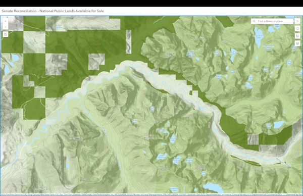 The Middle Fork Snoqualmie area shown on Outdoor Alliance's map. Image courtesy of Outdoor Alliance.
I was saddened to see how much land on the north side of the river was included in the Senate proposal. Selling these lands would affect access to some of the recently developed climbing areas near Quartz Mountain, as well as all the work that has gone into making this river corridor “Wild and Scenic.” Whitewater paddling is very popular along this stretch, and our Mountaineers packrafting committee takes students and paddlers into the corridor every spring.
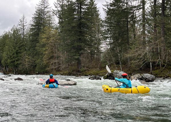 Students on a whitewater packrafting field trip on the Middle Fork of the Snoqualmie. Photo by Danielle Graham.
Outreach to Congress Works
By the time I closed my computer and climbed into bed that night, the joy of spending the day in a beautiful place with a wonderful group of Mountaineers had been replaced by the dread of losing so many of these places out of public hands if the Senate’s spending package goes forward.
The good news is that since my trip, these harmful public lands sales were removed from the current version of the Senate reconciliation bill. Our national forests are safe from public lands sell-offs for now, but they may crop up again. The threat is far from over, so we need more outdoor enthusiasts to speak up for the lands they love through advocacy.
In my trip down memory lane, I highlighted a few areas in our state that were threatened. I encourage you to take your own trip down memory lane, jot down a few of your stories of places on the Senate Reconciliation - National Public Lands Available for Sale Map that may still be at risk. Then take the next step by reaching out to your members of Congress to share those stories and ask them to keep public lands in public hands. There are easy links and sample scripts that you can access and modify through this blog and advocacy action from The Mountaineers.
Outreach to Congress works. Just a few weeks ago, our collective efforts helped remove over 500,000 acres of public lands sales from the House version of this bill, and now, our joint advocacy has helped keep our national forests safe from sell-offs.
Let’s keep defending our public lands so that they don’t face this threat again in the future. Help make it possible for me to take many more climbing students up The Tooth, and for future generations of Mountaineers to experience these and so many other amazing places on Washington’s federally managed public lands.
Danielle Graham is a Mountaineers leader, advocate, and member of the Outdoor Alliance Grasstops Collective.
Add a comment
Log in to add comments.Thanks for writing this and helping make more people aware! Glad to see advocacy is making a difference.
 Danielle Graham
