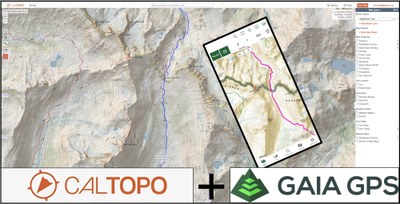
Lecture: GPS Navigation: Using CalTopo and Gaia GPS
Evening Zoom Workshop - Online Classroom
Join our beginner-friendly online workshop to unlock the potential for exciting and safe outdoor adventures using two empowering tools: CalTopo to create home-printable maps annotated with waypoints and routes, and Gaia GPS to guide you in the field along with your compass and altimeter. Curious? Listen to what the Blissful Hiker had to say after she took our class to prepare for a through-hike of the CDT and get inspired: https://pca.st/aainqld1
- Wed, Jun 14, 2023
- Seattle Navigation Committee
- Navigation
- Adults
- Casual
- 13 (30 capacity)
- 1 (5 capacity)
- Sun, May 14, 2023 at 12:00 AM
- Mon, Jun 12, 2023 at 5:00 PM
- Cancellation & Refund Policy
- iCal Google
This entry-level class introduces the modern way to use both physical and digital/GPS-enabled maps in planning and executing your wilderness navigation adventures. The class consists of two parts:
=== Click MORE for details on this course ===
- A self-paced online presentation with exercises that you must view and complete at home (approximately 4-6 hours to complete) - prior to the Workshop. This is a serious time commitment, and we encourage the students to start early! YOU CAN FIND THE LINKS UNDER THE "MATERIALS" TAB AS SOON AS YOU ARE REGISTERED.
- A Zoom workshop that focuses on creating a customized home-printable physical map for a short trip, uploading this data to the Gaia GPS app on your cell phone. We will discuss and demonstrate (as best we can on Zoom) how to use the physical map in concert with the digital map (Gaia), a compass, and an altimeter (approx 2.5 hours).
The applications used in this class are Gaia GPS on a cell phone (for either Android or iOS) and CalTopo—the premier online custom physical map creation tool.
Students need to register and pay for this main class, then register for one of the Zoom workshops. The online presentation will be available to the student 2 weeks prior to the start of the Zoom workshop that you signed up for. Students MUST complete the self-paced online presentation prior to attending the workshop. Once you complete both parts, you will earn a Basic GPS Course badge.
Learning goals:
- Understand that Maps—both physical and digital—are the core of wilderness navigation representing two of the five tools of modern wilderness navigation.
- Understand how to create physical maps to print at home that are specific to your planned trip, learn the differences between various base maps, know how to choose an appropriate scale and reference grid, how to create custom waypoints and routes, how to print, and how to upload these customizations in a GPX file for Gaia GPS.
- Understand digital maps: how GPS works, differences between digital maps, and how to download appropriate maps to Gaia GPS.
- Understand how to recognize common accuracy and technology issues when using a GPS device, and various solutions available.
- Understand what options are available for emergency communications:
- One- and two-way satellite communicators and Personal Locator Beacons (PLBs).
- How satellite communicators and PLBs are used in a rescue scenario.
- Why all parties traveling in the wilderness should strongly consider carrying a satellite communicator or PLB.
- Trip Planning Workflow: Understand how CalTopo and Gaia GPS are awesome tools for trip planning and how they fit into this broader topic.
- Receive a brief introduction to the critical topics of Situational Awareness and the Ethic of Self-Reliance.
Curious about what the class is like? Listen to the June 17, 2021, podcast of the Blissful Hiker as she took this class to prepare for her through-hike of the CDT: https://pca.st/aainqld1
An online Zoom invitation will be sent out a few days prior to the class.
Badges
students will earn:
instructors will earn:
Required Equipment
- Cell phone with the latest Gaia GPS app installed. You will need a basic Gaia GPS membership ($20/year) or a Premium membership ($40/year). A one-year free Premium membership is available to all Mountaineers members at mountaineers.org/membership/benefits
- A laptop or desktop computer, either Apple- or Windows-based, is required. Tablets could possibly work but they are troublesome and we will not have time to attempt troubleshooting.
- A magnetic compass, preferably (but not required) with declination adjustment and a baseplate.
- The following computer skills are required: The ability to download and upload files to your iOS/Android device and your computer via the internet, the ability to send and receive an email, and the ability to install applications on your iOS/Android device.
- "Freedom 9": The 600-page climbing text called Mountaineering: The Freedom of the Hills, 9th Ed. (2017), chapter 5, "Navigation," is good background reading for this class but is absolutely not required. Earlier editions of Freedom would be less helpful.

 Basic GPS Course