Clinic
Advanced Off-Trail Navigation - Heybrook Lookout & Ridge
Sharpen your off-trail (bushwhacking) skills along this 5 mile course. Practice accurately navigating through dense vegetation and other terrain obstacles.
- Sun, Apr 27, 2025
- Seattle Navigation Committee
- Navigation
- Adults
- Moderate
- Moderate
- Mileage: 4.0 mi
- Elevation Gain: 900 ft
- High Point Elevation: 1,900 ft
- $50.00 $65.00
- 3 (12 capacity)
- FULL (9 capacity)
- Mon, Feb 3, 2025 at 6:00 AM
- Fri, Apr 25, 2025 at 5:00 PM
- Cancellation & Refund Policy
- iCal Google
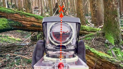
A Basic Navigation badge, and a mirrored compass are required to attend. This course will include pre-trip planning, situational awareness, terrain recognition, 500 meter bushwhacking exercises, 250-300 meter Labyrinth exercises, altimeter and GPS use, and how to get the most out of a mirrored compass. Practice using the UTM grid to quickly estimate distance, then visually comparing that estimate to the terrain.
The off-trail difficulty rating for this course is moderate, and will vary depending on the time of year, foliage density, and water levels. Steepness is low, however you will encounter some dense vegetation and other terrain obstacles. This will require you to occasionally use both hands for balance, and to test where you are stepping. You'll need to be in reasonable physical condition as the elevation gain is about 1200 feet.
Meet time: Students arrive 7:15am, Instructors 6:45
Meet Location: Meet at the giant saw blade in Doolittle Pioneer Park, Index WA.
WGS84 UTM Zone 10T 608198E 5297323N
47.82017, -121.55457
Heybrook Lookout & Ridge
-
USGS Baring
USGS Index
Green Trails Index No. 142
Green Trails Alpine Lakes West (Stevens Pass) No. 176S - See full route/place details.
Required Equipment
Come prepared as you would for a scramble or hike in varied weather. Bring over-the-ankle high-top boots, a waterproof outer layer, warm clothes in layers, protective eyewear, thick gloves, food, water. Bring a barometric altimeter (AltimeterPlus app for phone is okay), Smartphone with Gaia GPS with backup power, headlamp, whistle, pencil and paper for notes.
