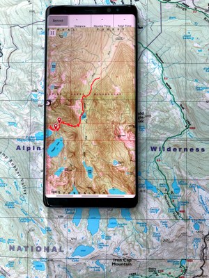
Navigation Course
GPS Navigation: Using CalTopo and Gaia GPS
This online class plus a one-evening workshop (conducted online in 2020) is an introduction to GPS Navigation, Trip Planning, Online Map Making, and a Navigation Workflow. The curriculum will focus on using GPS in Trip Planning and in Navigation Workflow.
- Rolling Enrollment: Sun, Dec 1, 2019 - Thu, Dec 31, 2020
- Committee: Seattle Navigation Committee
- Members: $45.00 Guests: $65.00
- Availability: 43 (92 capacity)
- Cancellation & Refund Policy
This is an entry-level class that introduces GPS and how the Trip Planning Workflow makes use of GPS. The class consists of two parts:
=== Click MORE for details on this course ===
- An online presentation with exercises that you must view and complete at home (approx 4-5 hours to complete) - 2 weeks prior to the In-Person Workshop.
- An in-person workshop (conducted online in 2020) that will focus on planning a short trip, uploading this data to your device, and then using the data to navigate around the Program Center (approx 2.5 hours).
The applications used in this class are Gaia GPS on a cell phone (for both Android and iOS devices), and CalTopo for the online trip planning segment.
Students will need to register and pay for this main class, then register for one of the in-person workshops (online in 2020). The online presentation will be available to the student 2 weeks prior to the start of the workshop of your choice. Students MUST complete the presentation prior to attending the workshop. Once you complete both parts, you will earn a Basic GPS Course badge.
The learning goals for this class:
- Understand that a GPS device is one of the five tools of modern wilderness navigation.
- Understand how GPS works, its history, and the various networks available.
- Understand how to recognize common accuracy and technology issues when using a GPS device, and various solutions available.
- Understand what options are available for emergency communications:
- One- and two-way satellite communicators and Personal Locator Beacons (PLBs)
- How they are used in a rescue scenario
- Why all parties traveling in the wilderness should strongly consider carrying a satellite communicator or PLB.
- Understand what options are available and the trade-off between cell phone GPS applications and dedicated GPS devices.
- Understand how the Trip Planning Workflow makes use of GPS.
- Obtain a basic level of understanding of Gaia GPS and CalTopo to be able to plan a trip and navigate short routes in the field following a course/bearing, track, route, and waypoints.
Badges you will earn:
This course has no scheduled activities.
A GPS enabled device with the latest Gaia GPS App installed. This can be either an iOS or Android device. The Gaia GPS application is free to download, and Mountaineers membership includes a premium subscription for a year.
A laptop computer (or tablet) with internet connectivity. You will need to connect to the internet and view the online presentation before joining the in-person workshop (online in 2020). You will need to bring this computer to the in-person workshop and be able to connect to the Mountaineers public Wi-Fi. You should also be able to receive and send email from this laptop.
Digital map of the Seattle Program Center area pre-loaded into your device prior to workshop.
Headlamp for the outdoor exercises.
Appropriate clothing for the weather. The in-person workshops have an outdoor session.
The following computer skills are required: The ability to download and upload files to your iOS/Android device and your computer via the internet, the ability to send and receive email, and the ability to install applications on your iOS/Android device.
| Name/Description |
|---|

 Basic GPS Course