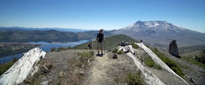
Field trip: Conditioning Hiking Series
CHS 2 Hike - Esmeralda Basin–Gallagher Head Lake Loop
We will do a counter-clockwise hike around Esmeralda Peak with a hike up Fortune Pass, proceed to Gallagher Head Lake and follow De Roux Creek back to the Trailhead. CHS hike led at a CHS 2 pace (2.0-3.0 mph)
- Sat, Jul 1, 2023
- Seattle Hiking Committee
- Day Hiking
- Adults
- Moderate/Strenuous
- Moderate
- Mileage: 12.0 mi
- Elevation Gain: 2,940 ft
- High Point Elevation: 5,950 ft
- Pace: 2.0-3.0 mph
- 2 (9 capacity)
- Wed, Jun 21, 2023 at 1:00 PM
- Thu, Jun 29, 2023 at 5:00 PM
- Cancellation & Refund Policy
- iCal Google
Here is a good description of the hike: Esmeralda-peak-loop
Details will be emailed to registered participants a few days before the hike. We will be hiking for about 6-7 hours including brief stops for views and snacks.
Check current weather here: Mountain-Forecast
We will meet at the Tibbetts Valley Park & Ride at 6:00 am, consolidate hikers into carpools and depart for the trailhead by 6:15. We will carpool about 2 hours to DeRoux Trailhead, Northwest Forest Pass Required.
From the Park & Ride, it’s about a 100 mile drive to the trailhead that takes around 2.0 hours each way. We highly recommend carpooling for this hike (at $0.15/mile this is about $30 for carpool). However, if you choose to drive straight to the TH, meet us there no later than 8:15 a.m. Allow plenty of time to get there.
Directions to the Tibbetts Valley Park & Ride
Take exit 15 (WA-900 W/17th Avenue NW) off I-90 eastbound. Take a right at the bottom of the ramp. Drive approximately ½ mile and turn left on Newport Way NW. Take the first right into the Tibbetts Valley Park & Ride. (Not the multi-level parking garage on your left.) Drive past the Skate park. We will meet at the far end of the parking lot.
Directions to the DeRoux Trailhead
From I-90, take exit 85. Get on Highway 970 (also signed for Highway 10), and drive seven miles to the turnoff for the Teanaway Road. Turn left onto this paved road and proceed north for 7.5 miles to where the pavement ends. When the pavement ends, continue straight, now on the North Fork Teanaway Road 9737. Continue straight for about 8.5 miles to where the road splits. Take a left, arrive in the DeRoux campground. Take the righthand fork near the campground and park, allowing room for others to pass.
DeRoux Creek
-
Green Trails Alpine Lakes East (Stuart Range) No. 208SX
Green Trails Mt Stuart No. 209
USGS Mount Stuart - See full route/place details.
Required Equipment
Ten Essential Systems
- Navigation (map & compass)
- Sun protection (sunglasses & sunscreen)
- Insulation (extra clothing)
- Illumination (headlamp/flashlight)
- First-aid supplies
- Fire (waterproof matches/lighter/candle)
- Repair kit and tools
- Nutrition (extra food)
- Hydration (extra water)
- Emergency shelter (tent/plastic tube tent/garbage bag)
