Field trip: GoHike: Beginner Hiking Course
July Hikes: 3.75 to 6.5 miles, 500 to 1,750 feet gain - Glacier Basin (Mount Rainier)
Come, get up close to Mt. Rainer! There will be wildflowers, too, with time to pause, enjoy and take pictures. Be aware that the route starts at ~4400' elevation and goes up to ~5900'. While the elevation gain is not great, hiking at this altitude for us who reside a sea level can feel strenuous. Our pace will be whatever is comfortable for everyone. This hike counts toward your monthly required GoHike course hike for July.
- Tue, Jul 11, 2023
- Foothills Hiking Committee
- Day Hiking
- Adults
- Moderate
- Moderate
- Mileage: 6.5 mi
- Elevation Gain: 1,700 ft
- High Point Elevation: 5,900 ft
- Pace: 1.5 - 2 mph
- 8 (8 capacity)
- 2 (2 capacity)
- Fri, Jun 2, 2023 at 8:00 AM
- Wed, Jul 5, 2023 at 5:00 PM
- Cancellation & Refund Policy
- iCal Google
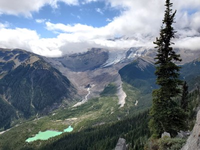
The trail ascends the upper White River valley through forest, past mining relics, flower meadows and ends in the glacial moraine at Glacier Basin Camp with views of Mount Rainier and Saint Elmo Pass. Elevation gain is gradual but continuous. There will be wildflowers (yippee) with time to pause, enjoy and take pictures. Here's the GPS route - https://www.gaiagps.com/public/YigjPz0aINBrsKxAMTbED8ku WTA hike description including additional driving directions https://www.wta.org/go-hiking/hikes/glacier-basin
Please be ready to hike at 8:00am. Meet near the bathrooms in the backpacker/hiker parking lot next to the White River campground. Google map link - https://goo.gl/maps/nvVDU6i9PwsGQaX69 From that location, we will walk together to the trailhead. My experience is that there's no cell reception in this location; so, it's important that you understand where we're meeting, as I won't be able to contact you. National Park Pass required for entrance to Mt. Rainier National Park.
Glacier Basin (Mount Rainier)
-
Green Trails Mount Rainier Wonderland No. 269SX
Green Trails Mt Rainier East No. 270 - See full route/place details.
Required Equipment
Your leader will send out a Hello Hiker email prior to the hike with details on the hike, as well as recommended and required equipment.
