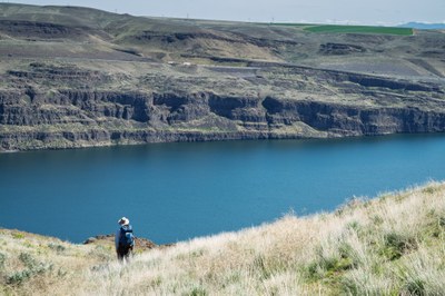
Trip Report
Naturalist Trip - Ginkgo Petrified Forest
We did a loop north from Rocky Coulee across the area, looking for flowers and birds while discussing the geology. The area had burned and much of the sagebrush was gone, now replaced by a cheatgrass prairie.
- Fri, Apr 11, 2025
- Naturalist Trip - Ginkgo Petrified Forest
- Ginkgo Petrified Forest
- Naturalist
- Successful
- Road suitable for all vehicles
-
The jeep track climbed up the hill. It had a few loose rocks, but was easy hiking. We did a loop back from the top across the prairie, careful to not make a trail.
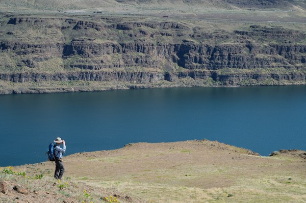
The grassy slope descends steeply. Last year’s bunchgrass dominated this area, while much of our hike was through invasive cheatgrass. The flowers were relatively abundant on this early April day, prompting us to stop frequently for identification. A few Carey’s balsamroots bloom along this slope. However, the view and my thoughts caused me to pause.
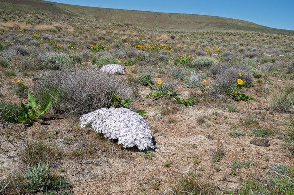
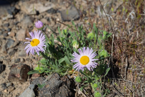
My GPS unit indicated that my feet were at 1243 feet above sea level. It is a long way down to the Columbia River, which is 573 feet above sea level. I was trying to understand the water’s depth during one of the late Pleistocene Missoula Floods. According to the book “Cataclysms on the Columbia: The Great Missoula Floods,” the water would have been a foot over my head when it reached 1250 feet above sea level.
At the end of the Pleistocene, a lobe of the Cordilleran Ice Sheet extended into northern Idaho, blocking the Clark Fork River. Water accumulated behind this dam, creating what is known as Lake Missoula. Periodically, perhaps 40 or more times over two thousand years, the water became deep enough to lift the multi-thousand-foot-thick ice dam, causing the ice to crack and disintegrate rapidly. A wall of water, several hundred feet high and filled with icebergs, rocks, sediment, and other debris, rushed out. The lake drained in less than a week, sending more water down the Columbia River and across central Washington than is currently found in all the world’s rivers.

To my right, I can see Sentinel Gap, where the Columbia cuts through Rattlesnake Ridge. It seems like it would be a bottleneck for all that water, but the true bottleneck apparently occurred farther downstream at Wallula Gap. This gap is where the Columbia makes a westward turn and forms the boundary between present-day Washington and Oregon. The volume couldn’t pass through the opening, causing it to back up. Think of it as if you were to dump a large bucket of water into your sink. There is too much water for it to flow down the drain, and the sink fills up. If you pour it too quickly, the sink could overflow. And that is what happened to this valley.
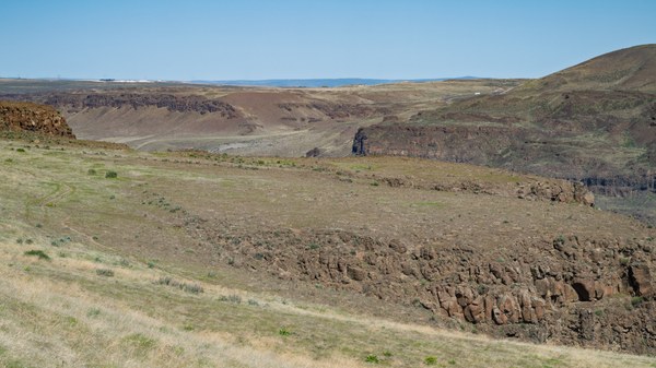
Geologists refer to the backed-up water as Lake Lewis. The lake reportedly formed rapidly, perhaps in a day or two, and persisted for about a week or two before draining. Scientists describe the flood as cataclysmic! Echo Basin is barely visible upstream, across the river, and Frenchman Coulee lies just beyond. Those floodwaters tore out the basalt columns and lava beds at both locations, carving the valleys back into the highlands. The wall of water rushing out of the Quincy Basin reached several hundred feet in height. As it crashed over the cliff, the force and resulting turbulence created back eddies, yanking rocks, tearing them from the walls, and sending them downstream.
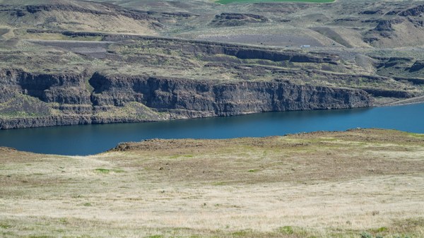
My eyes returned to the river, particularly to the cliff on the opposite shore. The Miocene lava flows reveal layer upon layer of basalt, angling slightly downward toward the south. This slope resulted from the buckling that occurred after the material solidified some 15 or 17 million years ago. It is hard to believe that ancient fissures in eastern Washington, Idaho, and northeastern Oregon expelled billions of tons of lava, enough to create a lake of molten rock across the Columbia Basin. Over the course of a few million years, the earth opened more than 300 times, releasing these lava flows, some of which traveled down the Columbia Gorge and out to the ocean.
What kind of force must have been required to buckle those basalt layers? Geologists refer to this as an “anticline,” where the stratified rock slopes downward from the crest. Frenchman Hill is on that side, and its summit remained above the Missoula floods. Behind me, the ridge extends westward. As the folding occurred, it happened slowly enough for the river to continue cutting through the rock, maintaining its position. I gazed downriver toward Sentinel Gap, trying to fathom what had transpired. The oceanic plate pressed against the continental plate at an angle through Oregon, causing the folding. Please grant me more brain power so I can comprehend.
We stopped for lunch a few hundred yards back, where we could look south along the river. The elevation at that spot was 1,280 feet, so we would have been above the water if another flood had suddenly arrived. Those torrents traveled at sixty miles an hour or more, and scientists believe one would have heard the roar at least thirty minutes before it arrived. When Hurricane Agnes swept through Pennsylvania, I witnessed massive flooding, raging creeks, and rivers, but those were nothing like what this must have been.
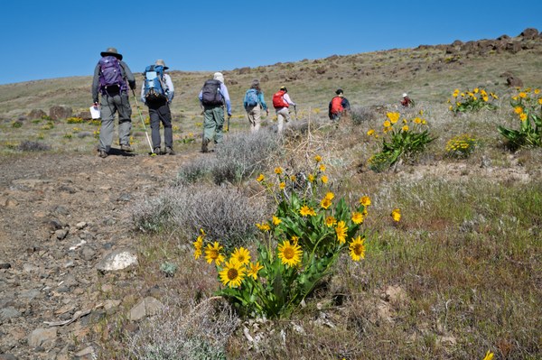
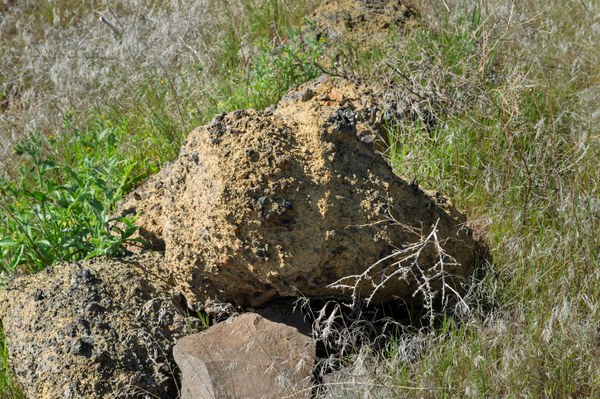
This morning, we started up the jeep trail from Rocky Coulee, turning north at a side wash to climb to the crest of the ridge. The trail was composed of broken basalt and sand grains, likely from the basalt. However, occasionally, a lighter-colored rock would appear. I picked one up and called Stewart, our leader, over. “What do you think this is, granite, Stewart?” I asked. He rolled it over and said, " Look, feldspar, mica, hornblende- yup, granite. Interesting!”
It seemed odd to find plutonic rock like granite atop basalt. We began searching and soon discovered other small chunks of granite, along with a few basketball-sized ones off in the grass. The geologists explained that chunks of ice had accompanied the floods. They carried rocks, gravel, and even truck-sized boulders. The trail ascended the backside of a ridge and this area would have been a back eddy for the main channel. Ice may have drifted up here, run aground, and then melted, leaving behind those pieces of granite and rock from farther north.
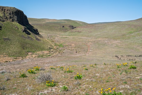
After our group continued up the dirt track this morning, I stood for several minutes looking northwest to Rocky Coulee and northeast across the basalt ridge toward the Columbia—so much change in the last decade. When I first hiked here in March 2018, the sagebrush habitat in Rocky Coulee had burned a few years earlier; all the sagebrush and most of the rabbitbrush were gone, while the area to the northeast still supported thick sagebrush steppe with all the expected species. Then, that summer, a wildfire swept through the other part.
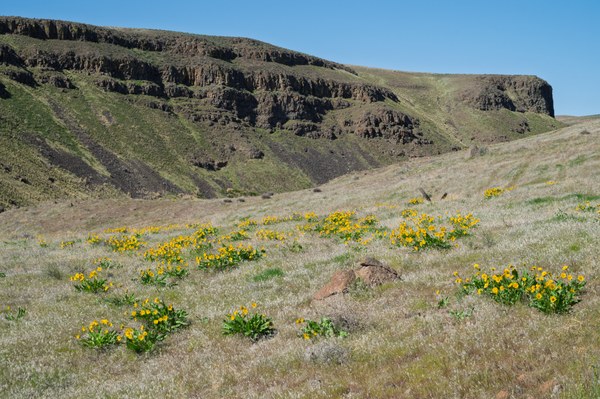
Now, it resembles more of a grassland dotted with a few wildflowers rather than a sagebrush ecosystem. Several short, big sagebrush plants bordered the dirt track this morning, but virtually none now exist across these hills. In 2018, the unburned area was filled with lush, thick sagebrush that reached my shoulder, forcing me to twist and turn to navigate through it.
Cheatgrass, Bromus tectorum, now appears to be the dominant plant here. This invasive annual, which originated from Europe and Asia, is outcompeting native species. It grows rapidly, produces seeds, dries out, and then burns easily. Cheatgrass has contributed to an increase in fire frequency and intensity. The fires create ideal seedbeds for the next generation. An article from the Center for Sustainable Agriculture and Natural Resources states that the spread of cheatgrass and climate change are causing the disappearance of sagebrush shrub-steppe and the formation of cheatgrass prairies. Clearly, the rapidly growing grass absorbs water and nutrients quickly, rendering these essentials unavailable to native species. Populations of animals, birds, and insects have decreased. Cheatgrass presents a conservation disaster.

At the trailhead, a sign asked everyone to carefully brush their boots, and a brush device cleaned the bottoms and sides. Clean boots help prevent carrying seeds from other areas into this place. The US Fish and Wildlife Service, along with Washington State Parks, has initiated a sage-steppe restoration project at Ginkgo State Park. In fiscal year 2025, it received $106,466 in federal funding. The project focuses on protecting unburned areas so they can serve as a seed source for restoration. Unfortunately, with the cuts that the new administration is implementing at the national level to our federal agencies, this project may be at risk.
High-pitched, tingly notes pulled me from my mulling. I scanned the air, searching for horned larks. Five flitted 20 feet above the slope, zigzagging before finally disappearing upriver. One of those patches of healthy sage steppe lies in that direction, about half a mile away. Two years ago, a friend and I hiked that far. It was great to see vibrant big sagebrush and all the associated natives. As we entered the patch, a small flock of white-crowned sparrows hopped up to investigate us.
Regrettably, we lack the time to hike there today, so we turn right and return to the trailhead. Support for our state and federal agencies is essential for protecting our natural lands. As individuals, we need to ensure we don’t contribute to the spread of cheatgrass by keeping our boots clean and not igniting wildfires.
A bird list for the day can be found here: https://ebird.org/checklist/S225258734
Thanks to Cristy, a plant list for the day.
|
Family |
Scientific Name |
Common Name |
|
??? |
Grayia spinosa |
spiny hopsage |
|
??? |
Nothocalais troximoides |
sagebrush false dandelion, false agoseris |
|
??? |
Salsola tragus |
prickly Russian thistle, southern Russian thistle |
|
??? |
Toxicoscordion paniculatum |
foothill death camas, sand-corn |
|
Apiaceae |
Lomatium macrocarpum |
big-seed biscuitroot, biscuit root |
|
Asteraceae |
Achillea millefolium |
yarrow, gordaldo |
|
Asteraceae |
Artemisia tridentata |
sagebrush, big sagebrush |
|
Asteraceae |
Balsamorhiza careyana |
Carey's balsamroot |
|
Asteraceae |
Balsamorhiza hookeri |
Hooker's balsamroot |
|
Asteraceae |
Erigeron linearis |
desert yellow fleabane, desert yellow daisy |
|
Asteraceae |
Erigeron poliospermus |
purple cushion fleabane, Kittitas fleabane |
|
Boraginaceae |
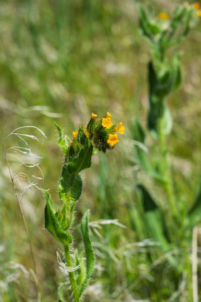
Amsinckia menziesii |
common fiddleneck, Menzies' fiddleneck |
|
Brassicaceae |
Draba verna |
spring whitlow-grass, shadflower |
|
Brassicaceae |
Sisymbrium altissimum |
tall tumblemustard |
|
Fabaceae |
Astragalus leibergii |
Leiberg's milk-vetch |
|
Fabaceae |
Astragalus purshii |
woolly-pod milk-vetch, Pursh's milkvetch |
|
Geraniaceae |
Erodium cicutarium |
redstem storksbill, redstem filaree |
|
Polemoniaceae |
Phlox hoodii |
spiny phlox, carpet phlox |
|
Polemoniaceae |
Phlox speciosa |
showy phlox |
|
Polygonaceae |
Eriogonum sphaerocephalum |
rock wild buckwheat |
|
Polygonaceae |
Eriogonum strictum |
Blue Mountain buckwheat |
|
Polygonaceae |
Eriogonum thymoides |
thyme wild buckwheat |
|
Ranunculaceae |
Delphinium nuttallianum |
upland larkspur, Nuttall's larkspur |
|
Santalaceae |
Comandra umbellata |
bastard toadflax |
 Thomas Bancroft