Trip Report
Basic Glacier Climb - Winthrop Glacier Traverse
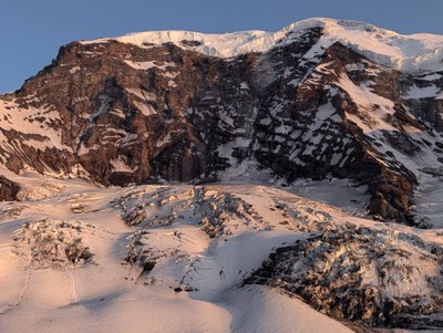
An exploratory Plan B climb in case we couldn’t get walk-up permits for Meany Crest to climb Little Tahoma turned out to be a spectacular climb with stunning views. The trip took us over St. Elmo Pass and across the Winthrop Glacier to Camp 1 for the Liberty Ridge route at Curtis Ridge (not to be confused with Camp Curtis), resulting in an excellent vantage point of the Willis Wall, Liberty and Ptarmigan Ridges.The next day, we climbed Steamboat Prow and Mount Ruth.
- Sat, Jun 14, 2025 — Sun, Jun 15, 2025
- Basic Glacier Climb - Winthrop Glacier Traverse
- Winthrop Glacier Traverse
- Climbing
- Successful
-

- Road suitable for all vehicles
Trailhead to Glacier Basin
The trail to Glacier Basin was in great shape, with a few remaining snow patches on the trail but creek bridges are all bare. Took us about 1.5 hours to reach Glacier Basin, where we enjoyed a break & snack by the river.
Glacier Basin to St Elmo Pass
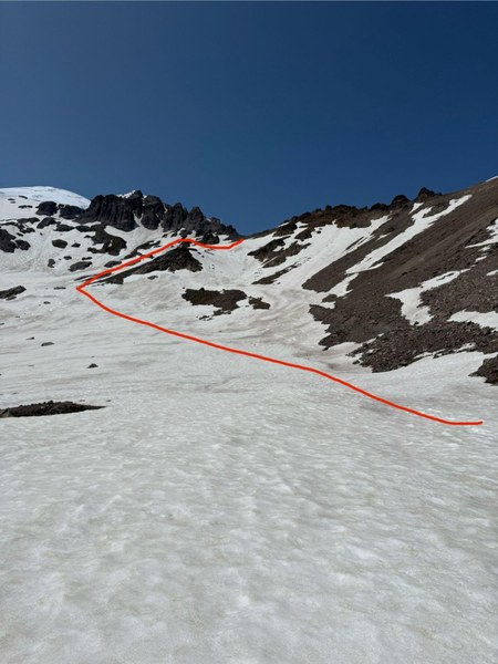
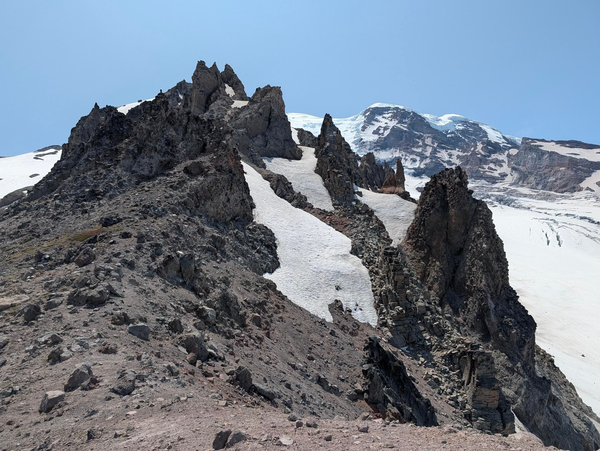
We followed a boot path on the north side of the river towards St Elmo Pass, no creek crossing needed, but we did find some patches of thin snow cover over rocks and vegetation to be mindful of. We surveyed route options and determined to stay low around a large rock island and then make a mostly direct ascent towards the pass. Several trickling water sources were coming off the rock islands. Most of this path was low angle with good steps, but the final ascent below the scree is steeper with some runout, so ice axes may be recommended for this section. Test holds and be mindful of kicking rocks down on the final ascent as it’s quite loose. St Elmo Pass is a beautiful break spot with a great view of the Winthrop crossing. We put on harnesses here.
Winthrop Glacier crossing and travel to Curtis Ridge
The descent from St Elmo Pass down to the glacier is steep and loose but pretty short. We named it “Kitty Litter Gap” for the steep scree and loose rock. It leads onto a section of steep snow with significant rockfall hazard, so we opted to travel a short distance on the glacier before roping up. This required traversing a short section of firm bootpack without crampons and stepping over a small crack unroped, but our group unanimously agreed that was the appropriate call to mitigate the overhead hazard. We moved quickly through this section and stopped at a safe place to rope up for the remainder of the crossing.
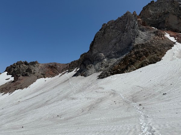
There are several knolls on the glacier which make it difficult to see the full route at once. We opted to stop and assess at the top of each knoll, as there were several areas with active rock fall and open crevasses along the traverse, requiring parties to move quickly and be constantly cognizant of surroundings. We watched a large boulder roll right into the actively used boot path below, and decided to veer North before ascending another ridge. After descending that hill, we found a series of longitudinal and transverse cracks that required careful navigation.
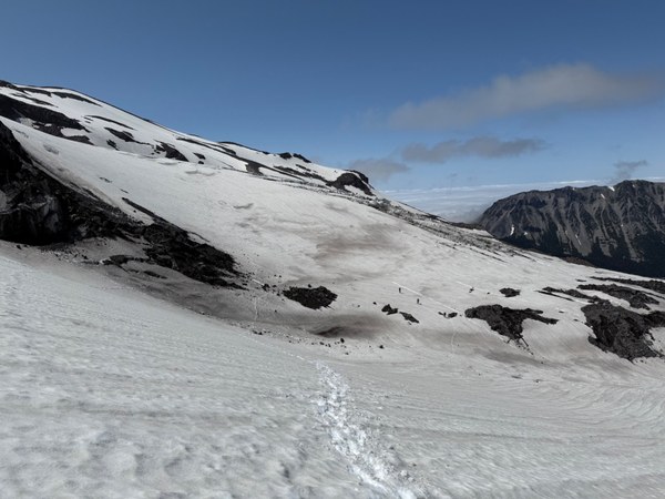
There is a moat forming on the west side of the glacier, and we spotted several options for crossing. We followed the existing boot path that turned out to be a snow bridge over the waterfall.
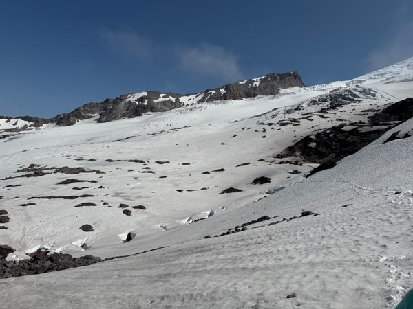
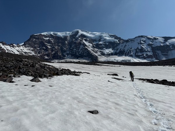
Photo below is looking back east back over the Winthrop towards St Elmo Pass. We crossed on the boot path near the dark rock band on the right, but looking back we could see that the moat crossings toward the lower center of the photo were thicker with less running water underneath.
Curtis Ridge camp (and views!)
After crossing the glacier, we followed the contour lines at roughly 7400 ft towards camp, arriving at approx 5pm. We opted to follow the faint boot path going up and over a small ridge instead of going around it to the North. We crossed a few rock islands but found it was generally easier / faster to detour around them on the snow to avoid punching through thin snow cover.
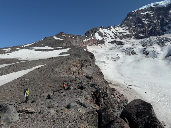
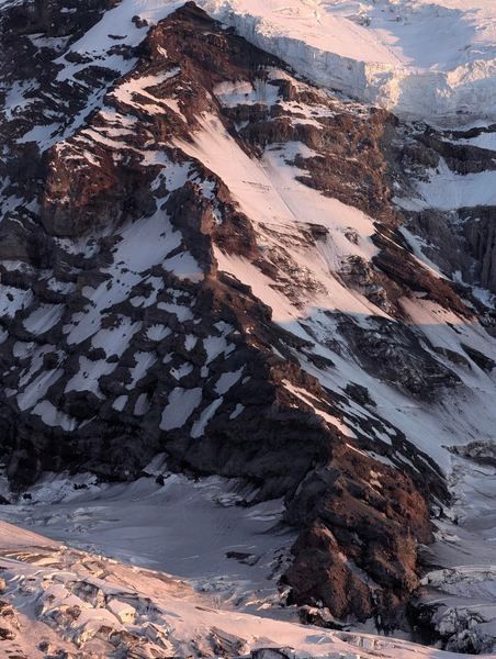
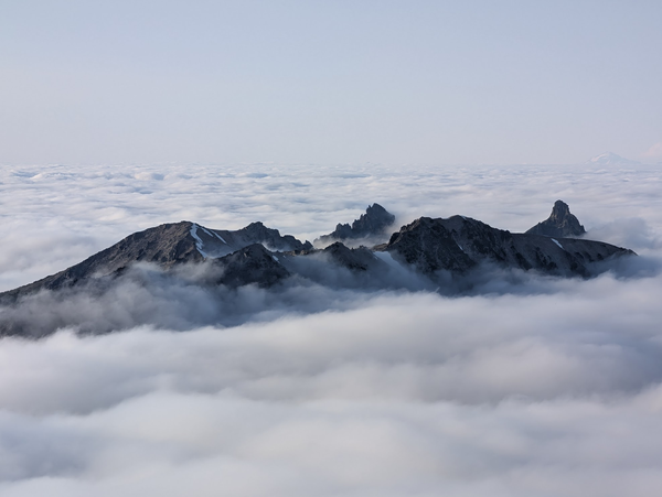
Curtis Ridge is magnificent! Steep exposure to the west gives way to the Carbon Glacier with epic views of Willis Wall, Liberty Ridge, Ptarmigan Ridge, Observation Rock, Echor Rock and Russell Glacier. The mountains to the south including Mineral Mountain, Old Desolate, and the Sluiskins appeared above the clouds. There were several flat tent sites here but no running water. We melted snow and enjoyed a lovely dinner on the rocks with mild temperatures and no wind.
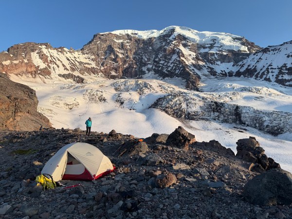
We encountered only two other climbers who had hoped to camp there and climb Liberty Ridge the next day but they had given up on that once they saw how little snow remained on Liberty Ridge.
Return to St Elmo Pass
We left camp at 7am on firm but quickly softening snow. We opted to reduce snow/rock transitions by taking a higher traverse on the way back to the glacier, and then determined we would cross onto the Winthrop lower than the day prior to avoid the waterfall bridge before making a rising traverse to rejoin the original boot path (blue line).
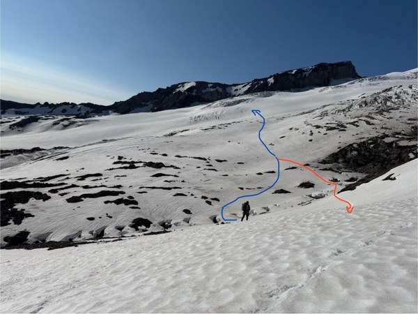
We unroped on the east end of the Winthrop Glacier at the same place as the prior day and decided to keep crampons on to cross the firm snow patch and ascend to St Elmo Pass. From there, we took a break, stowed glacier gear, and made our way down towards Inter Glacier. Refilled water at some snow melt on the rocks - not the best given modest flow, moat formation and some nearby rock fall, but we were happy to fill up since there was no other obvious water on route to Steamboat Prow or Mount Ruth.
Ascent to Steamboat Prow
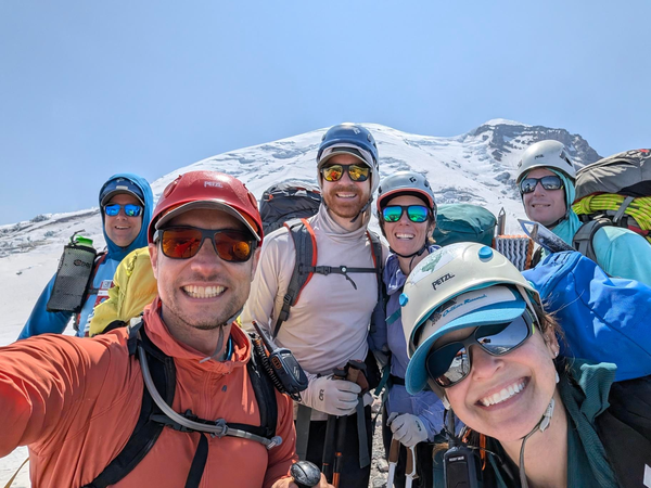
Upon observing the Inter Glacier, we opted not to rope up given coverage. We did not observe any open crevasses. While it’s a bit of a slog, there was a good boot path most of the way to the summit, where we arrived around 1:30pm. The very top of the Inter Glacier near the summit of Steamboat Prow is covered with penitentes and sun cups. There were tons of climbers and skiers descending the Emmons route, which looked to be in good condition with a direct approach after exiting the top of the Corridor.
Steamboat Prow to Mount Ruth
From Steamboat Prow, we followed the obvious snow-free ridge trail towards Mount Ruth, passing through Camp Curtis. Be mindful of food storage at camp, as we saw evidence that ravens had gotten into a food stash, leaving Mountain House and candy debris along the ridge.
There are now numbered sites at Camp Curtis.
There is a direct route at the base of the Camp Curtis ridge up onto the Mount Ruth ridge. This appears to involve an exposed class 3 or 4 scramble. We instead opted to descend very slightly on snow and reascend snow on the other side, which likely actually saved time. There is a faint path to the summit of Mount Ruth. We did not find any summit register.
Mount Ruth descent to trailhead
Most of our group opted to glissade extensive snow fields descending from Mount Ruth, almost all the way to Glacier Basin, where we refilled water.
The water level was considerably higher than the previous morning when we got to the main creek crossing around 5pm. We took some time to scout different options and opted to cross at a spot down very slightly downstream from the trail where the water was slower and more shallow with 1-2 big steps.
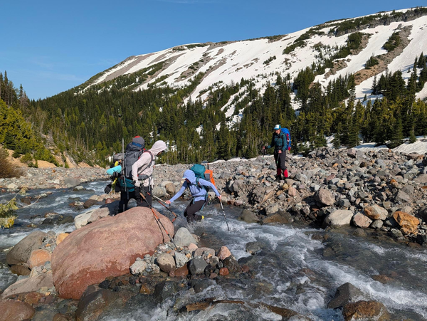
Once across the creek, we made good time to the trailhead, arriving a little before 7pm.
Conclusions
This turned out to be an excellent route, with plenty of mileage and elevation gain. Though some climbers do travel to Curtis Ridge as part of the Liberty Ridge and Ptarmigan Ridge routes, it is not as well-travelled as the Inter Glacier, and we were unsure whether the Winthrop Glacier could be crossed this late in the season, so it was a bit exploratory.
An alternative route could be to descend from Curtis Ridge to Mineral Mountain and Old Desolate, exiting via the Wonderland Trail to Sunrise.
 Dennis Kiilerich