Trip Report
Basic Glacier Climb - Mount Daniel/Lynch Glacier
Two-day climb of Mt Daniel via the Lynch Glacier.
- Sat, Jun 14, 2025 — Sun, Jun 15, 2025
- Basic Glacier Climb - Mount Daniel/Lynch Glacier
- Mount Daniel/Lynch Glacier
- Climbing
- Successful
-

- Road recommended for high clearance only
-
- The Scatter Creek crossing was not too bad. Our lowest-clearance vehicle, a Subaru Crosstrek, was able to make it; however, I would not want to drive anything lower-clearance through that.
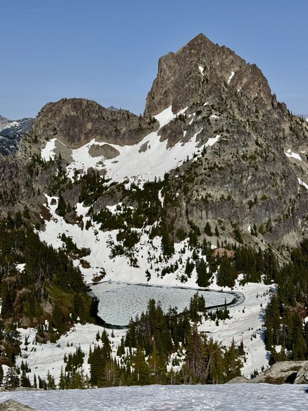
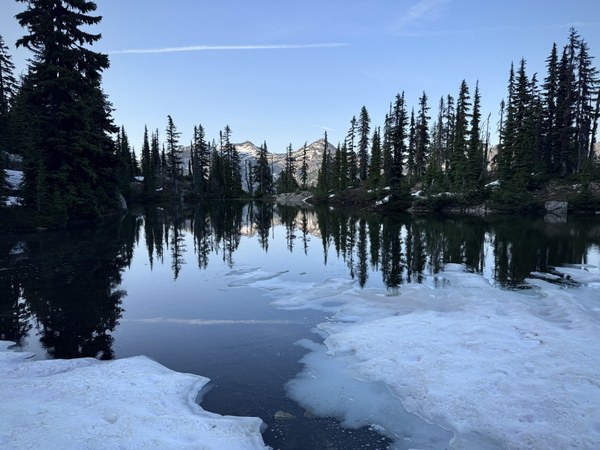
- Peggy's Pond was mostly frozen over, but we were able to get water from a creek about a quarter-mile past Peggy's near the bathrooms. You cross the creek on the ascent route up.
- We mostly followed Ian Lauder's tracks (https://www.peakbagger.com/climber/ascent.aspx?aid=1701575), which were very helpful, but with a few variations noted below.
- At about 5850' and 0.5 miles past Peggy's Pond we deviated from Ian Lauder's tracks. The gully his tracks went up was moderate-angled snow with poor runout and water running underneath the snow. (His tracks were from July, and this part might have been snow-free.) We instead took the ridgeline climber's right to get up to the notch. The rock was a little loose in some areas, but it was mostly class 2 scrambling.
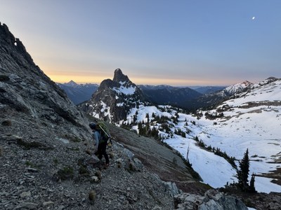
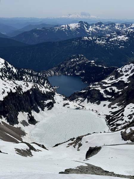
- On the way to Pea Soup Lake we dropped down to around 6200' to avoid going above the buttress with the steep descent mentioned David Johnson's trip report https://www.mountaineers.org/activities/trip-reports/basic-glacier-climb-mount-daniel-lynch-glacier-1. This option was straight-forward. We aimed for a notch that provided a good point to descend to Pea Soup Lake (see photo below).
- The descent to Pea Soup Lake was partly on loose rock. We moved one at a time to avoid rockfall hazard, which there was plenty of. This section was short, but it will likely be longer in a few weeks/later season.
- Dropping down all the way to Pea Soup Lake proved to be a good idea. Getting onto the toe of the glacier was easy and straightforward. Although tempting to drop down onto the Lynch Glacier from a higher elevation to avoid elevation loss and then later gain, we saw that doing so would have meant downclimbing steep loose rock with bad runout onto moderately-angled snow that then led to more rock. This problem has been noted in many trip reports.
- The Lynch Glacier was sewn up with the exception of one small visible crevasse near the top of the glacier.
- Once atop the Lynch Glacier, there are big cornices that block the gully that leads up to the summit scramble. However, there was a notch between cornices with a hogsback leading up that our climb leader was able to set a running belay on. The snow was steep and icy near the top. Our climb leader used 5 pickets, but would have preferred to have 6. Two tools were helpful for our lead climber.
- There was a snow step at the top of the hogsback. We used a standing carabiner ice axe belay to protect it.
- We took the scramble route down. There was a bootpack set on the traverse below the Daniel's East Peak, which made travel relatively easy and straightforward. However, in a few weeks this will likely be a moderate-angled talus slope.
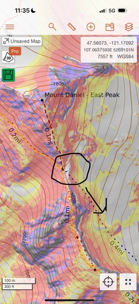
- We dropped down to snow at the intersection of the trail (as seen on the Caltopo map) with the Daniel East Peak. We initially attempted to continue traversing the ridgeline, but dropping down would have required a moderate snow and/or rock descent, whereas this path was gentle.
This was a two-day climb of Mt Daniel ascending via the Lynch Glacier and descending the scramble route. Many thanks to Mountaineers climb leaders David Johnson for his trip report, whose suggested deviations we found to be very helpful, and Ian Lauder for his useful tracks!
We met at Martin P&R at 8 am on Saturday to carpool to the TH. The road in was very good, except for the Scatter Creek crossing. We made it through with two trucks and Subaru Crosstrek. We were on the trail at around 12:15 pm and made it to the lake at 2.75 miles in for our first break in about 1h20m. There's a bathroom relatively close to the lake.
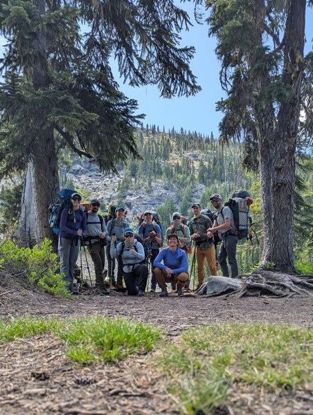
Lots of small creek crossings after the lake; expect to get your shoes/boots wet. Snow started continuously about a mile after the lake. The scrambling under Cathedral Rock was snow-free, which was very fortunate; I wouldn't have wanted to be up there with snow given the likely steepness of a snow traverse and the bad runout. We exited the scramble nearly at Peggy's Pond, which was mostly frozen over. There was a small creek to fill up water about a quarter mile past Peggy's Pond that you would otherwise cross on the route. We camped on snow; there were a few spots on dirt already taken by other parties.
We got on trail at about 4:15 am. At about 5850' and 0.5 miles past Peggy's Pond we deviated from Ian Lauder's tracks. The gully his tracks went up was moderate-angled snow with poor runout and water running underneath it. (His tracks were from July, and this part might have been snow-free.) We instead took the ridgeline climber's right to get up to the notch. The rock was a little loose in some areas, but it was mostly class 2 scrambling.
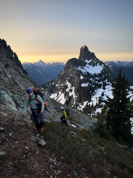
Once through the notch we were greeted with spectacular views of Glacier Peak and nearby Cathedral Rock.
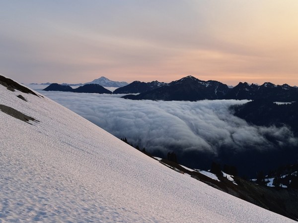
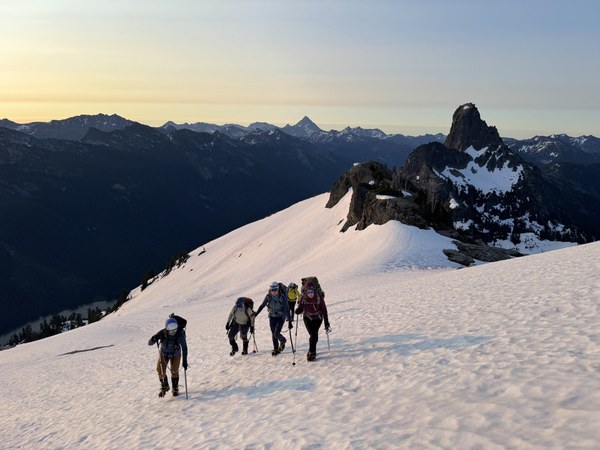
Following David Johnson's recommendation, we dropped down below the buttress to around 6100'.
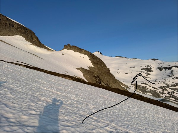
There was lots of sidehilling until beginning our descent to Pea Soup Lake at 6550'. We aimed for the notch in the picture seen below.
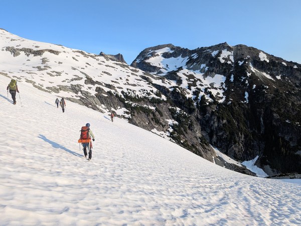
The descent to Pea Soup Lake was partly on loose rock. We moved one at a time to avoid rockfall hazard, which there was plenty of. This section was fairly short, but it will likely be longer in a few weeks/later season. We then contoured the lake until we reached the toe of the glacier, where we roped up.

The climb up the Lynch Glacier was straightforward and without any visible crevasses. We were glad to have dropped down all the way to Pea Soup Lake when we saw the scramble with poor runout that other trip reports have mentioned.
Once we reached the top of the Lynch Glacier we encountered a very-corniced gully that we would need to climb up to get to the scramble for the summit. We were in luck, though, that were was a small notch between the cornices with a hogsback leading up to it. Our climb leader, Kerri Wheeler, set pickets for a running belay up the moderate to steep snow. She used 5 but would have preferred to have had 6. There was a small snow step (4-5 feet) before reaching the top, which we protected with a standing carabiner ice axe belay. We checked in with students to gage their readiness and willingness to carry on, and after receiving affirmative responses, they got to put some of their skills they learned from the Basic Alpine Climbing course to use!
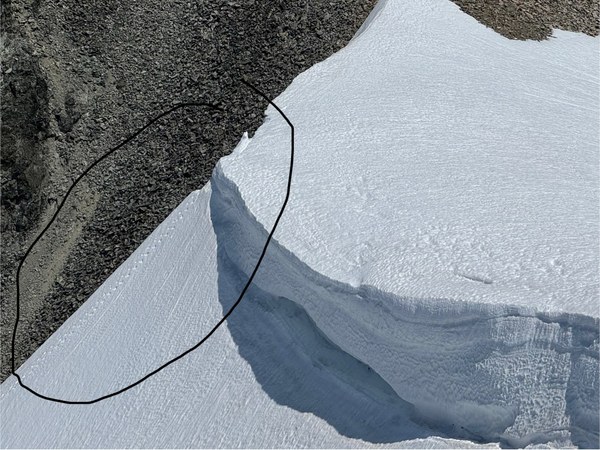
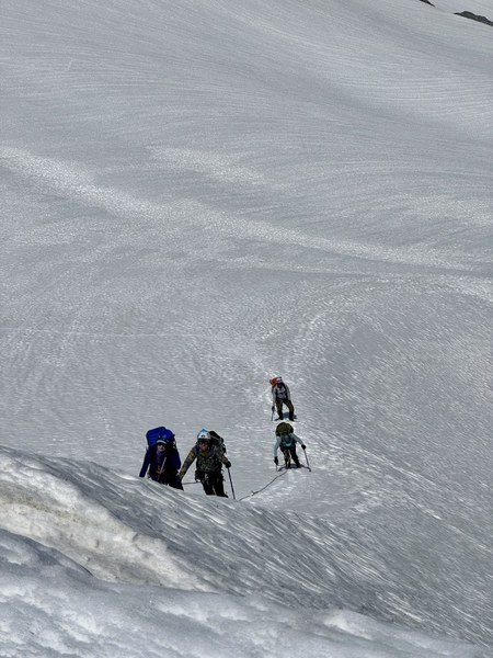
Once above the lip, we scrambled up to the summit for photos, snacks, and signing the register at 1:20 pm.
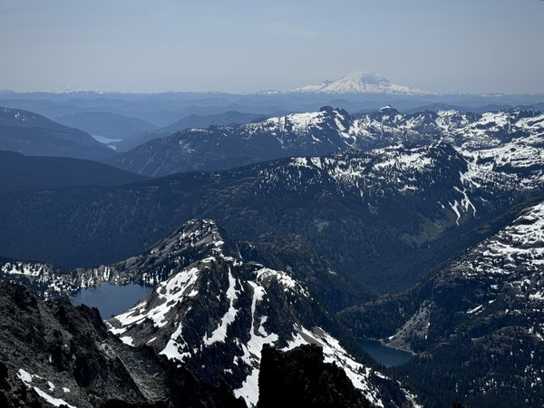
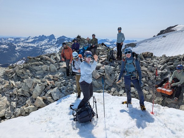
We took the scramble route back. There was a traverse under Mt Daniel's East Peak that looked steeper than it was. As noted earlier, the moderately-angled talus slope below will likely be melted out soon.
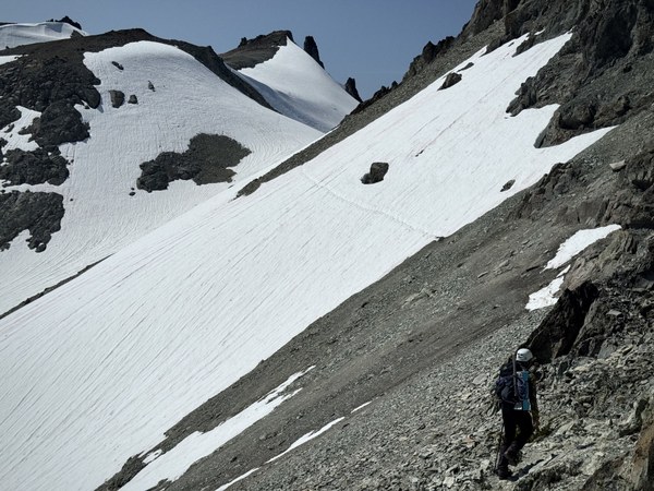
We continued scrambling along the ridgeline, but backtracked after seeing that at the intersection of the ridgeline scramble route and the path up the East Peak of Mt Daniel there was a better point to drop down on the snow to continue back to camp. This was a deviation from Ian Lauder's tracks/the scramble route. Otherwise, had we tried to drop down onto the snow from ridgeline we would have had to scramble down moderately-angled rock and/or snow.
We arrived back at camp a little before 6, filtered water, and left around 7. There was a stop off at the lake with about 2.75 miles to go, and we were back to the cars around 10. It was nice to finish the trip in good spirits and with smiles on everyone's faces.
 Martin Fisher