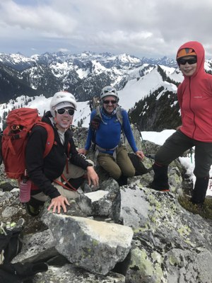
Lennox Mountain & Canoe Peak
A strenuous scramble of 5 miles and 3,500 feet of elevation gain. It's 39th on peakbagger.com's "Home Court 100."
getting there
Forest Road 5730 Road End
Take Exit 31 off of I-90 and drive through North Bend on Main Street. Turn left (north) onto Ballaratt Street and follow it as it leaves town and becomes North Fork Road SE. At the fork ~4 miles out of the town, bear left and drive 17 miles to where the road becomes Forest Road 57. Bear left at the next junction onto Forest Road 5730 and drive to its end (3,040 ft).
Bare Mountain Trailhead
Take Exit 31 off of I-90 and drive through North Bend on Main Street. Turn left (north) onto Ballaratt Street and follow it as it leaves town and becomes North Fork Road SE. At the fork ~4 miles out of the town, bear left and drive 17 miles to where the road becomes Forest Road 57. Bear right at the next junction to continue on Forest Road 57 and drive 3.2 miles to the Bare Mountain Trailhead (2,100 ft).
approach & ascent
Lennox Mountain (5,894 ft)
5.0 miles round trip, 3,500 feet of elevation gain, difficulty: strenuous 4, technical 3
To avoid brush on Lennox, start ~200 yards from end of Forest Road 5730, heading mostly up the fall line and slightly right if needed to ~3,800 ft. Traverse at 3,800 ft and cross the creek drainage at any spot that looks inviting between 3,800 ft and 4,000 ft. Then head up to the west rib, reaching it between 4,000 ft and 4,600 ft, where the rib steepens. Follow the ridge until reaching the upper snowfield at 5,100 ft. If avalanche danger is not a concern, the going is less steep and more open below the rib. A pleasant open slope traverse below tree bands reaches the ridge at about 5,460 ft. Follow the ridge to the summit. Watch for cornices on the northeast side of the ridge in early season.
Canoe Peak (5,706 ft)
7.5 miles round trip, 3,700 feet of elevation gain, difficulty: Strenuous 4, technical 4
Hike the Bare Mountain Trail to the end of a few switchbacks and where the trail turns back to the west. Leave the trail and scramble roughly northeast toward Bear Lakes. Continue past Bear Lakes to the saddle at 5,400 ft. Scramble the west ridge to the summit of Canoe Peak.
Lennox Mountain & Canoe Peak
Scramble Lennox Mountain or Canoe Peak from either approach and then scramble the ridge that connects these two peaks.
notes
- Persevere at the beginning through a fair amount of brush. It only lasts for 0.25 miles, after which there is almost none.
- The Miller River Road off of US-2 offers an alternative approach.
- Suitable Activities: Scrambling
- Seasons: Year-round
- Weather: View weather forecast
- View avalanche forecast.
- Difficulty: Strenuous 4, Technical 3
- Length: 5.0 mi
- Elevation Gain: 3,500 ft
- 5,894 ft
- Land Manager: Mount Baker-Snoqualmie National Forest
- Parking Permit Required: Northwest Forest Pass
- Recommended Party Size: 12
- Maximum Party Size: 12
- Maximum Route/Place Capacity: 12
- Green Trails Skykomish No. 175
- Green Trails Mount Si NRCA No. 206S
- USGS Grotto
- USGS Mt Phelps
This is a list of titles that represent the variations of trips you can take at this route/place. This includes side trips, extensions and peak combinations. Not seeing a title that fits your trip? Log in and send us updates, images, or resources.
- Lennox Mountain
- Canoe Peak
There are no resources for this route/place. Log in and send us updates, images, or resources.
