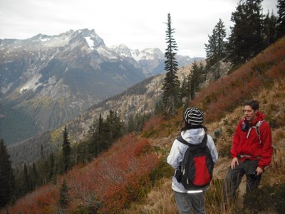
Carne Mountain
Strenuous day hiking and backpacking trips of 8 to 16 round trip miles with 3,600 to 4,800 feet of elevation gain. The trail winds up the mountain through forests and meadows into a wildflower basin beneath the peak. The high country traverses northwest on sometimes sketchy trail to Leroy Creek where you can descend to Phelps Creek and loop back to the trailhead.
getting there
Drive US-2 to Coles Corner. Follow SR 207 north for 3.8 miles. Turn right on the Chiwawa Loop Road. Continue for a few miles looking for a signed left turn onto the Chiwawa River Road (Forest Road 62). Follow it for 22 miles and right turn onto Forest Road 6211, Phelps Creek Road. Drive it 2.5 miles to a parking area at its end, the Phelps Creek Trailhead. The road can be very rough; check before you try it with a low-clearnce vehicle.
on the trail
carne mountain
Hike the Phelps Creek Trail 0.25 miles to the Carne Mountain Trail. In 3 miles and at 6,100 ft, teach a basin filled with larches, blossoms and some some depending on the season. At 6,450 ft reach the Old Gin Trail junction, turn left, and head to the saddle between Carne Mountains two summits. The higher of the two at 7,085 ft is to the left. It's 8 miles round trip with 3,600 feet of elevation gain to a high point of 7,085 ft.
carne mountain High Route Loop
From the saddle follow the well-marked trail that descends the east side and works its way over to a saddle at ~6,600 ft on the northeast ridge of Carne Mountain. (Do not take the signed trail less than a mile from the saddle that heads to the right and drops into the Rock Creek Valley, an easy mistake and another trip altogether). From the saddle, traverse north on easy to follow trail, losing and then gaining elevation. Below Ice Box Peak, the trail becomes sketchy, disappearing under snow (even in mid August sometimes) or going through overgrown brush. Hike northeast around knob marked Point 7103 on the map, traverse a short way above the head of Chipmunk Creek. Continue west and then northeast to round a knob. At a saddle about a mile past the knob, a climber's trail heads east and straight uphill to camps and views of Ice Lakes, and a "side trail" up Mount Maude. From the Ice Lakes junction traverse about due north, crossing the headwaters of two tributaries of Leroy Creek, before dropping into Leroy Basin where a good trail descends Leroy Creek back to the Phelps Creek Trail. Turn left on the Phelps Creek trail and hike about 4 miles back to the start of the loop. It's 16 miles round trip with 4,800 feet of elevation gain to a high point of 7,400 ft.
Notes
- This is a very popular area with hikes to Spider Meadows, climbs of Mount Maude/North Face, and scrambles of Mount Maude & Seven Fingered Jack and Dumbell & Greenwood Mountains.
- Carne is pronounced "karn" as opposed to the Spanish "kar-nay."
- Side trips are available to a ridge above Ice Lakes and to scrambles up Mount Maude, Ice Box Peak and Freezer Peak.
- Route finding skills may be required for some sections of the high county north of Carne Mountain.
- Camps are available in the basin just before the saddle below Carne Mountain, on the saddle above Ice Lakes, on upper Leroy Creek, and on Phelps Creek just after the left turn from Leroy Creek.
- There is no water other than possibly snow melt at the camps above Ice Lakes.
- Visit wilhiteweb.com for an excellent topo map with the route.
- Suitable Activities: Backpacking, Day Hiking
- Seasons: June, July, August, September, October
- Weather: View weather forecast
- Difficulty: Strenuous, Very Strenuous
- Length: 8.0 mi
- Elevation Gain: 3,600 ft
- 7,085 ft
-
Land Manager:
Okanogan-Wenatchee National Forests
Glacier Peak Wilderness, Entiat Ranger District (OWNF)
- Parking Permit Required: Northwest Forest Pass
- Recommended Party Size: 12
- Maximum Party Size: 12
- Maximum Route/Place Capacity: 12
- USGS Holden
- Trails Illustrated Glacier Peak Wilderness
- Green Trails North Cascades Lake Chelan No. 114SX
This is a list of titles that represent the variations of trips you can take at this route/place. This includes side trips, extensions and peak combinations. Not seeing a title that fits your trip? Log in and send us updates, images, or resources.
- Carne Mountain Loop
- Carne Mountain High Route
- Carne Mountain High Route Loop
There are no resources for this route/place. Log in and send us updates, images, or resources.
