
American Border Peak/Southeast Route
Climb one of the "Baker's Dozen" peaks that is just northwest of Mount Larrabee and just south of the US-Canadian border. It's a basic-level alpine rock climb of 9 miles round trip and 2,800 feet of elevation gain.
Getting there
Follow US-542 (Mount Baker Highway) past Glacier. Turn left on Forest Road 3065, which is at the highway maintenance facility. Drive 5 miles to small parking area at the Tomyhoi Lake trailhead. A high clearance vehicle can continue to the Twin Lakes trailhead. The last two miles have some tight switchbacks, rocky sections and deep dips.
approach
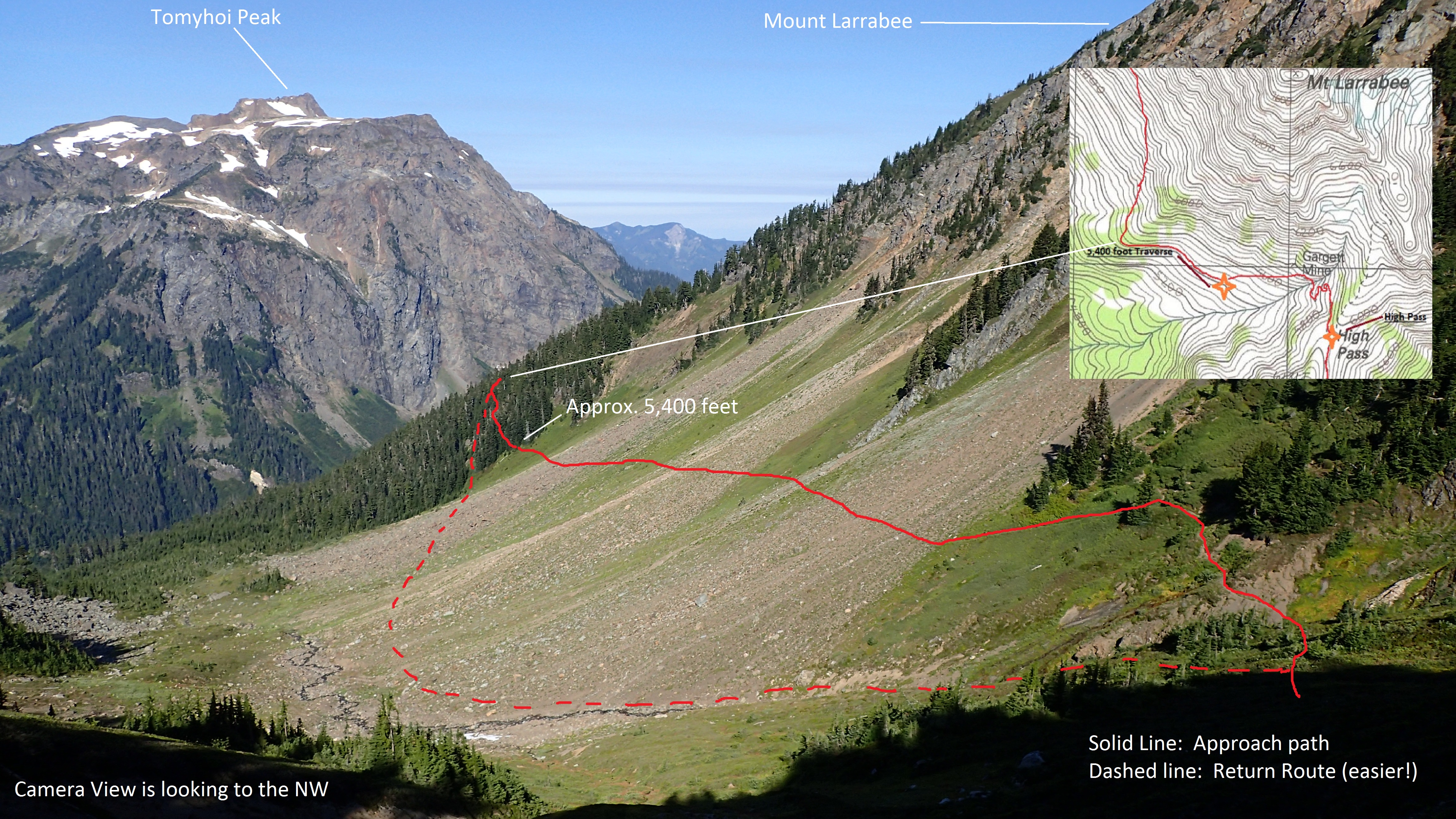
From the Twin Lakes trailhead, hike north to Low Pass, then to High Pass. There is marginal camping at High Pass (if snow is present) and in a basin about 3.7 mi from the trailhead (5,600 ft) .
ascent
Traverse from High Pass North, until you reach a notch in the Larabbee/American Border Peak ridge. Pass through and go across slabs, ledges and gullies to a chimney. Climb chimney (or bypass lower half on the right. Ascend to summit ridge and follow northward to the summit.
DESCENT ROUTE
Descend the climbing route.
TRIP PROFILE
| SEGMENT | TIME (HR) | ELEVATION GAIN (FT) |
|---|---|---|
| Trailhead to High Pass | 2 | 1,540 |
| High Pass to Summit | 5 | 1,244 |
| Summit to Trailhead | 7 | 2784 |
EQUIPMENT
Standard rock gear with a few small to medium chocks. An ice axe for the approach in early season.
NOTES
- This is one of the Baker's Dozen Peak Pin peaks.
- Suitable Activities: Climbing
- Climbing Category: Basic Alpine
- Seasons: June, July, August, September
- Weather: View weather forecast
- Difficulty: Basic Rock Climb
- Length: 9.0 mi
- Elevation Gain: 2,800 ft
- 7,994 ft
-
Land Manager:
Mount Baker-Snoqualmie National Forest
Mount Baker Wilderness, Mount Baker Ranger District (MBSNF)
- Parking Permit Required: Northwest Forest Pass
- Recommended Party Size: 12
- Maximum Party Size: 12
- Maximum Route/Place Capacity: 12
- Green Trails Mt Shuksan No. 14
- Green Trails Mount Baker Wilderness Climbing No. 13SX
- USGS Mt Larrabee