Trip Report
Sea Kayak - Olympic Coast
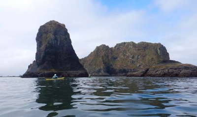
From July 1st to July 5th Karen Cramer, Charlie Michel, and I paddled the Pacific coast of Washington from Makah Bay in the north to Ruby Beach in the South. This is the roadless stretch of wilderness beaches in the Olympic National Park. This trip is right in our “back yard” but because the coast is exposed to the Pacific with very limit protection from surf and winds it requires skill and experience paddling the open ocean.
- Mon, Jul 1, 2019 — Fri, Jul 5, 2019
- Sea Kayak - Olympic Coast
- Olympic Coast
- Sea Kayaking
- Successful
-

- Road suitable for all vehicles
-
This coastline is exposed to ocean swell and wind with minimal protection. Along the coast there are many, many rocks, many submerged and hidden. Much of the coast is rock or beach with rocks.
To reduce the chance that we would get caught out in very difficult conditions we decided on the maximum forecast conditions for the trip were 5ft swell and 15knot winds with some allowance for direction and duration. The conditions we had were light winds (under 10kt), generally from the south and 4 ft swell.
However, while the swell heightwas within our limits the waves were quite long (18 to 22 second period). Longer waves make larger surf than shorter waves of the same height. This long swell arrived on day 2 and dominated the remainder of the days. We could see it as broad waves that rolled easily under us in the deep water. However, periodically (about every 10-15 minutes) sets of much larger waves would roll through. Over reefs, these would standup to 6-8ft. In some places they turned what previously look like a safe passage into a death trap, pushing tons of breaking water to ultimately crash onto rocks. On shore, they would break powerfully, much further out than the normal break. Watching from seaside, we knew we did not want to be involved with the large sets. Avoiding that was a constant focus for us. So, don't forget to account for wave length.
We all paddled plastic “play boats”. All had sufficient capacity for this short trip and their maneuverability was much preferred over our longer expedition boats.
We each carried VHF radio and the group carried on InReach communicator. We wore helmets the whole way.
The car shuttle is large. We were fortunate that Will Wade gave us a shuttle so we were able to park all our cars at Ruby Beach and could drive directly home at the end of the trip. I much prefer this to shuttling cars after the trip. Thanks Will.
The coast is part of the Olympic National Park so one must get permits for camps, bring bear canisters, and comply with other regulations.
This is a hiker’s coast line. Every place we landed we met hikers. Every beach we camped at had 2-5 other parties camped on the beach. We met rangers.
Day 1: Hobuck Beach to Ozette River South. 11 nautical miles.
Captured photo of Alien artifact. 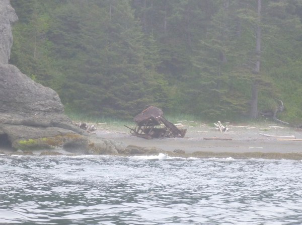
Landed S end of Shi Shi beach on protected low gradient sand beach. Explored the arches and tunnels along at Point of Arches. South of Point of Arches there are more rocks with tunnels until you pass “Father and Son”. Higher tide opens more passages for exploration.
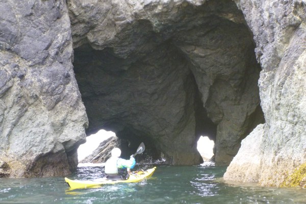
Through the next bay we stayed well off the beach as large waves were rolling in.
Waves were smaller at Ozette River. Paddled into the river mouth and landed easily. At lower tides many rocks exposed off river mouth. 200 ft to the north there is a rock free section of beach. Don’t know what protected this beach from larger surf.
There are two camp sites here: Ozette North and Ozette South. Both are quota with limited number of people permitted each night. We stayed in the south camp. Land on first beach south side of the river. Ascend the clear trail to an open forested campsite with multiple tent sites on pine duff. Latrine present but “full”.
North beach campsites may be nicer, and it is closer to the rock free landing.
Day 2: Ozett River South to Cedar Creek. 14 nautical miles.

Paddled around Bodelteh islands where we saw two grey whales feeding. Paddled outer coast of Ozette Island.
Landed Sand Point camp ground. North facing beach with some protection from surf. Camping primarily in the forest. Rocks may uncover at low tide.
I saw a seal swimming under water as we approached this beach. I see them on the surface all the time but this the first time I’ve ever seen one swimming below me. It was not aware of me until I raised my arm to point. Our eye’s met and it darted away.
Landed Yellow Banks. This is an open bay with more surf. We did not find camping inviting. However, this is the last easy break before a 5nm stretch to Cedar Creek.
Landed in Cedar Creek. The beach faces SW and is exposed to swell but surf was relatively small. Possibly due to rocks and reefs off shore.
Fresh water creek. Camped on cobbles south of the creek. There was a forest camp inshore from us with one medium and one large tent site. We prefer clean, sand free cobbles. 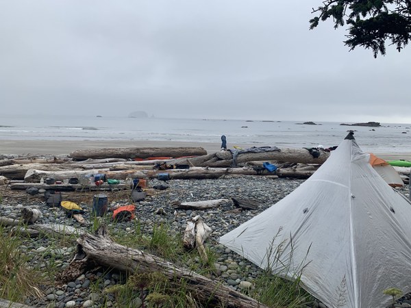
Band of children camped across creek.
Day 3: Cedar Creek to Scott Beach. 16 nautical miles
Paddle around Jagged Island
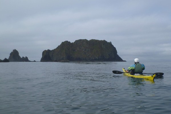
Land on beach south of Little Jones island off LaPush. There is another beach on the east shore of James Island which should be protected in most conditions.
There is large surf on First, Second and Third beach. We look at a pocket beach on north side of Teahwhit Head. Sitting outside the break we see the whole beach floods. While discussing this, a large set catches us off guard. Charlie and I quickly back over the waves before they break. One catches Karen but does not carry her to the beach. She escapes and paddles out. A reminder that the large waves are LARGE and easily larger than anticipated.
We look into 3rdbeach. Can land there through largish surf (between the BIG sets) but decide to continue exploring south.
Scott Beach landing is protected by off shore islands and rocks. Navigate through those and land on sandy beach. Nice camp site. Sunshine helps.
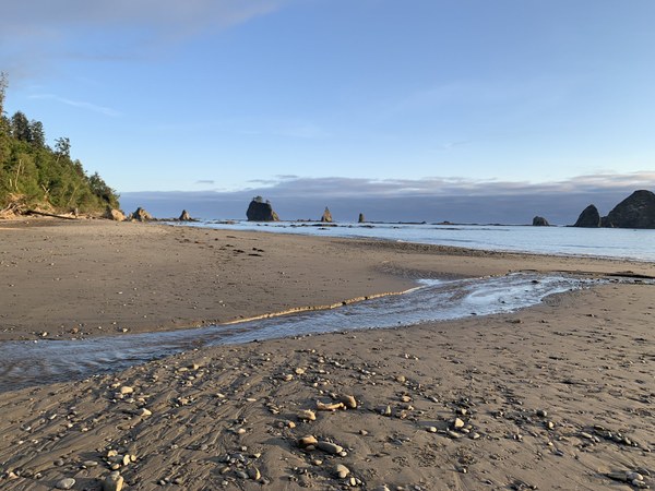
Day 4: Scott Beach to Mosquito Creek. 7 nautical miles.
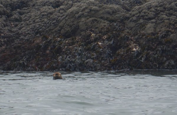
Sea otters have made a huge comeback. We see many mothers with pups.
Try to land at Holeak Pt. The bay to the north has large surf and multiple rocks. The north shore of Toleak Pt is sandy beach then exposed rocks below. We are able to enter a protected area within the rocks but carry over remaining rocks will be difficult. This is a difficult beach to land or depart at lower tides. We never make it to “shore”.
Rounding a point we see 6 large birds flying toward us, rising from the surface to not pass to close to us. They are brown pelicans. Plentiful to the south, this is the first time I've seen them in my home waters.
We were hoping that Mosquito Creek would have protection from offshore rocks but it does not. We paddle around Alexander Island, then sit well off the break watching the pattern of breaking waves. When we have identified the best landing and think a large set has recently passed we paddle in, spaced in sequence. We move quickly to reduce chance of getting caught by a big set. A large wave breaks just behind me and quickly engulfs my boat. I manage to prevent it from burying my bow, get broached, recover, and land with dignity. Charlie and Karen have similar experience but we all land well. Estimate surf to be 6ft.
Drag boats up small creek and camp on sand and cobble. Several sand camp sites. Trail up slope to south leads to camping on open forest and first operating toilet we have encountered.
Day 5: Mosquito Creek to Ruby Beach. 8 nautical miles.
Surf has diminished. Easy launch from creek mouth.
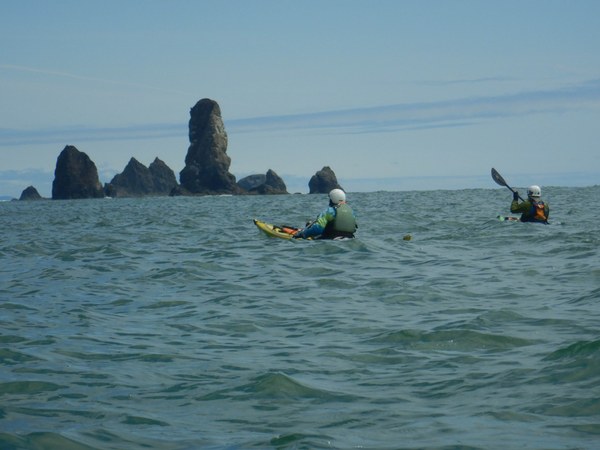
Paddle around Hoh head and approach the Hoh river. River bed has shifted and now exits near south side. Large sets of waves roll through the bay. We take our time, plan our landing, and land at the river mouth.
Land at Ruby Beach just north of Abbey Island. Surf is 3-4ft. At high tide the shore is steep cobble. Below that it is low gradient sand.
We rinse in the creek then carry gear and wheel boats up to our cars in the parking lot. Landing to driving takes about 2h 15m.
 Tom Unger