Trip Report
Sea Kayak - Whidbey Island Circumnavigation
Our 4 day adventure began and ended in Saratoga Passage and along the way we were lucky enough to see the entire shoreline of Whidbey Island. Just keep the island to your left and you can't go wrong!
- Sat, Aug 6, 2022 — Tue, Aug 9, 2022
- Sea Kayak - Whidbey Island Circumnavigation
- Whidbey Island West Shore
- Sea Kayaking
- Successful
-

- Road suitable for all vehicles
-
We launched from Camano Island State Park and paddled counter-clockwise around Whidbey Island. Overnight camps included Bowman Bay, Fort Casey, and Possession Point. Tides and currents are listed for each day in the trip report.
PADDLERS:
Terry Jaret (leader)
Will Wade
Brian Stone
SAT 08/6/2022 – CAMANO ISLAND STATE PARK TO BOWMAN BAY, 23 NM, NW WIND 1-5 KTS W/ WAVES 0-1 FT, SUNNY, HOT, VISABILITY EXCELLENT
Crescent Harbor: 8.89 H @ 1329, 7.05 L @ 1751
Bowman Bay: 5.66 H @ 1452, 5.64 L @ 1603
Skagit Bay (Rocky Pt): S @ 0929, 0.39 (N) @ 1157
Skagit Bay (Goat Island): S @ 0948, 1.53 (N) @ 1257, S @ 1721
Skagit Bay (Hope Island): S @ 1052, 1.67 (N) @ 1312, S @ 1717
Deception Pass: S @ 1145, -3.36 (W) @ 1431, S @ 1756
Will arrived at my house around 5:45 AM and I loaded my gear in to his car. We promptly headed to Starbucks for breakfast, and more importantly caffeine. Traffic was light and we made great time arriving at the Camano Island SP boat launch a few minutes before Brian pulled up. The main reason I picked this launch site is because it has overnight parking which I verified with the park ranger in advance. It’s deceptive though because the parking machine does not have an option for overnight and the paper envelope was for day passes only. We followed the ranger’s instructions and used the envelope with a note to account for how much we paid. Launch fee was $7 plus $10 per night parking. With boats fully loaded and thoughts of the long trip ahead it was exciting to finally be starting after planning this trip months before. Whidbey Island is considered the fourth largest island in the contiguous United States and the currents are rather strange since the general direction of the flood is south on the west side and north on the east side of the island. Likewise, the direction of the ebb is north on the west side and south on the east side. Planning this circumnavigation in roughly 4 equal parts took advantage of the currents and allowed us to conveniently stay overnight at the very few camping possibilities with beach access around the island. We launched at 9 AM and headed north through Saratoga Passage following the Camano Island shoreline to Rocky Point. Along the way we passed lots of crab pots and Will played in the wakes of several passing boats travelling north as well. After a quick break at Rocky Point we decided to leave Camano Island and head directly over to Whidbey Island where we started to feel the flood more significantly during the crossing. Since it was past noon and our legs needed a real stretch we had lunch at Strawberry Point (our first stop on Whidbey) and pondered the landmarks to the north. Coming in to Skagit Bay from the south provided a totally different perspective for me. Is that Ika or Goat Island, where’s Hope Island and Ala Spit, can we see the entrance to Swinomish Channel?? It took a while to get our bearings as we continued to paddle north but soon everything became obvious. I was surprised how big Goat Island looked from the south as I’ve approached it several times from the north and it never left that impression on me. After a break at Ala Spit we rounded the corner and Deception Pass came in to full view. We choose a path to the north of Strawberry Island, which was covered in harbor seals, before entering Canoe Pass and getting surprised by a tour boat. At that point the ebb wasn’t very strong and we gently floated through the pass enjoying the scenery before arriving at Bowman Bay around 5:15 PM. Our first night was at the WWTA site next to the old Bowman Bay pier. The site is somewhat hidden from the main trail out to Lighthouse Point and pleasant enough to stay overnight. There is a wetland next to the camp site but the bugs didn’t seem too bad the night we were there.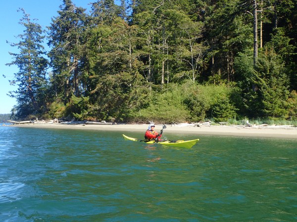
SUN 08/7/2022 – BOWMAN BAY TO FORT CASEY STATE PARK, 20 NM, NW WIND 5-10 KTS W/ WAVES 0-1 FT, SUNNY, HOT, HAZY VISABILITY
Bowman Bay: -0.83 L @ 0634, 6.55 H @ 1557
Admiralty Head: -0.99 L @ 0644, 7.17 H @ 1518
Deception Pass: S @ 0610, 4.02 (E) @ 0906, S @ 1252
Point Wilson (Admiralty Head): S @ 0652, 3.24 @ 1043, S @ 1457, -1.67 (N) @ 1726
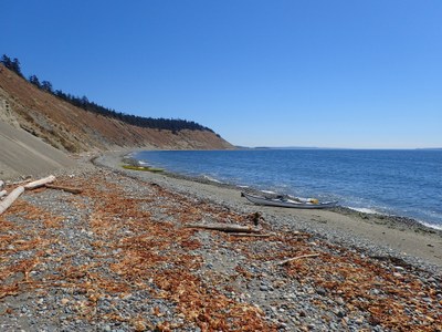
We launched near low tide at 7:15 AM with Deception Pass already flooding at 2+ kts. It took a few ferry angle adjustments to make the crossing past Deception Island and over to West Point but the current did ease a little once we got close to the beach on the south side of the pass. The fun began at the point as we had to punch through a stronger opposing current before leaving Deception Pass behind. As the flood comes down the Strait of Juan de Fuca and hits the northern shores of Whidbey Island it behaves strangely. As soon as we rounded West Point and headed south we were faced with an opposing 1+ kt current all the way to the Whidbey NAS. We were also paddling well offshore due to the shallow waters around Whidbey (this became a theme of the trip) and the restricted area in front of the naval base. It’s a good idea to know what’s happening in this area because at times it is used for artillery practice. Today we were lucky and did not become moving targets! The first bit of surf came in to view at Rocky Pt and then we stopped for a break at Joseph Whidbey State Park. This side of Whidbey is known for high bluffs, ocean swells, and dumping surf and that’s exactly what we experienced minus the swell. Of course conditions were rather mild the day we paddled but there was small surf breaking on shore most of the way past Pt Partridge and larger 2+ ft waves near any prominent headlands. We were able to find landing sites away from the biggest cobbled beaches but still needed to pay attention to the dumping waves as we came near shore. Will was paddling close to Pt Partridge when a large set of waves suddenly crashed on his deck and overturned his boat. He quickly realized the danger of being upside down near those big cobbles at Pt Partridge and was able to stay in his cockpit by rolling off the bottom, all while grabbing gear that had been ripped from his boat. His experience kicked in and allowed him to stay calm and minimize risk while quickly getting to a safer position. Unfortunately his glasses ended up in the surf and were sacrificed to the Whidbey Gods. Next we stopped for lunch just south of Pt Partridge and were entertained by the continual landslides coming off the high bluffs behind us. We also saw a tugboat pushing a Washington state ferry towards Port Angeles and wondered if it was the Cathlamet which crashed in to the Fauntleroy dock a week earlier. After lunch we chose a route offshore from Ebeys Landing and made it to Admiralty Head in record time thanks to a stronger NW wind and following seas. We pulled in to the Fort Casey State Park campground at 3:15 PM and were pleasantly surprised to see Callen’s Restaurant across the road from the Coupeville ferry dock. Needless to say the stoves were not used that night and excellent food and beer was enjoyed by all! The sites at Fort Casey are adjacent to the beach and right next to the Pt Townsend ferry, which comes very close to shore when it pulls in to the terminal. The big excitement was when the “monster” RV arrived to find no vacancy, but alas we were not using the pull-in so they stayed at our site. If you’ve ever wondered what a $650,000+ RV looks like here you go (and this is not the biggest model they make); https://unicatexpeditionvehicles.com/in57p-man-tgm-4x4/. We endured endless gawkers coming by asking “what the heck is that thing”!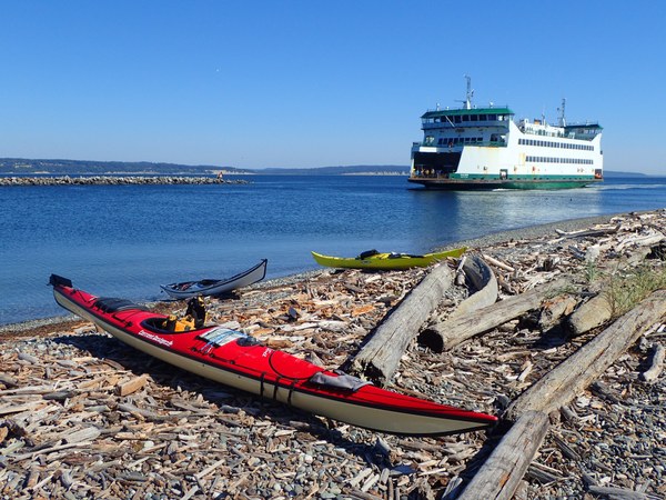
MON 08/8/2022 – FORT CASEY STATE PARK TO POSSESSION POINT, 20 NM, NW WIND 1-5 KTS W/ WAVES 0-1 FT, SUNNY, HOT, VISABILITY EXCELLENT
Admiralty Head: -1.83 L @ 0739, 7.93 H @ 1604
Glendale (Possession Pt): -1.55 L @ 0810, 10.10 H @ 1619
Admiralty Inlet (Marrowstone Pt): S @ 0851, 4.33 (S) @ 1226, S @ 1619
Bush Pt: S @ 0818, 3.25 @ 1145, S @ 1533
Double Bluff: S @ 0853, 2.23 @ 1248, S @ 1551
Point No Point: S @ 0936, 0.73 @ 1436, S @ 1655
Today was all about big bays, big crossings, big fetch, and big panoramas! We launched at 9:15 AM and decided to skip Lagoon Pt while crossing Admiralty Bay and head directly to Bush Pt instead. As we neared Bush Pt at max flood it looked like a cargo ship was heading around the point from the south as the shipping lane turns rather close to the point. To my amazement the “cargo ship” turned out to be Double Bluff, the next point south and was moving relative to Bush Pt faster than I’ve ever seen anything move before! We were flung through the tide rip and circled back to take a short break at the tip of the point. Just off Bush Pt a ridge extends at least half a mile underwater to the SW and creates quite a rip with lots of boils and small whirlpools. On a strong ebb I think the underwater ridge causes a big whirlpool to form just off the southern end of the point. After our break we decided to go through the tide rip and ride it for all it’s worth as we continued south. In the middle of all that excitement I heard a blowhole behind me and turned to see 2 porpoises right next to my kayak. The Seattle skyline came in to view shortly after leaving Bush Pt and we soon discovered another tide rip in the middle of the shipping channel that extended most of the way south to Double Bluff and were able to take advantage of it since there was absolutely no boat traffic from the north or south. We made the 5.5 NM crossing of Mutiny Bay and arrived at Double Bluff in under an hour! Lunch was in order and we found a shady spot on the southern side of the bluff. This was one of the best lunch spots I’ve ever been to. It had a beautiful sandy beach, lovely trees and flowers, souring cliffs to the east, and an amazing view to the south. After an hour we dragged ourselves off the beach and started the third crossing of the day (Useless Bay). The western end of Scatchet Head where we landed is very shallow and warms the water quite a bit. If it weren’t for all the seaweed that catches here (and the fact that this is technically private property per the sign above the beach) this would be the perfect swimming spot. After a short break we crossed Cultus Bay, which has a very narrow route the motor boats must follow due to how shallow it is, and rounded Possession Pt to arrive at the WWTA site around 5:15 PM. Some of the takeaways from today; 1) The sheer size of Whidbey started to sink in when we realized this circumnavigation felt different as every day Whidbey continued to be off to our left, 2) the water temperature is noticeably colder on the west side vs the east side of Whidbey, which makes sense but is still quite amazing to feel within the span of two days, 3) the visual panoramas paddling along the west side of Whidbey are incredible and continually make it seem like you’re viewing a gigantic map of Puget Sound and the San Juan’s laid out right in front of you, 4) the incredible panoramas come at a price as there are stretches of very long fetch all around Whidbey Island, 5) the waters around many sections of Whidbey Island are very shallow so we spent a great deal of time paddling far from shore, and 6) paddling 20+ NM day after day is tiring. We enjoyed a good dinner watching an eagle mess with the crows on the beach and went to bed early.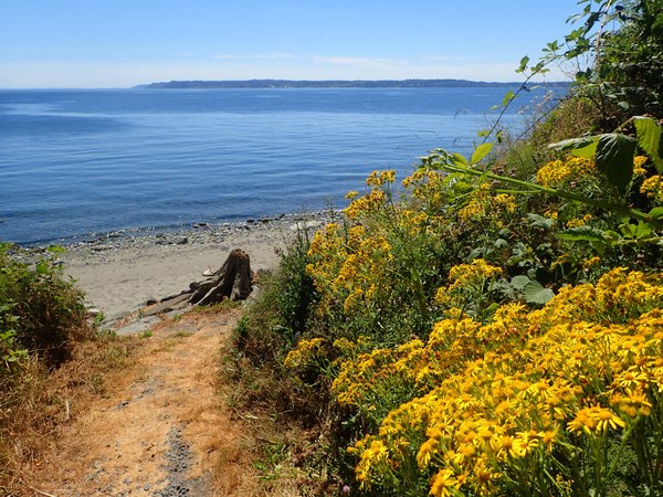
TUE 08/9/2022 – POSSESSION POINT TO CAMANO ISLAND STATE PARK, 17 NM, NW WIND 5-10 KTS W/ WAVES 0-1 FT, OVERCAST, COOLER, VISABILITY EXCELLENT
Glendale (Possession Pt): -2.37 L @ 0906, 10.79 H @ 1708
Greenbank: -2.51 L @ 0912, 11.61 H @ 1702
Clinton Ferry Terminal: S @ 0948, 0.28 @ 1355 (N), S @ 1625
Sandy Pt: S @ 0926, 0.80 @ 1315 (N), S @ 1722
After a beautiful sunrise earlier we finally emerged from our tents on the last day of the trip to overcast skies. I ate my breakfast on the beach and watched a river otter feeding on fish off the sandy point for 30 minutes. It then spotted me and took a minute to plan it’s retreat over the beach and back to the woods behind our tents. Again, a low tide launch at 9 AM which was a little earlier than planned because we all decided to stop for a civilized lunch in Langley regardless of the effects of not bathing for 4 days. As we proceeded north past Glendale we saw lots of ell grass in the water and were soon at the Clinton ferry terminal. It’s a short crossing for the 2 ferries in continual service and the timing of our arrival was perfect as the ferry left to go back to Mukilteo. From there it was a nice paddle over to Sandy Pt when suddenly the NW wind picked up and we were paddling in 1+ ft seas the rest of the way to Langley. Brian was spontaneously chanting “hamburger” which I’m sure unconsciously quickened our pace through the chop. Speaking of another long fetch, once you round Sandy Pt you can see up Saratoga Passage all the way to Oak Harbor some 18 NM to the north! We reached the seawall at the bottom of the bluff from Langley and exited our kayaks only to quickly sink up to our knees in the sand. It took some fast walking to get to more solid ground where we parked the kayaks parallel to the concrete seawall and tied them off to the railing above. We climbed the stairs to Village Pizzeria and decided to order 2 slices each which actually turned out to be almost the size of half a pie! The pizza was excellent but due to the hearty portions there was no room left for ice cream at Sprinklz Ice Cream Parlor down the street so we decided to head down to the boats. The shore around Langley is another of those shallow areas around Whidbey and we came back to discover how fast the tide had come in. Good news is we didn’t have to carry our kayaks as they were just beginning to float and lucky that we tied them off before lunch. Our remaining journey would take us past one last point of land and then the crossing over to Camano Island State Park. Once nearing East Pt we spotted a beached motor boat named “Island Sprinter” and decided to take a quick break to investigate. It was missing it’s motor and had a few holes in the hull but we confirmed no bodies in the cabin, just lots of beer cans and leftover food. Given our male reptilian brains I’m sure we all had the same fleeting thought of towing that behemoth off the beach but the lure of our cars just under 2 NM away soon took over and we began our crossing to Camano Island landing on the beach around 5:15 PM. It was a satisfying end to the biggest circumnavigation any of us have completed to date. Hot temperatures or any significant wind would have made this trip very challenging! Despite the long daily paddles wearing us down it was a wonderful and interesting trip to see all of Whidbey Island in 4 days. Sharing this experience with Brian and Will was awesome and I couldn’t have asked for better paddling partners. Now on to the next adventure in Puget Sound!
 Terry Jaret