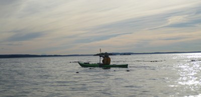
Whidbey Island West Shore
A long sea kayaking journey along the west shore of Whidbey Island. This trip can be done in both directions but north to south allows more options for shore breaks in the last half of the trip, and shorter sections can be explored. Padding from Whidbey Island to Smith and Minor Islands is a challenging trip with opportunities to explore nature in a state aquatic preserve and part of the San Juan Islands National Wildlife Refuge..
launch & Landing points
- West Beach or North Beach on the south side of Deception Pass State Park near Cranberry Lake.
- Bowman Bay at Deception Pass State Park
- Cornet Bay at Deception Pass State Park
- Joseph Whidbey State Park
- Hastie Lake Boat Ramp
- Ebey's Landing
- Fort Ebey State Park
- Fort Casey Historical Park, just east of the Keystone ferry terminal.
West Beach is the best launch point. It has a good sandy beach to launch from, ample parking, and bathrooms. To add a little distance and the excitement of paddling through Deception Pass currents, you can also launch from Cornet Bay or Bowman Bay. There are bathrooms at both launch points. To shorten the trip, launch from the beach access at the south west corner of Joseph Whidbey State Park. There is parking for about nine cars and bathrooms nearby in the park.
on the water
Whidbey Island West Shore
19 nm round trip
The shoreline is exposed to wind and waves from the Straight of Juan de Fuca and conditions can vary considerably. Much of the shore is cobble beach. Landings are possible but will be tricky with breaking waves. Ebb currents in the morning and flood in the afternoon are most favorable.
Naval Air Station Restricted Areas
- Just south of Deception Pass are two restricted areas defined by CFR 33.334.1200 which keeps boats out of the path of low flying airplanes. Regulations permit vessels to enter "at their own risk." You can choose to paddle around these, making for a 6 mile stretch of paddling.
- Small Arms Safety Zone. Contact the Small Arms Range Safety Officer at 360-257-3825. It can be active any time but is most commonly used Monday to Friday. When it is active there are red flags on the beach, and observers will watch for people in the area. Call the day before and ask if it will be active and for more information.
Smith & Minor Islands
10 nm round trip, difficulty: sea kayak IV
Launch from Joseph Whidbey State Park and paddle west to Smith and Minor Islands. This is a 4 nm crossing with a significant shipping channel mid-crossing. These islands are part of the Smith and Minor Islands Aquatic Reserve and San Juan Islands National Wildlife Refuge, so there's lots of nature to explore. But there's no place to land, so be prepared for about four hours in the boats.
- Suitable Activities: Sea Kayaking
- Seasons: Year-round
- Weather: View weather forecast
- Length: 19.0 nm
- Land Manager: Land Manager Varies
- Parking Permit Required: Discover Pass
- Recommended Party Size: 12
- Maximum Party Size: 12
- Maximum Route/Place Capacity: 12
- NOAA Puget Sound No. 18440
- NOAA Puget Sound: Northern Part No. 18441
This is a list of titles that represent the variations of trips you can take at this route/place. This includes side trips, extensions and peak combinations. Not seeing a title that fits your trip? Log in and send us updates, images, or resources.
- Whidbey Island Circumnavigation
- Deception Pass to Keystone
- Whidbey Island: Deception Pass to Keystone
- Keystone to Deception Pass
- Whidbey Island: Keystone to Deception Pass
- Deception Pass to Ebey's Landing
- Whidbey Island: Deception Pass to Ebey's Landing
- Smith Island
- Smith & Minor Islands
- Whidbey Island to Smith Island
- Whidbey Island to Smith & Minor Islands
There are no resources for this route/place. Log in and send us updates, images, or resources.
