
Trip Report
Basic Alpine Climb - Mount Shasta/Avalanche Gulch
Very long drive over 4th of July weekend, made longer by crazy Tacoma/Olympia traffic. Beautiful mountain though, and a good time of year to climb this peak.
- Wed, Jul 3, 2019 — Fri, Jul 5, 2019
- Basic Alpine Climb - Mount Shasta/Avalanche Gulch
- Mount Shasta/Avalanche Gulch
- Climbing
- Successful
-

- Road suitable for all vehicles
-
Snow free at Bunny Flats trailhead, and only spotty snow up to Horse Camp. REgular snow beyond Horse Camp. Found bivy sites in rock at Helen Lake, although most other parties camped on snow. Alpine start at 3:15 AM, summitted at 8:45, and back to cars about 3:30 PM. Clear day with a cold breeze.
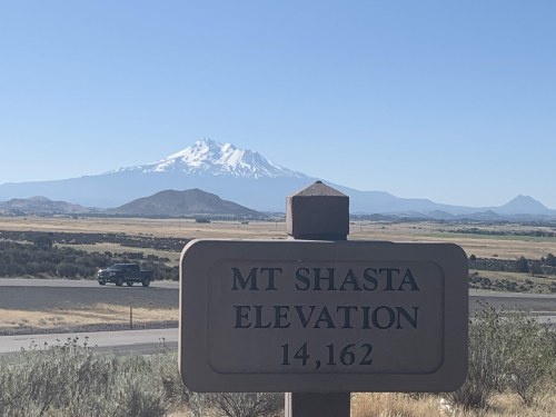
This was a backup plan to an "Ice Cap Slam" around Eldorado, Klawatti, etc. A forecast of rain and low clouds pushed us away from the North Cascades and way down into California to take advantage of a long Fourth of July weekend. Shasta was forecasted mostly clear with some afternoon clouds, and not any thunderstorms. It's a lot of driving. Some people do Shasta in three days, but we combined Shasta and McLoughlin in a 4.5 day weekend to help break that up.
THE DRIVE DOWN -- We left Seattle about 2 PM on Wednesday 7/3 and hit a crazy two hour traffic delay in Tacoma. There were accidents, road construction, and lots of other people trying to get out of town. We hoped to reach Medford, OR, but it was obvious we'd barely get to Roseburg by 10 PM. We didn't have a place to stay, planning this on the fly. We considered sleeping at a Rest Area, but we needed to pitch a tent and didn't want to get a "camping trespass" ticket at a rest stop. We heard that pitching a tent at an Oregon Rest Area is okay, but their policy is "no camping". There were more campgrounds around Grants Pass, but not much around Eugene/Roseburg, so we settled on the Douglas County Fairgrounds RV Park near Roseburg. It's a great place for RVs, and was okay for one tent, one short night. The next morning, we left the Fairgrounds about 7 AM and drove only few more hours to reach the Bunny Flats Trailhead (6,900 feet).
THE APPROACH -- At the Bunny Flats Trailhead, we registered for a climbing permit and paid our $25 each in cash. Anyone going above 10,000 feet needs this permit. We were on trail by 11:30.
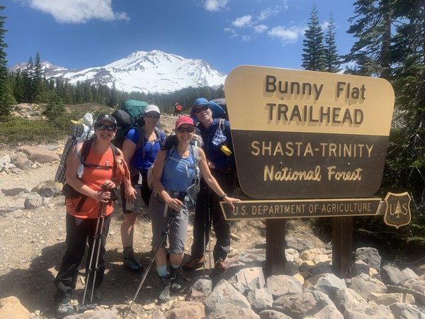 Weather was sunny and cool, which made for great hiking up to Horse Camp (about 1.7 miles). After that, we were mostly on snow, following the curves of Avalanche Gulch on the way to Helen Lake at 10,443 feet. The sun-cupped snow slowed us down, softened by the early afternoon sun, and we reached camp at 3 PM (3.5 hours, trailhead to Helen Lake). Most parties were setting up camp on snow, but we went over to the rock band south-southwest from the snowfield and found two good bivy sites on dirt. It was much warmer there, with views up the gulch as well as down to the town of Mt. Shasta. I counted maybe 60-70 people around Helen Lake, but they were over the hump from us. We had a pretty peaceful camp until some noisy guy pitched a bivy almost right next to us about 8 PM. Dude!
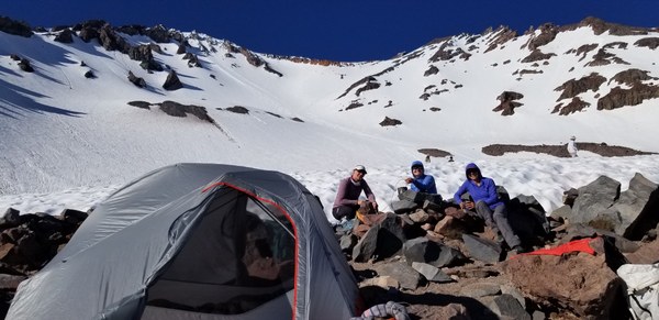
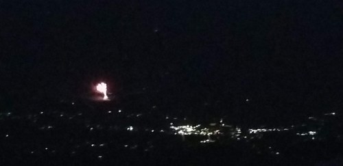
Alina, Emma, and Becca rested and napped while I read to them from "My First Summer in the Sierra" by John Muir. Muir's prose and my reading style always puts people to sleep. Then we spent a couple hours cooking dinner and melting snow before hitting the sacks about 8 PM. We were awoken about 9:30 by hollow "thump, thump" sounds, which were the fireworks way down in Mt Shasta. That was pretty cool to watch from way up high.
THE CLIMB -- We awoke about 2:15, aiming for a 3AM start. There weren't yet any headlamps up the gulch, but that soon changed as the entire camp awoke and began sending parties uphill. By the time we left at 3:15, there were already a couple dozen people ahead of us, a dozen others among us, in the dark, and many more below us. 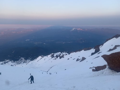 Without glacier ropes tying us together, it was hard to keep track of each other. We just cramponed straight up the gulch among frozen sun-cups until we finally found a great zig-zag boot path about halfway up. Also about this time, Alina was feeling nauseous and starting to slow down. I had lost track of her in my attempt to hurry toward a rock band and umm... (fill a blue bag), but soon heard Emma yelling for us to gather up and consider options. We weren't far from the Red Banks ridge (12,800'), so we decided to get up there, out of the cold wind, rest, drink, eat, and evaluate. The resting helped, and Alina was soon feeling better. We slowed our pace and made sure to stop periodicaly to drink and eat the rest of the way up. Her nausea dissipated and her appetite remained good.
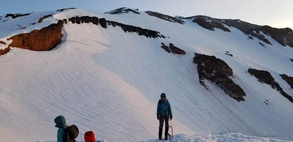
The route traverses the top of Red Bank, with Konwakiton Glacier on the right side of that ridge. Although there was some moating between the rock and the glacier field, it was easy to just walk across the top of the snow and begin climbing up "Misery Hill". It actually seemed easier than coming up Avalanche Gulch. Av. Gulch climbs about 2400 feet in a span of only about 3/4 mile, so it's steep, maybe 30-35 degrees at its steepest. There wasn't much snow on Misery Hill, but it was easier to crampon up the little sections of snow than to go up the cindery frozen scree, and easier on crampons. It was much colder up there and we had pretty much donned all our extra layers, including a wind shell. The sun was just now warming us a little.
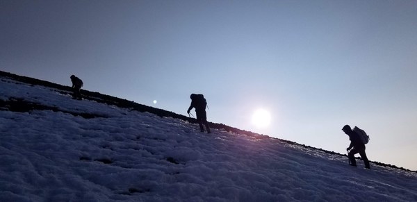
Misery Hill has one small knoll at about 13,200', then another larger knoll at about 13,800' and we finally began to see the summit block. 
For strange reasons, many people were going directly up against the rock of the summit block, and front-pointing a couple steep and icy gullies to reach the top. Those have additional risk of rock and ice fall. The typical route description says to stay away from that rock face, circle climbers left and up to a kinda saddle to the north of the summit block, and then easily ascend the north ridge to the summit area. 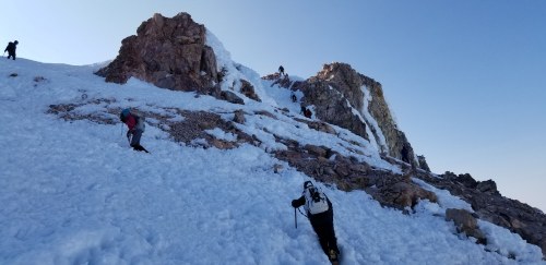 That was perfect. We reached the summit at 8:15, exactly 5 hours from camp. Altough the summit itself is small, there was a great "summit lobby" just below the summit where people sat, rested, ate, and took turns standing on the summit for photos. We rested , ate, and drank for about 45 minutes.
THE DESCENT -- Leaving the summit about 9 AM, we quickly descended Misery Hill and returned to the top of Red Banks. 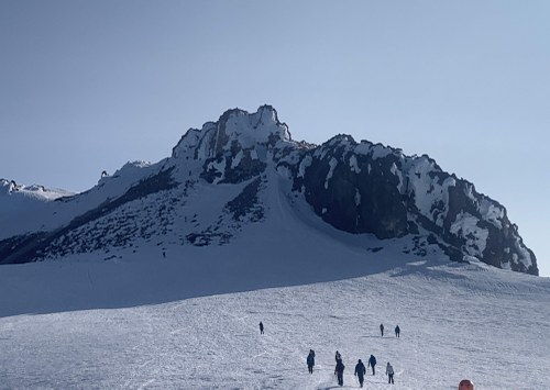 We donned rain pants for glissading, but kept our crampons on. The upper part of Avy Gulch was still too icy to glissade. We cramponed quickly down the upper part of the gully until we saw other people beginning to glissade. We should have continued booting down. We all removed crampons and gave glissading a try. Unfortunately, it was still way too icy. Emma was first, went faster than expected, but maintained control. I went second, and it was very fast, because Emma had smoothed the channel even more. I had to brake really hard, and arrest a couple times on rather hard snow. I stepped out of the channel and told Alina and Becca that it was "very fast, be ready to stop as soon as you go". Alina got going much too fast, yelled for Emma to get out of the way, bumped into Emma, and then began flipping and log-rolling maybe another hundred feet down the slope before managing to arrest. Not good. I couldn't even see her anymore. Emma was out of the channel and I went down to be sure she was okay. She was. Then Becca came flying down the channel and went into arrest mode. It took her at least 50 feet to arrest. I made sure they were okay, and headed down to check on Alina. She was standing, putting her crampons back on. She had lost her phone in the tumble, but one other guy saw it and returned it. Alina was badly shaken and decided to boot the remainder of the gulch back to camp. A little further down, snow had warmed even more, and Emma and I chose to continue glissading, carefully, and the snow just kept getting better and better. Big lesson learned. If the snow still isn't very good for plunge-stepping, it's definitely not good for glissading.
Safely back at camp, we packed up to continue back to Bunny Flats. We just booted the rest of the way down to Horse camp, and then hit the trail back to Bunny Flats. The sun cups had once again warmed up, and it was a bit of a slog getting back to Horse Camp. This was now Friday the 5th of July, and a lot more people were coming up the mountain. The parking lot was crazy-full.
We planned to drive to the base of Mt McLoughlin in southern Oregon to climb it the next day. We stopped in Mt Shasta at a place called "Bistro 107" on Chestnut Street. They had great beer and really good burgers! Highly recommended!
We spent only about 2 hours driving to "Lake of the Woods" and camped at Sunset Camp on the lake. For a Friday night on a holiday weekend, we were happy to find a couple campsites available.
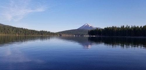
We climbed Mt McLoughlin on Saturday, and then drove to Redmond, OR and camped at the "Expo RV Park" south of Redmond. They had a few tent sites.
We considered camping at Smith Rock, but chose the simplicity of car camping. where we could just get in and out quickly, and get some Dinner in Redmond at the Cascades River Brew House. Then Sunday, we drove the rest of the way back to Seattle, hitting some typical Sunday afternoon return traffic around Cle Elum. This trip definitely has a lot of driving, but I honestly swear that going Hwy 97 along the east side of the cascades would probably be a better drive, both ways, than I5. I'm sure we would have hit more return holiday traffic on I-5, rather than only about 10 miles worth of slowdown in Cle Elum. And, climbing another Cascade Volcano in Oregon was a great way to break up this trip.
GEAR -- We had our camping gear, crampons, helmet, and ice axe. We didn't have or need any glacier gear, pickets, or rock gear on either peak. We had extra fuel to melt snow on Shasta (one 4 oz canister per pair of people). Emma Agosta made a separate trip report on Mt McLoughlin, so check that out if interested.
 Brian Starlin