Trip Report
Alpine Scramble - Mount McLoughlin
An easy and fun scramble to summit one of the Cascade 20 peaks. This was an add-on scramble to a trip to climb Mount Shasta which was a plan B after an Ice Cap Traverse trip on the North Cascades was weathered on. Very glad to have added this peak. Great prominence, stunning views and an easy rock scramble on a very fun ridge. At this time, only a few snow patches that could be mostly avoided. Great add-on to Shasta to make the long drive more worthwhile.
- Sat, Jul 6, 2019
- Alpine Scramble - Mount McLoughlin
- Mount McLoughlin
- Scrambling
- Successful
-

- Road suitable for all vehicles
-
Forest Road 3661 is in good conditions coming from the east side, only a few miles from the paved road (140). The trail in the forest is pleasant and smooth, becomes rocky as you approach the ridge but it is in good shape. The scramble at this time is mostly a hike with a final 1000 ft of class 2-3 rock scrambling to the summit. Only a few patches of snow encountered and they can mostly be avoided. Did not need any traction or ice-ax. No water sources on this route. Bring plenty of water on a hot day!
This was an add-on scramble to a trip to climb Mount Shasta which was a plan B after an Ice Cap Traverse trip on the North Cascades was weathered out. A separate trip report on the Mount Shasta climb was added by Brian Starlin.
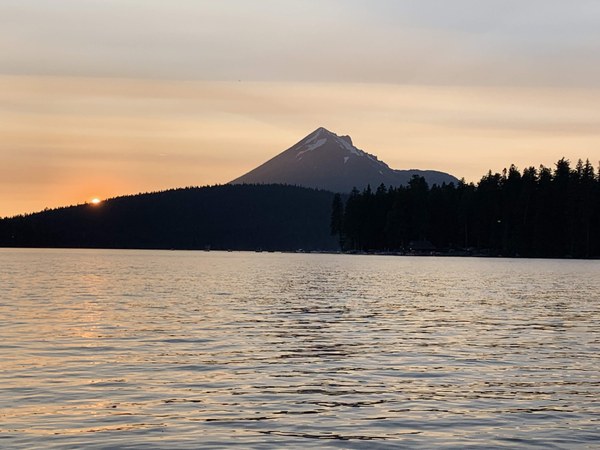
We wanted to add one more peak to make the long drive more worthwhile. We drove down on I-5 on the afternoon before the 4th of July and due to very bad traffic did not make it to Shasta on the first day. On the way back after climbing Shasta we stayed at the Lake of the Woods, Sunset campground and had fantastic views of the peak from the south-west.

We drove back to Seattle on the east side of the Cascade crest and returned via Highway 97 passing by the Bend area. For someone with more time, this area offers the opportunity to tag several other Cascade 20 summits. Some of us were there only two weeks earlier to do a traverse in the 3 Sisters. More details on that on this trip report. https://www.mountaineers.org/activities/trip-reports/middle-sister-south-sister-and-broken-top-traverse
We had a leisurely start and left the trail head at 8:15 am. From reports we read and heard and visual inspection from the lake, we knew that snow coverage would be minimal so we left ice ax and crampons in the car.
The trail starts easy with a smooth forest approach on a gentle grade, crosses and overlaps with the PCT for a little over a 1/4 mile and then splits climber's left continuing in the forest for quite a while. It finally steepens about 2/3 of the way in as it approached the ridge and becomes more bouldery. Still a climber's trail can be easily found all the way to the top. Once above timberline, the views open up and the scramble becomes very scenic as it follows the SE ridge mostly climber's left of the ridge but often intersects it at the crest revealing great views of the inside of the old volcano and the surrounding country-side, lakes and distant peaks.

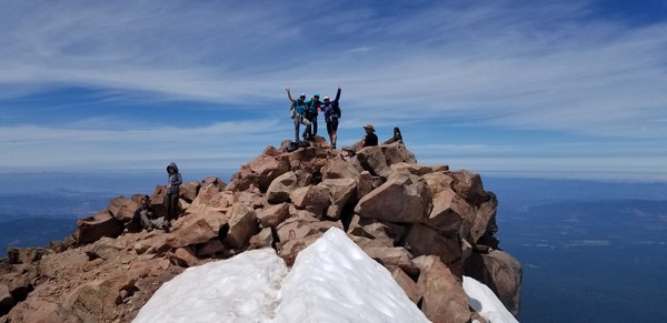
The hike becomes a little more like a scramble in the final 500 feet or so requiring a few class 3 moves and care around mostly solid rock. The summit has plenty of space for several groups and two peaks, the real summit the further to the north. A small strip of snow separated the two at the time we climbed it. From the summit we could see see 4-mile Lake to the east, Lake of the Woods, Shasta (that we had just climbed the day before) to the south, Fish Lake, Ashland, Medford to the Sourtheast, Medford to the Northeast, and Crater Lake, Mount Thielsen, Bachelor and South Sister to the northeast.

On the descent we had to work hard not to follow a myriad of side paths that head too far south (south) and depart from the ridge. Stick to the ones closest to the ridge on skier's left to avoid traversing back too much. Lots of wrong flags and paint led us a bit off but we kept correcting as needed.
Very glad to have added this peak. Great prominence, stunning views and an easy and fun rock scramble on a very scenic ridge.
 Emma Agosta