Trip Report
Basic Glacier Climb - Wedge Mountain/West Ridge
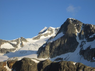
Successful late spring climb in the Canadian Coast range.
- Fri, Jun 14, 2019 — Sun, Jun 16, 2019
- Basic Glacier Climb - Wedge Mountain/West Ridge
- Wedge Mountain/West Ridge
- Climbing
- Successful
-

- Road suitable for all vehicles
-
Ascent. Left camp at 5:20am. The Wedgemount Glacier was straightforward to climb. There were a few small cracks beginning to appear but we just stepped over them.
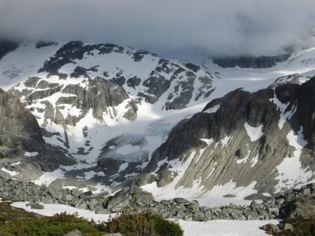 A pond has formed at the top of the glacier right below the saddle – we ascended above the pond on climbers’ right.
 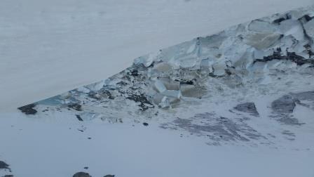 We unroped on the far side of the Parkhurst-Wedge saddle. We tried to traverse high on rock fields on skiers left but were forced down by terrain features – probably best to just head straight down into the basin. We dropped about 400ft then made an ascending traverse up the snow slope on climbers left to attain the ridgeline, 7500ft.
The route from the ridgeline to the summit is essentially 2000 vertical feet of talus and rock.
 We encountered a number of cairns but there didn’t seem to be a definitive climbers path – just head up. There were a few small snow fields within the talus but we skirted them. We did not find the snowfield mentioned in the basic climbs guide. Once we gained the upper ridgeline we followed rock islands and rock on climbers right to the summit. There was a soaked summit register but a dry geo-cache on the summit.
We had two climbers decide part-way up the talus field that they weren’t wanting to climb more talus. They waited for us at the base of the talus field.
Descent. From the summit we basically retraced our ascent route. We located a scree gully on skiers far right that was easier to descend than the talus but this gully cliffs out near the bottom so need to work left to regain the talus field. We dropped straight down into the basin then back up to the Parkhurst-Wedge saddle, where we roped up. Descended the glacier without any issues.
Time: 8h camp to summit. 5h30m summit to camp.
Start Location: Wedgemount Lake TH
End Location: Wedgemount Lake TH
Elevation Gain: 7082ft
General Activity Notes:
We planned to meet at noon at High Mountain Brewing Company in Whistler, BC. Probably should had set the meeting time an hour earlier in order to get into camp a little earlier in the day.
Another team climbed the NE ridge and were just climbing up the final section to the summit as we started our descent.
Post-climb meal at Copper Coil Still & Grill, in Squamish.
Approximately 45 minute wait at the Blaine border crossing mid-afternoon on a Sunday.
Approach conditions:
Wedgemount Lake Trail is well-marked, with yellow/orange diamonds or flagging the whole way. There were a few downed trees especially on the last half of the trail but they were easily passed.
First hour trail is very steep – think Mailbox Peak old trail. Trail eases off as the climb continues but it is still fairly steep all of the way to the lake. Final section to the lake looks steep but is a well-travelled gully that is easy to follow.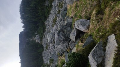
There are two primary camping areas at Wedgemount Lake. We camped right at the top of the trail, in the vicinity of the hut.  Tent platforms are disbursed around the area so we chose 3 platforms near each other. There is a bearwire available to hang food/smellables. Also a privy. The second camping area is about 10 minutes up the north side of the lake. Again several tent platforms disbursed through the area but many of these are right on the lake. There is also a bear wire available here.
Wedgemount Lake was still mostly frozen. Water available in collection ponds near the tent platforms where we camped.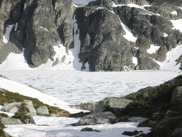
Time: 4h50m from TH to Wedgemount Lake camp. 3h5m from Wedgemount Lake to TH.
Permits required?
Provincial Park camping permits/fees. Our camping permits were checked by two park rangers during our approach hike.
Driving / parking notes:
Access road to TH from Hwy 99 is well marked. Road itself was usable by all vehicles. The rocks in the parking lot itself were rather large (talus vs gravel) but should not impact any vehicles.
Equipment notes:
Carried and used poles, ice axe, crampons, ropes.
Required Skills:
Snow & rock scrambling skills. Glacier travel skills
Weather Notes:
Day 1: Mostly sunny, TH afternoon temps in the mid-70s.
Day 2. Mostly high overcast with sun breaks. Low clouds moved in and out most of the day.
Day 3. Mostly sunny and warm.
 Curtis Stock