Trip Report
Winter Scramble - Eunice Lake & Tolmie Peak Lookout
An early season off trail excursion to a popular summer destination.
- Fri, May 13, 2022
- Winter Scramble - Eunice Lake & Tolmie Peak Lookout
- Eunice Lake & Tolmie Peak Lookout
- Scrambling
- Successful
-

- Road recommended for high clearance only
-
The West Boundary trail from the Mowich entrance is starting to get overgrown with ground cover. There was snow from the night before on the trail when we arrived. It was gone when we departed. Snow fully covered the trail starting at around 3,800 feet elevation.
For today's trip we decided to do an early season visit to one of the most popular destinations in Mt. Rainier national park. Of course being early season access to this area of the park is extremely limited. Currently the road is open and snow free to the closed gate located at the Paul peak trailhead area. Before heading up this road the trip leader verified that it was accessible with the park service. The ranger he spoke with said that we should be able to access all the way to the closed gate but to beware that they had just started grading the road for the year and it would be like driving on marbles. On the drive in we did find the road freshly graded but it was only done about halfway. The remainder of the road was in very poor condition with some sections forcing you to crawl through the mess of potholes which were unavoidable. On our drive in and out we found very soft sections of the graded road that would pull the car left and right as well as bog it down a bit. You may want all wheel drive or four wheel drive if you plan on accessing this area over the next week or so just to ensure you don't get sucked in and stuck.
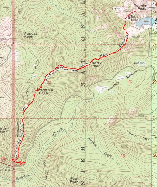
For our route in we opted to head in the West Boundary trail and then head cross country to reach Eunice lake and finally the lookout. For those not familiar with this area this is not the typical route in. In order to do this our group packed in nearly every single piece of scramble gear imaginable. We were all loaded down with full avalanche rescue gear, ice ax's, snowshoes, and crampons as well as the group gear we might need if things did not go as planned. Needless to say we were all carrying a bit of weight.
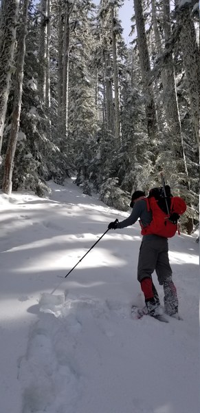
We proceeded up the West Boundary trail heading for our off trail take off point to Virginia peak at an elevation of around 4,500 feet. At around the 4,000 foot level we ended up donning our snowshoes. This was not encouraging since we were only around a half mile into our trip at this point. From there we proceeded to our take off point and headed up Virginia peak. Travel up and over Virginia was fairly easy since there was enough snow that we were able to easily go straight up and over without having to deal with detouring around small blowdowns or brush. This was encouraging.
Once we passed over Virginia peak we continued NE towards the Viginia/Razzleberry peak saddle. Travel was still easy until we started up the slope to Razzleberry peak. This was the first steeper slope we had to deal with for the day. Between the steepness of it and the snow conditions progress slowed considerably.
Heading up Razzleberry
As we neared Razzleberry we decided to cut climbers right and avoid it to get on the ridge running to Berry peak quicker. Once on the ridge progress once again picked up. At this point we figured travel to Berry would be straight forward since a few of us had done it without snow on the ground and consider it a "walk up" peak with a small bit of rock scrambling on the ridge. Little did we realize that getting to Berry peak and over it would be the crux of the trip.
If you have ever done Berry peak the normal route is to drop of the ridge climbers right and sidehill a fairly steep section before ascending to the true summit of Berry. Doing this avoids a nearly knife edge exposed rock section. With snow on the ground this section was so steep we did not want to try and drop off the ridge and sidehill through it. Instead we elected to go high and stay on top of the ridge to the true summit of Berry. This proved to be the way to go but did test the nerves of our party due to the exposure and moving across a very narrow ridge covered in snow.
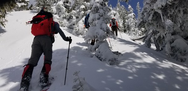
Once over Berry we continued on making good progress towards our goal ridge that would take us up to Eunice lake. Travel was easy until we hit the ridge. Once again the trip turned into quite the slog as we dealt with going up steep slopes and snow that did not want to cooperate. We all took turns breaking trail, kicking steps, and blowing out steps but eventually we reached the basin that Tolmie peak sits above.
Heading up to Eunice lake
Once in the basin we were greeted by the site of the Tolmie look out above us. By this point we were really questioning our sanity about continuing on for the final push. We figured it was going to take us another hour or more to gain the look out.
Tolmie lookout above us on the ridge
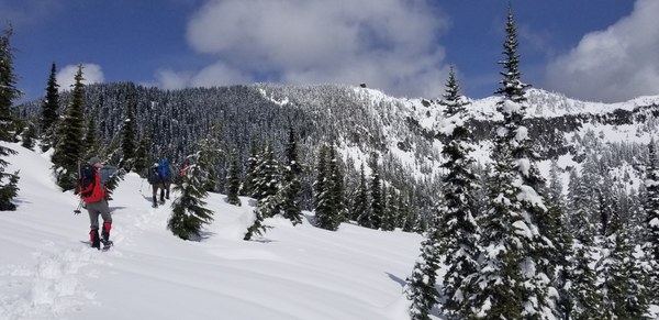
After a quick break, snack, and discussion on how best to proceed to the lookout we got on our way again. Ultimately we decided to proceed and head up the ridge line climbers left in the above photo. From a distance it looked daunting since it appeared we would have to go way out of our way to get to it as well as losing a bit of elevation. In the end it went very well and we were surprised how quickly we gained the ridge to the lookout.
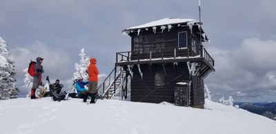
Seldom seen view of the lookout wearing its winter wardrobe
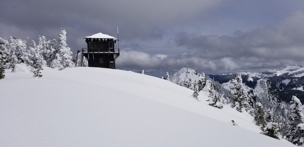
Finally we arrived at our goal for the day. The final push which we thought would take an hour or more only took around half an hour. After a rest at the top we proceeded to head back to our vehicles on the same route we took in. Depending on the snow conditions we were able to sometimes quickly plunge step down in our snowshoes. Other sections required slow methodical progress to avoid slipping and tumbling in the snow. Unfortunately for us the trip out involved once again going back over the three peaks we went over on the way in resulting in a bit of uphill travel to get out.
Total trip time for the day was just under nine hours.
Distance was around 8 miles round trip.
Elevation gain, one gps tracker stated 3,500 feet while another stated over 4,000 foot gain. Most in the party figured the trip felt much more like a 4,000 foot day.
 Jerrick Linde