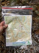
Wenatchee, WA No. 211S
Green Trails Maps

Description
Mission Ridge rises more than 6,000 feet above the city of Wenatchee on the Columbia River. Far enough east to be within the Cascade rain shadow and high enough to receive ample snowfall, Mission Ridge offers superb skiing opportunities. Our 211S map provides detailed coverage of the system of roads and trails doubling as backcountry skiing, snowshoeing, and snowmobile routes. Mission Ridge is also known for its excellent mountain biking and horseback riding trails. This map covers The Devils Gulch trail system, Tronsen Ridge, Table Mountain and Blewett Pass. Map also covers the northern half of the Colockum Wildlife Area, the Foothills Trails, and other community trails within and near Wenatchee. Map also includes a close-up (1:24,000 scale) of the Devils Gulch Mission Ridge Trail network.
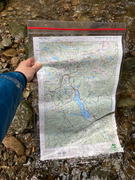
1:69500 Wenatchee Map, 1:24000 Mission Ridge Devils Gulch detailed Inset. Printed on a rugged Waterproof - Tear Resistant Sheet.
Reprinted 2023
Map Scale 1:69,500 with 1:24000 inset of Mission Ridge / Devils Gulch
CLICK HERE to search all maps via Green Trails interactive map feature.
1:69500 Wenatchee Map, 1:24000 Mission Ridge Devils Gulch detailed Inset. Printed on a rugged Waterproof - Tear Resistant Sheet.
Reprinted 2023
Map Scale 1:69,500 with 1:24000 inset of Mission Ridge / Devils Gulch
CLICK HERE to search all maps via Green Trails interactive map feature.
