Trip Report
Packrafting the San Juan River Utah, April 12-18 2024
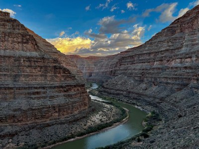
Our group of seven spent 7 days on the The San Juan River paddling from Sand Island, near Bluff, Utah, 83 river miles downstream to Clay Hills. Along the way we hiked and explored the washes and canyons containing Puebloan ruins, rock art and breathtaking scenery.
- Fri, Apr 12, 2024 — Thu, Apr 18, 2024
- San Juan River
- Packrafting
- Successful
-

- Road suitable for all vehicles
-
Our group of seven spent 7 days on the The San Juan River paddling from Sand Island, near Bluff, Utah, 83 river miles downstream to Clay Hills. Along the way we hiked and explored the washes and canyons containing Puebloan ruins, rock art and breathtaking scenery. After taking off the river, we spent several days exploring Natural Bridges National Monument, canyons of Cedar Mesa, and Hovenweep. The trip was planned and led by Brian Collins.
Things to know about the San Juan River:
- Wildlife included wild donkeys, beaver, pronghorn sheep, mule deer, turkey, blue heron, lots of geese and ducks and some large cougar tracks.
- The river water is not considered potable owing to upstream agricultural runoff and a high sediment load. While water was available from the pools in Slickhorn Canyon, this cannot be counted on, and we carried water sufficient for the entire trip. Human waste must be carried out in a hard-sided, waterproof container. See the Mountaineers route description and BLM guidelines for detail.
- River levels at the USGS gage near Bluff ranged from 680 CFS to 880 CFS. Higher flows are preferred, but the river was readily navigable in packrafts. At this flow it was necessary to paddle downstream nearly the entire time we were on the river.
- Permitting for launches April 15 - July 15 is by a lottery closing January 31 has a low success rate. Permits for launches prior to April 15 can be obtained on December 1 at 8:00AM, but plan on being fast to beat the bots!
- Stopping, hiking, or camping on river left require permits from the Navajo Nation.
- “Guide to the San Juan River” by Whitis and Martin was an indispensable guide.
- Weather during our trip was generally great, with highs in the 60s and 70s (except for 1 day in the 50s) and lows in the 40s. Spring weather is highly variable–it can be cold and snowy or warm and sunny–but summer months are very hot.
Minor challenges along the way:
- One packraft puncture, readily repaired with Patch and Go.
- Sand everywhere, lots of it, most annoyingly in packraft cargo zippers. A single grain of sand can keep a boat’s zipper from closing, making a good brush an essential component of a packraft repair kit.
- There were too many incredible things to see, and hikes and scrambles to do, and not enough time to do them all!
- A spot of cold on one day, including about 15 minutes of rain and sleet. Most of us wore dry suits on some days and went without on other days.
- Wind blowing upstream on several afternoons motivated a few early starts.
- On the final day, numerous sand bars, thanks to the backwater effects of Lake Powell, required a comically zig-zagged downstream path with occasional boat dragging.
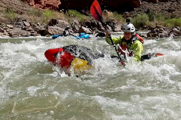
Day 1. We launched from Sand Island on 4/12. Cultural sites were concentrated in this upper part of the river. We made stops to explore River House Ruins and nearby Butler Wash petroglyphs. We made our first camp at Chinle Wash where we played a roving game of river bocce among wild donkeys and a herd of turkeys. Brian found a semi-finished stone ax head in the river (which he left in place in accordance with guidelines).
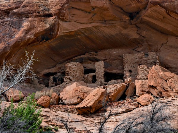
River House Ruins
Day 2 we explored Chinle Wash, including numerous early Puebloan cliff structures and wall art. Pottery sherds litter the ground in places. We then paddled 15 miles to Mexican Hat Camp.
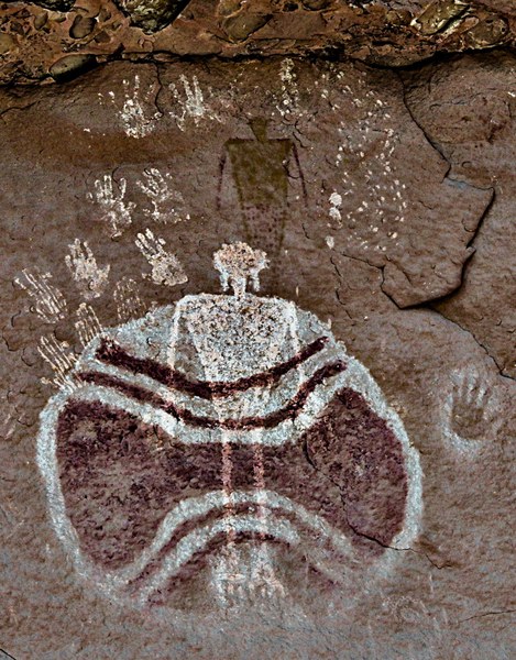
Rock art in Chinle Wash
Day 3 took us 21 river miles through the entrenched meanders of the goosenecks, with 2,000 foot canyon walls and three fun class II rapids, to camp at Honaker.
Day 4 began with a pre-dawn, pre-breakfast hike to the canyon rim on the Honaker Trail. We then paddled 14.4 miles, including the straightforward class III Twin Canyons Rapid.
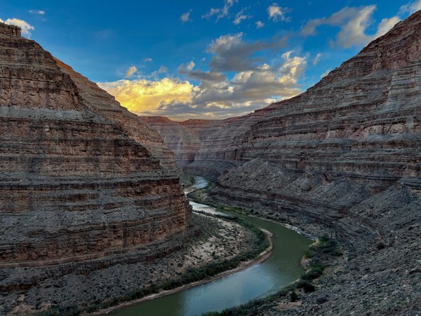
From the Honaker trail
Camp that night was adjacent to a photogenic tinaja in Johns Canyon.
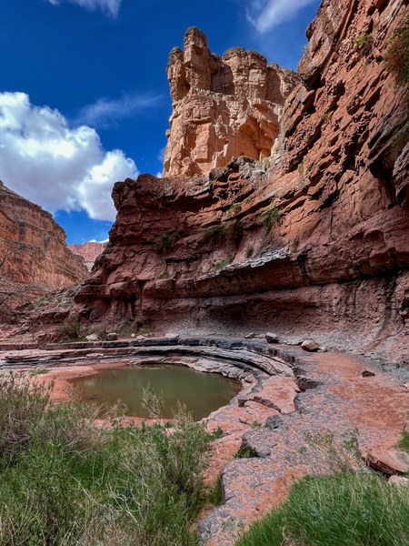
The tinaja at Johns Canyon camp
Day 5 began with a 7 mile paddle, including the short, but, at the relatively low flow of our trip, tricky class III Government Rapid. We arrived at our camp at Slickhorn Canyon in time to explore the upper canyon pools and to soak and bask in sun on the slickrock.
Day 6 was an 11 mile paddle with two stops to explore Grand Gulch and Oljeto Wash, the latter a trip highlight. Our last river camp was at Steer Gulch.
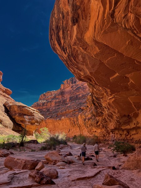 Oljeto Wash
Day 7 began with a 6 mile paddle through a maze of sand bars from Lake Powell backup to a late-morning takeout at Clay Hills. From there we drove to Natural Bridges National Monument where we spent the afternoon hiking the canyon loop to view the bridges and scramble up to more early Puebloan ruins..
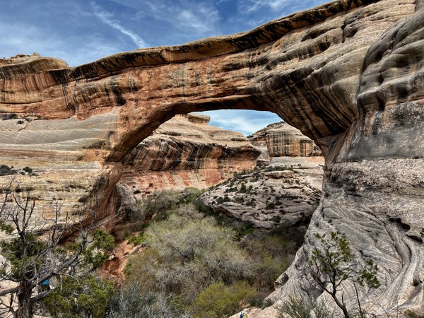
Sipapu Bridge at Natural Bridges National Monument
The next few days were spent visiting the Edge of the Cedars Museum in Blanding, eating fresh food, and exploring the spectacular Puebloan ruins at Hovenweep National Monument and Cedar Mesa. Several beers may have been consumed during this phase of the trip.
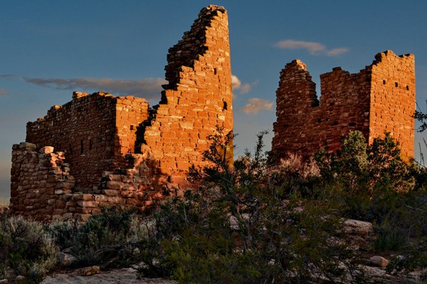
Morning sun at Hovenweep
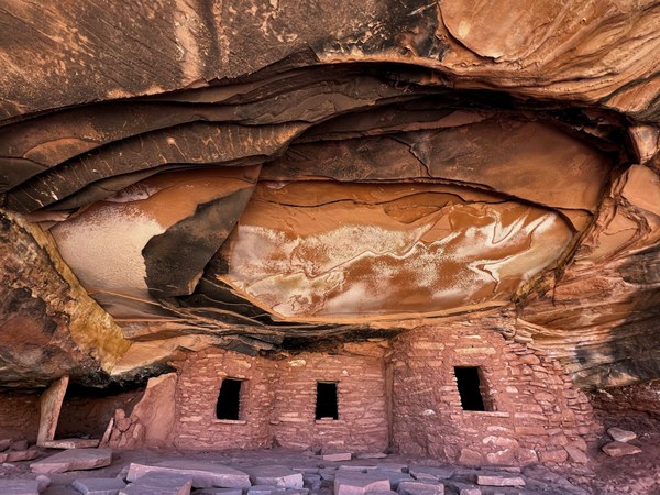
Fallen Roof Ruin
The group
Most group members had multiple years experience paddling rivers in rafts, kayaks and packrafts. One participant had two years experience, with only one previous multi-day river trip. The San Juan’s whitewater is relatively non-technical, having only two short class III rapids, and was well suited to our group’s skills.
The bottom line:
We accomplished everything on our itinerary and the trip went as planned. Packrafting is relatively new as a sport and has been a Mountaineers activity only since 2022. The relatively easy logistics of packrafts, their large carrying capacity, and their maneuverability in whitewater, make river explorations such as this one very accessible. It’s hard to think of a better way to travel in such a spectacular place.
 Robert Kaye