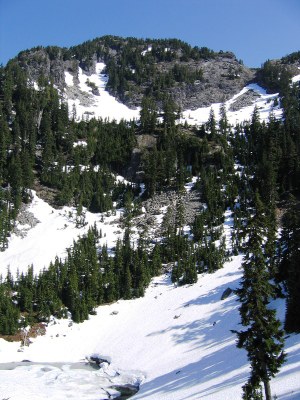
Treen Peak
A strenuous scramble about 1.25 miles northeast of Mount Garfield with panoramic views of the Taylor River and several lakes in the Alpine Lakes Wilderness.
getting there
From North Bend, drive the Middle Fork Snoqualmie River Road. Find a very faint miners/fishermans path on the north side of the road approximately 1.1 miles before the Dingford Creek Trailhead at an elevation of 1,350 ft.
approach & ascent
On the USGS Snoqualmie Lake map look for elevation Point 1571. The path follows steeply northeast toward Green Ridge Lake. At about 4,100 ft where the track forks, continue north up the ridge (the other fork leads east to the lake). After gaining the ridge at 4,700 ft travel cross country northwest through open forest, heather meadows, and past a couple of tarns. After reaching Tarn 4662, proceed west to a boulder field and to Upper Garfield Mountain Lake. Camp at lake. Hike through timber north to Charlie Brown Lake. Above the lake at 4,800 ft reach a boulder field. Look for a gully northwest and enter at about 5,200 ft. It is very steep. Find forest at the top (~5,400 ft). Scramble north to the summit.
FOr leaders
Permit information
As of 2017, the Snoqualmie Ranger District considers Mountaineers trips and courses to be "nominal use". Leaders should print and copy this designation letter to show rangers they may see on trail or carry a digital copy on their phone.
- Suitable Activities: Scrambling
- Seasons: April, May, June, July, August, September, October
- Weather: View weather forecast
- Difficulty: Strenuous 4, Technical 3
- Length: 7.0 mi
- Elevation Gain: 4,400 ft
- 5,763 ft
-
Land Manager:
Mount Baker-Snoqualmie National Forest
Alpine Lakes Wilderness, Snoqualmie Ranger District (MBSNF)
- Parking Permit Required: Northwest Forest Pass
- Recommended Party Size: 12
- Maximum Party Size: 12
- Maximum Route/Place Capacity: 12
- Green Trails Skykomish No. 175
- USGS Snoqualmie Lake
There are no resources for this route/place. Log in and send us updates, images, or resources.
