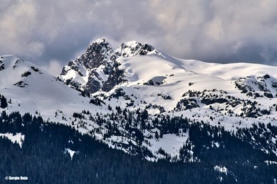
Tomyhoi Peak/Southeast Route
The Southeast Route on Tomyhoi Peak is a moderate but technically challenging, exposed scramble with 12.5 miles of travel and 5,000 feet of elevation gain.
Getting There
Drive SR-542 (Mount Baker Highway) to the Glacier Ranger Station. Continue on SR-542 13 miles and turn left (north) on Forest Road 3065 (Twin Lakes Road) and drive 4.7 miles to the Tomyhoi Lake/Yellow Aster Butte Trailhead (3,700 ft).
Approach & Ascent
Hike the Gold Run Pass Trail to 5,900 ft and bear left on the Yellow Aster Meadows Trail. Continue on the Yellow Aster Meadows Trail to the meadow and several small lakes at 5,580 ft. Camp on durable surfaces here and avoid trampling the fragile heather.
Head NNW from the meadow over a hump and down to a col at 6,266 ft. Ascend from there until the ridge narrows. Bypass this section via broad benches on the north side. Then ascend to and traverse the top edge of the glacier to avoid climbing around several rock pinnacles. Climb over the false summit, descending to a notch at 7,200 ft. Climb the left edge of the ridge for 160 feet and then cross a ledge west (left) to a wide corner. Climb scree and ledges to the summit.
- Suitable Activities: Climbing, Scrambling
- Climbing Category: Basic Alpine
- Seasons: July, August, September
- Weather: View weather forecast
- Difficulty: Basic Alpine Climb, Technical 5, Strenuous 5
- Length: 12.5 None
- Elevation Gain: 5,000 ft
- 7,435 ft
-
Land Manager:
Mount Baker-Snoqualmie National Forest
Mount Baker Wilderness, Mount Baker Ranger District (MBSNF)
- Parking Permit Required: Northwest Forest Pass
- Recommended Party Size: 12
- Maximum Party Size: 12
- Maximum Route/Place Capacity: 12
- USGS Mt Larrabee
- Green Trails Mount Baker Wilderness Climbing No. 13SX
- Green Trails Mt Shuksan No. 14
- Trails Illustrated North Cascades National Park
There are no resources for this route/place. Log in and send us updates, images, or resources.
