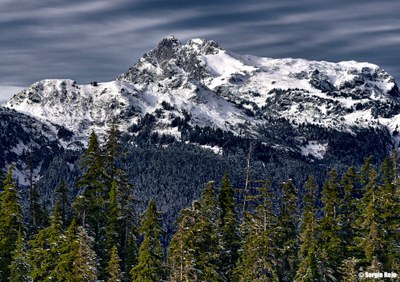
Tomyhoi Lake
In the Mount Baker Wilderness, the 4-mile trail to Tomyhoi Lake climbs steadily to Gold Run Pass with views of American Border Peak and Canadian Border Peak. It's 2 miles and 1,500 feet of elevation gain to the pass, and another 2 miles and 1,500 feet of elevation loss to the lake. The Gold Run Mining Company workers built this trail in the early 1900s.
Getting There
Drive SR-542 (Mount Baker Highway) to the Glacier Ranger Station. Continue on SR-542 13 miles and turn left (north) on Forest Road 3065 (Twin Lakes Road) and drive 4.7 miles to the Tomyhoi Lake/Yellow Aster Butte Trailhead (3,700 ft).
On The Trail
The trail begins with switchbacks traveling through an avalanche path thick with wildflowers in early summer. Then it enters timber and climbs until it breaks out onto a flat bench in a meadow. The junction with Yellow Aster Butte Trail is about 1.5 miles from the trailhead. Stay to the right at the junction and continue upward through the meadow to Gold Run Pass. The steep, pyramid shaped, reddish peak north of the pass is Mount Larrabee, and American and Canadian Border Peaks are visible to the north. From the pass, the trail quickly loses elevation, and a half mile below the pass reaches a meadow-covered bench known as Coyote Flats. The trail continues to the lake, a popular fishing spot with camping available near the lake. Avalanche debris and downed trees usually make the last half mile of the trail to the lakeshore and camps hard to follow.
- Suitable Activities: Day Hiking
- Seasons: June, July, August, September, October
- Weather: View weather forecast
- Difficulty: Moderate
- Length: 8.0 mi
- Elevation Gain: 3,000 ft
- 5,190 ft
-
Land Manager:
Mount Baker-Snoqualmie National Forest
Mount Baker Wilderness, Mount Baker Ranger District (MBSNF)
- Parking Permit Required: Northwest Forest Pass
- Recommended Party Size: 12
- Maximum Party Size: 12
- Maximum Route/Place Capacity: 12
- Green Trails Mount Baker Wilderness Climbing No. 13SX
- Green Trails Mt Shuksan No. 14
- Trails Illustrated North Cascades National Park
There are no resources for this route/place. Log in and send us updates, images, or resources.
