The Table Rocks
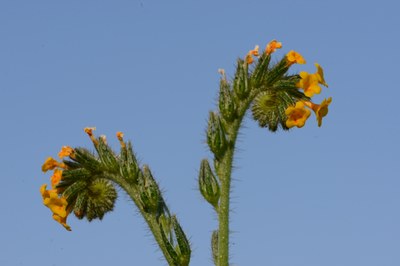
In early to mid-spring, this is an exceptionally colorful wildflower hike through serpentine woodland, savanna and vernal pond meadows. It's one of the premier wildflower destinations in the Pacific Northwest and an easy hike of 3-8 miles and 720-1,500 feet of elevation gain.
Getting There
Lower Table Rock
Take Exit 33 off of I-5 just north of Medford, OR. Drive east on Biddle Road 1 mile. Turn left (north) on Table Rock Road and continue for 5.1 miles as road swings left (west). Turn left (west) onto Wheeler Road (at Milepost 10). Follow the signs to fenced parking area and trailhead on left (west) side of road.
Upper Table Rock
From I-5, take Exit 33, Central Point located just north of Medford, OR, and drive east on Biddle Road 1 mile. Turn left on Table Rock Road, drive 5.2 miles to a curve, and turn right on Modoc Road. Drive 1.5 miles to parking lot on left.
on the trail
Lower Table Rock
It's 3.8 miles round trip and 800 feet of elevation gain to a high point of 2,047 ft.
Upper Table Rock
It's 3.0 miles round trip and 720 feet of elevation gain to a high point of 2,091 ft.
notes
- The Table Rocks are collaboratively managed by the Bureau of Land Management and The Nature Conservancy.
- Reference: Flowers of the Table Rocks by Susan MacKinnon (flowersofthetablerocks.com, 2008).
- Reference: Wildflowers of the Pacific Northwest by Mark Turner & Phyllis Gustafson (Timber Press, 2006).
- Suitable Activities: Day Hiking
- Seasons: Year-round
- Weather: View weather forecast
- Difficulty: Easy
- Length: 3.0 mi
- Elevation Gain: 700 ft
- 2,091 ft
- Land Manager: Oregon-Washington BLM
- Parking Permit Required: BLM Permits & Passes
- Recommended Party Size: 8
- Maximum Party Size: 12
- Maximum Route/Place Capacity: 12
- USGS Sams Valley
This is a list of titles that represent the variations of trips you can take at this route/place. This includes side trips, extensions and peak combinations. Not seeing a title that fits your trip? Log in and send us updates, images, or resources.
- Lower Table Rock (Oregon)
- Lower Table Rock
- Upper Table Rock (Oregon)
- Upper Table Rock
There are no resources for this route/place. Log in and send us updates, images, or resources.
