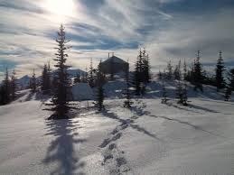
Sun Top Lookout
In winter, snowshoe or cross-country ski on this strenuous route to one of the few remaining fire lookouts in Washington. In summer, drive to near the lookout and hike the short trail to the lookout and continue out the Suntop Trail. Enjoy an unobstructed spectacular view of Mount Rainier and possibly sightings of the White River elk herd!
getting there
winter
Turn east onto Forest Road 73 (Huckleberry Creek Road) off of SR-410 just east of Milepost 49, and drive 1.3 miles to the Sun Top Sno-Park (2,250 ft). A Sno-Park permit is required.
summer
Turn east onto Forest Road 73 (Huckleberry Creek Road) off of SR-410 just east of Milepost 49, drive 1.3 miles, and turn left onto Forest Road 7315. Drive 5 miles to a large forest road intersection (4,800 ft). Park here or turn right and drive 0.1 mile to a gate and park on the side of the road not blocking the gate (4,800 ft). In summer during the day and if the lookout is staffed, it may be possible to drive to the lookout. A Northwest Forest Pass is required.
on the trail
Sun top Lookout (winter)
The route to the top follows Forest Road 7315 all the way from the Sno-Park. There are plenty of opportunities for snowshoers to climb off the road and stomp around in open meadows too! The road is often groomed for cross-country skiers, but still quite enjoyable for snowshoers. For the best views of Mount Rainier, head southwest around the summit bench. It's 10 miles round trip and 3,000 feet of elevation gain to the lookout.
- Reaching the summit requires crossing some serious avalanche slopes, so be sure to check the avalanche report and plan this trip only when avalanche danger is low.
Huckleberry Creek (winter)
From the Sno-Park travel south on Forest Road 73 (Huckleberry Creek Road) as far as desired, up to 10 miles round trip and 700 feet of elevation gain.
sun top lookout & suntop trail (summer)
Hike the ½-mile trail to the look out. Return the way you came or walk the forest road back to your car. From the lookout, hike south on the Suntop Trail, No. 1183, as far as desired up to 16.6 miles and 2,700 feet of elevation gain.
Information for leaders
Permit information
As of 2017, the Snoqualmie Ranger District considers Mountaineers trips and courses to be "nominal use". Leaders should print and copy this designation letter to show rangers they may see on trail or carry a digital copy on their phone.
- Suitable Activities: Cross-country Skiing, Day Hiking, Snowshoeing, Trail Running
- Snowshoeing Category: Intermediate
- Seasons: Year-round
- Weather: View weather forecast
- View avalanche forecast.
- Difficulty: Strenuous, U-XC 3 Intermediate Ungroomed
- Length: 10.0 mi
- Elevation Gain: 3,000 ft
- 5,280 ft
-
Land Manager:
Mount Baker-Snoqualmie National Forest
Snoqualmie Ranger District (MBSNF)
- Parking Permit Required: see "Getting There" section (above)
- Recommended Party Size: 12
- Maximum Party Size: 12
- Maximum Route/Place Capacity: 12
- Green Trails Greenwater No. 238
This is a list of titles that represent the variations of trips you can take at this route/place. This includes side trips, extensions and peak combinations. Not seeing a title that fits your trip? Log in and send us updates, images, or resources.
- Sun Top
- Suntop Trail
- Sun Top Sno-Park
- Huckleberry Creek
There are no resources for this route/place. Log in and send us updates, images, or resources.
