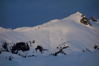
Snowking Mountain/Northeast Shoulder
A great early season snow scramble. With 12 miles of travel and 6,800 feet of elevation gain, this is a long and challenging scramble.
Getting There
Drive to Marblemount on SR-20. Register your climb at the Ranger Station. From Marblemount, go straight onto Cascade River Road and follow it for 14.2 miles to Forest Road 1570. Follow this road down to the river (stay left at first fork at about 0.1 miles). Park at the next road fork, 0.4 miles beyond the river crossing and 1.9 miles from Cascade River Road (1,250 ft). The right fork is blocked by large boulders.
Approach
Hike the blocked, overgrown road approximately 3 miles to the start of a steep way trail (2,300 ft). Then hike the steep way trail at end of a clearcut to a knoll at 5,116 ft. The trail stays to east (left) of the knoll and drops to a saddle before continuing to climb SSW on Kindly Found Ridge to a knoll at 5,791 ft. The trail continues over a third knoll at 5,695 ft to two lakes at 5,442 ft. It is best to pass this knoll on the west (right) although you can climb over the top if there is no snow. Camp at the lakes at 5,442 ft just north of Cyclone Lake.
Climbing Route
option #1
Follow Kindy Found Ridge Crest SSW passing above Cyclone Lake. The Ridge Crest then tends to the southwest. Stay south of a cornice overhanging the ridge above Cyclone Lake. After passing the cornice, the route tends due west up a moderately steep snow slope to the summit block. A very short rock scramble finishes the climb. Climb the center of summit pyramid and follow a fracture line diagonally up and left.
option #2
Travel counterclockwise around Cyclone Lake and descend to the head of the outlet stream from Cyclone Lake at 5,350 ft. Bypass a vertical rock wall lining the east side of the outlet stream by dropping towards the lake 50 feet east of the outlet. Make a Class 3 move around the end of the rock wall to the head of the outlet or descend 100-150 feet vertical down stream to bypass the rock wall. Ascend gentle rock buttress heading southwest, bypassing several small cliffs in the rock by scrambling either up or down. Upon reaching the small glacier, continue southwest directly towards the summit. Scramble the summit block from the southeast ridge (left) or south slope.
Trip Profile
| SEGMENT | TIME (HR) | ELEVATION GAIN (FT) |
|---|---|---|
| Trailhead to Camp | 6-8 | +5,300, -1,100 |
| Camp to Summit | 3-4 | 2,000 |
| Summit to Camp | 2 | +400 |
| Camp to Trailhead | 3-4 | +1,100, -5,300 |
Notes
- Our climbing groups often offer Option #2 as a "Basic Alpine" difficulty climb.
- Avoid Option #2 when Cyclone Lake's outlet stream is running at a high flow.
- This is a very good early season climb (May-June).
- The view from base camp is spectacular at sunset.
- The approach can also be made through Enjar Lake or from Illabot Creek Road.
- After snow is gone, camping is also available at 4,700 ft, northeast of the knoll at 5,116 ft.
- There is little to no water available on the long approach.
- Suitable Activities: Climbing, Scrambling
- Climbing Category: Basic Alpine
- Seasons: May, June, July, August, September, October
- Weather: View weather forecast
- Difficulty: Technical 5, Strenuous 5, Basic Alpine Climb, Basic Experience Climb
- Length: 12.0 mi
- Elevation Gain: 6,800 ft
- 7,433 ft
-
Land Manager:
Mount Baker-Snoqualmie National Forest
Glacier Peak Wilderness, Darrington Ranger District (MBSNF)
- Parking Permit Required: Northwest Forest Pass
- Recommended Party Size: 12
- Maximum Party Size: 12
- Maximum Route/Place Capacity: 12
- Trails Illustrated North Cascades National Park
- USGS Snowking Mountain
- USGS Sonny Boy Lakes
This is a list of titles that represent the variations of trips you can take at this route/place. This includes side trips, extensions and peak combinations. Not seeing a title that fits your trip? Log in and send us updates, images, or resources.
- Snowking Mountain
There are no resources for this route/place. Log in and send us updates, images, or resources.
