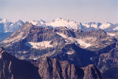
Sinister Peak/North Face
An attractive ice climb on a remote peak along the Ptarmigan Traverse in the Glacier Peak Wilderness, close enough to Dome Peak to allow a two-peak itinerary.
Temporary Closure
4/15/21 Update: In the aftermath of the Downey Mountain fire in 2020, the Suiattle River Road is closed west of Downey Creek, at about mile 19. This closure includes all trails beyond the road closure: Downey Creek Trail (No. 768), Sulphur Creek Trail (No. 793), Sulphur Mountain Trail (No. 794), Suiattle River Trail (No. 784), Bachelor Creek Trail (No. 796), and the Sulphur Creek Campground. Please check with the Darrington Ranger District for the most up to date information.
Getting There
Drive SR-530 to Darrington and continue north towards Rockport. About seven miles north of Darrington turn right onto Suiattle River Road (Forest Road 26) and continue on this road until road's end. This road has been washed out for years and you will need to check with the Forest Service to find where it ends. Although the peak is in North Cascades National Park, the road and approach is under Forest Service jurisdiction so bring your Northwest Forest Pass.
Approach
From road end continue on foot until Downey Creek Trailhead and campground (19.5 miles in from turnoff, elevation 1450 feet). Follow the trail 6.5 miles to Bachelor Creek and locate the Bachelor Creek trailhead. The trail crosses a pass 12.5 miles in at 6,000 feet before dropping to Cub Lake (5338 feet, 14 miles). Camp here or ascend 1600 feet to Ipswoot Ridge.
Traverse east along snow and talus until you reach the Dome Glacier at 7600 feet. Ascend the Dome Glacier and traverse to the SW to a flat area around 8000 feet. Climb to a col between the Dome and Chickamin glaciers at 8450 feet. Follow the ridge SE to about 8750 feet and you'll find benches that are good for camping.
Ascent Route
From the Dome Glacier-Chickamin Glacier col descend to the base of the north face of Sinister. Ascend the 45-50 degree neve and ice directly towards the summit. At the top the snow gives way to a short scramble to the summit.
Descent Route
Descend to the Dome-Sinister Col and continue to the base of the Chickamin Glacier. From here retrace your route back to camp.
TRIP PROFILE
SEGMENT |
TIME (HOURS) |
ELEVATION GAIN (FeeT) |
|---|---|---|
| Seattle to Trailhead | 2.5 | 1450 |
| Trailhead to Camp 1 | 8-9 | 3900 |
| Camp 1 to Camp 2 | 3-4 | 3450 |
| Camp to Summit | 6 | -1600, +1300 |
| Summit to Cars | 12 | -7000 |
Equipment
Standard glacier travel gear. Ice tools, ice screws and pickets.
- Suitable Activities: Climbing
- Climbing Category: Intermediate Alpine
- Seasons: July, August, September
- Weather: View weather forecast
- Difficulty: Intermediate Ice Climb
- Length: 32.0 mi
- Elevation Gain: 7,000 ft
- 8,440 ft
-
Land Manager:
North Cascades National Park
Glacier Peak Wilderness
- Parking Permit Required: Northwest Forest Pass
- Recommended Party Size: 6
- Maximum Party Size: 12
- Maximum Route/Place Capacity: 12
- USGS Downey Mtn
- USGS Dome Peak
- Green Trails Cascade Pass No. 80
- Trails Illustrated North Cascades National Park
There are no resources for this route/place. Log in and send us updates, images, or resources.
