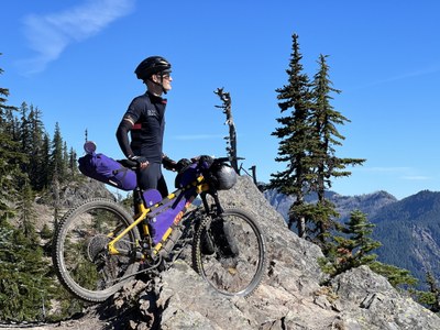
Siouxon Creek Loop
A very strenuous 3-day bikepacking loop. It connects the Tarbell, Chinook, Silver Star, Bluff Mountain, Siouxon, and Huffman Peak Trails. It features backcountry singletrack, expansive views, old growth forests, scree fields, and rugged ridges.
GETTING THERE
Take Exit 21 off of I-5 onto Pacific Ave. At 0.7mi, turn left to stay on Pacific Ave, then immediately turn left onto Lewis River Rd (0.1 mi). Turn right onto E CC St (0.2 mi) and continue to Bridge 80 (417 ft), NW Hayes Rd (5.3 mi), and NE Cedar Creek Rd (10.8 mi). Turn right onto NE 221st Ave (0.5 mi) and then a slight left onto NE Amboy Rd (4.3 mi). Find street parking in Yacolt.
on the trail
- Route: 75 miles, 9,868 ft, 74% unpaved, 46% singletrack, 95% rideable (time).
- Difficulty: The route is suitable for bikepackers experienced with loaded singletrack riding. The steep ascent up Silver Star on day one and the exposure of Bluff Mountain on day two are the most challenging route segments.
- Camping: There are several campgrounds and established sites along the route, and opportunities for dispersed camping are plentiful.
- Water: Water is abundant most of the year. During summer it may be scarce from miles 27-47.
- Food: There are no food resupply opportunities until Chelatchie at mile 69
Suggested Itinerary
Day One (26.8 miles, 5,600 feet of elevbation gain) - From Yacolt, pedal on pavement, and then ride steeply up Bells Mountain before reaching Tarbell Trail at Rock Creek Campground. Tarbell Trail climbs for a few miles then branches off on the Chinook Trail switchbacks. The recommended campsite rests on top of Silver Star. There is a fresh water spring nearby.
Day Two (26.4 miles, 2,709 feet of elevation gain) - Head east on Bluff Mountain trail. The riding is the most technical of the route as you traverse scree slopes with panoramic views. You’ll then connect with a series of doubletrack roads that maintain elevation and link you to Siouxon Creek. Day two ends with a descent to Siouxon Creek Falls campsite.
Day Three (21.8 miles, 1,559 feet of elevation gain) - Ride along Siouxon Creek to a narrow paved descent, and finally the return to Yacolt.
- Suitable Activities: Bikepacking
- Seasons: June, July, August, September, October
- Weather: View weather forecast
- Difficulty: Bikepacking MTB III
- Length: 75.0 mi
- Elevation Gain: 9,868 ft
- 4,207 ft
- Land Manager: Yacolt Burn State Forest
- Parking Permit Required: None
- Recommended Party Size: 12
- Maximum Party Size: 12
- Maximum Route/Place Capacity: 12
This is a list of titles that represent the variations of trips you can take at this route/place. This includes side trips, extensions and peak combinations. Not seeing a title that fits your trip? Log in and send us updates, images, or resources.
- Bikepacking, Bikepack
| Name/Description |
|---|
| Silver Siouxon on bikepacking.com The description, data, and map of the Silver Siouxon route on bikepacking.com. |
| Ride with GPS A Ride with GPS description, data, and map of the Silver Siouxon bikepack route posted. |
| Mountain Bike Project A description, data, and map of the "Lower Siouxon #130D" mountain bike route on mtbproject.com. |
