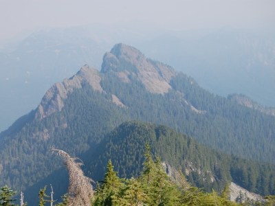
Russian Butte/East Ridge
Technical off-trail route with 13 miles and 4,500 feet of elevation gain. Seldom visited peak along the Middle Fork Road.
Getting There
From I-90 exit 34, drive north on 468th Ave SE for 0.6 miles. Turn right onto Middle Fork Road and drive 11.6 miles. Then turn right into the large and paved Middle Fork Snoqualmie Trailhead (1,040 ft).
APPROACH & ASCENT
Cross the Snoqualmie River using the footbridge then turn right (west) and continue on the Pratt River Trail as it follows the Snoqualmie River. In 2.5 miles as the trail nears the Pratt River, turn and follow the trail southeast, parallel and to the east of the Pratt River. Shortly, begin a descending traverse to the Pratt River and look for a good crossing at roughly an elevation of 1,100 ft.
Continue along the Pratt River and eventually turn southwest and ascend up the fall line of the broad east shoulder of Russian Butte. At an elevation of 3,800 ft head west along a single sharp ridge (just above the red "Section 7" marker on the USGS map). At elevation 4,000 ft head northwest and make an ascending traverse around the steep east ridge and approach the Russian Butte summit from its northeast face. The summit is a 5,000-foot balcony overlooking the Middle Fork valley and surroundings.
notes
- If the Snoqualmie River is low then it is possible to cross approximately where the Pratt River joins the Snoqualmie River. This will save you 2.5 miles each way, or roughly 2 hours total. Expect water depths of 3 feet or more.
- Suitable Activities: Scrambling
- Seasons: April, May, June, July, August, September, October
- Weather: View weather forecast
- Difficulty: Technical 5, Strenuous 4
- Length: 13.0 mi
- Elevation Gain: 4,500 ft
- 5,123 ft
-
Land Manager:
Mount Baker-Snoqualmie National Forest
Snoqualmie Ranger District (MBSNF)
- Parking Permit Required: Northwest Forest Pass
- Recommended Party Size: 12
- Maximum Party Size: 12
- Maximum Route/Place Capacity: 12
- USGS Bandera
- Green Trails Middle Fork Snoqualmie No. 174SX
- USGS Lake Phillipa
- Green Trails Bandera No. 206
There are no resources for this route/place. Log in and send us updates, images, or resources.
