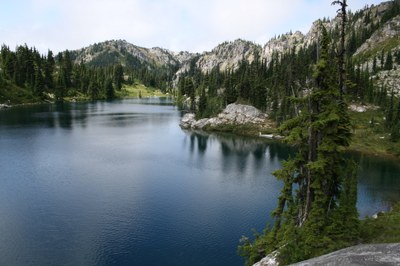
Josephine, Chain & Doelle Lakes
Hike south on the Pacific Crest Trail from Stevens Pass to the Icicle Creek Trail visiting stunning alpine lakes beneath the rocky spires of Bulls Tooth.
getting there
Drive SR-2 to Stevens Pass (4,000 ft). There are parking lots on the east and west sides of the pass.
on the trail
josephine lake
10 miles round trip, 2,150 feet of elevation gain, 5,100 ft high point
From the parking lot just east of the Steven Pass ski area, hike south on the Pacific Crest Trail (PCT) gaining 1,190 feet in 2.2 miles to reach the saddle between Cowboy and Big Chief mountains. From the saddle, drop 600 feet over the next 1.2 miles, passing under power transmission lines, to a point where the trail enters the Alpine Lakes Wilderness. Continue another 1.1 miles to Lake Susan Jane. From this small lake, start hike 0.5 mile and 425 feet of elevation gain to a pass where the PCT meets the Icicle Creek Trail. Turn around here or follow the Icicle Creek Trail for 0.7 mile and 300 feet of elevation loss to camps on the southeast corner of Josephine Lake.
chain & doelle lakes
25 miles round trip, 6,200 feet of elevation gain, 6,200 ft high point
From camp at the southeast corner of Josephine lake hike 2.6 miles with 900 feet of elevation loss on the Icicle Creek Trail, turn left onto the Chain Lakes Trail, and hike 2.5 miles and 2,000 feet of elevation gain to camps at Chain Lakes. Doelle Lakes and campsites are 1.8 miles and 600 feet of elevation gain from Chain Lakes.
JOSEPINE LAKE & TUNNEL CREEK
11.2 MILES ONE-WAY, 2,450 FEET OF ELEVATION GAIN, 3,500 FEET OF ELEVATION LOSS, 5,260 FT HIGH POINT
A one-way car shuttle variation that extends a hike to Josephine Lake by continuing south on the PCT and exiting via the the Tunnel Creek Trail. From southeast corner of Josephine Lake, hike 0.7 mile and 300 feet of elevation gain back to the PCT. Follow the PCT south then southwest for 3.5 miles, 535 feet of elevation gain, and 1,100 feet of elevation loss, passing Hope and Mig Lakes to the intersection with the Tunnel Creek Trail (4,380 ft). Turn right (north) onto the Tunnel Creek and follow it 1.35 miles and 1,200 feet of elevation loss to the Tunnel Creek Trailhead.
notes
- In August and September, expect to encounter PCT thru-hikers making their way to Canada from the Mexican border.
- Suitable Activities: Backpacking, Day Hiking
- Seasons: July, August, September, October
- Weather: View weather forecast
- Difficulty: Moderate/Strenuous
- Length: 25.0 mi
- Elevation Gain: 4,700 ft
- 6,200 ft
-
Land Manager:
Okanogan-Wenatchee National Forests
Alpine Lakes Wilderness, Skykomish Ranger District (MBSNF)
- Parking Permit Required: Northwest Forest Pass
- Recommended Party Size: 12
- Maximum Party Size: 12
- Maximum Route/Place Capacity: 12
- Green Trails Alpine Lakes West (Stevens Pass) No. 176S
- Green Trails Stevens Pass No. 176
This is a list of titles that represent the variations of trips you can take at this route/place. This includes side trips, extensions and peak combinations. Not seeing a title that fits your trip? Log in and send us updates, images, or resources.
- Josephine Lake
- Chain & Doelle Lakes
- Josephine Lake & Tunnel Creek
There are no resources for this route/place. Log in and send us updates, images, or resources.
