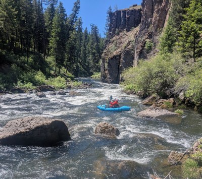
John Day River (North Fork): Dale to Monument
45 miles of Class II-III water in a beautiful basalt canyon that begins in the Elkhorn Mts foothills in ponderosa pine forest and ends in central Oregon juniper-sagebrush desert
FLOW
- USGS Gage: North Fork John Day River at Monument, OR
- NOAA Northwest River Forecast Center: North Fork John Day River at Monument, OR
- NOAA Northwest River Forecast Center Extended 45 to 120 Day Forecast
- The season is late spring snowmelt
- Recommended range is 800 - 10,000 cfs. Above 2500-3000 cfs the run is Class III-III+; below 2500 cfs it is Class II+
PUT-INS & TAKE-OUTS
- Just upstream of the Camas Creek confluence at a river access site on river left (across the river from Highway 395) where Haden Creek joins the North Fork John Day.
- Alternate put-ins: (1) river right downstream of the Camas Creek confluence; (2) at Tollbridge Campground; (3) upstream Forest Service sites to extend the run and add more class III whitewater.
- The take-out is a developed BLM river access in Monument Park on river right about 1/2 mile downstream of the Hwy 402 Bridge.
ON THE RIVER
- The most significant rapids are in the first 10 miles.
- Above 2500-3000 cfs, four named rapids are Class III- III+, and there are at least 20 Class II rapids.
- Below 2500 cfs, the four named rapids are Class II+.
- Additional class II rapids continue all the way to the take-out and include several fun surf waves.
- “The river feels like one giant class II rapid keeping you moving down stream with ease” (Whitewater Guidebook)
- Soggy Sneakers has a detailed description.
LOGISTICS
Permits
- Self-issued BLM permits are available at kiosks in Monument and Camas Creek.
Guides, Maps & Online Resources
Car Shuttles
- Driving distance from put-in to take-out is approximately 90 minutes.
- Shuttles are available in the towns of Monument, Service Creek, and Dale.
Water, Human Waste, and Fires
- River water can be filtered or carried.
- Human waste must be carried out.
- A fire pan is required for campfires, and ashes must be packed out. Cutting standing vegetation, either dead or alive, is not allowed. No fires are allowed from June 1 through October 15.
- Suitable Activities: Packrafting
- Seasons: March, April, May, June
- Weather: View weather forecast
- Difficulty: Class II River, Class III River
- Length: 45.0 mi
- Land Manager: Oregon-Washington BLM
- Parking Permit Required: BLM Permits & Passes
- Recommended Party Size: 12
- Maximum Party Size: 12
- Maximum Route/Place Capacity: 12
There are no resources for this route/place. Log in and send us updates, images, or resources.
