Nisqually Land Trust
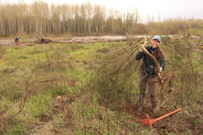
Join our partner in a variety of stewardship and educational opportunities to restore, maintain, and learn about essential habitats along rivers, wetlands and forests.
about the land trust
The Nisqually Land Trust acquires and manages critical lands to permanently benefit the water, wildlife, and people of the Nisqually River Watershed. Founded in 1989, the Land Trust has grown to own, protect, and steward more than 6,500 acres.
Land Trust protected areas conserve important forest and shoreline habitats from the foothills of Mount Rainier to the shores of the Puget Sound. Join the Land Trust for their weekly stewardship activities to improve wildlife habitat and explore these unique places throughout the Nisqually River Watershed.
protected areas managed by the trust
- Anderson Island
- Brighton Creek
- Elbe
- Hogum Bay
- Lackamas Flats
- Lake Saint Clair
- Lower Reach
- Mashel River
- Middle Mashel
- Mount Rainier Gateway
- Nisqually Mashel
- Ohop Creek
- Powell Creek Complex
- Red Salmon Creek
- South Muck Creek
- Thurston Ridge
- Upper Muck Creek
- Upper Ohop Creek
- Yelm Shoreline
- Suitable Activities: Stewardship
- Seasons: Year-round
- Weather: View weather forecast
- Land Manager: Nisqually Land Trust
- Parking Permit Required: None
- Recommended Party Size: 12
- Maximum Party Size: 12
- Maximum Route/Place Capacity: 12
This is a list of titles that represent the variations of trips you can take at this route/place. This includes side trips, extensions and peak combinations. Not seeing a title that fits your trip? Log in and send us updates, images, or resources.
- Anderson Island
- Brighton Creek
- Elbe
- Hogum Bay
- Lackamas Flats
- Lake Saint Clair
- Lower Reach
- Mashel River
- Middle Mashel
- Mount Rainier Gateway
- Nisqually Mashel
- Ohop Creek
- Powell Creek Complex
- Red Salmon Creek
- South Muck Creek
- Thurston Ridge
- Upper Muck Creek
- Upper Ohop Creek
- Yelm Shoreline
There are no resources for this route/place. Log in and send us updates, images, or resources.
