Spray Park
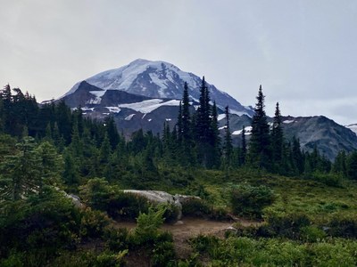
A moderate 7-mile hike with 1,600 feet of elevation gain in the northwest corner of Mount Rainier National Park. This trail has it all—rolling woods, a large waterfall, wildflowers and tarns, and on a clear day, a great view of Mount Rainier.
Emergency closure
As of April 14, 2025, the Fairfax bridge at milepost 11.5 has been closed until further notice. This closes access to Mount Rainier National Park's Mowich Lake and Carbon River entrances. Check WSDOT.com for status.
This hike is in Mount Rainier National Park. The National Park Service preserves unimpaired the natural and cultural resources and values of the National Park System for the enjoyment, education, and inspiration of this and future generations. The National Park Service cooperates with partners to extend the benefits of natural and cultural resource conservation and outdoor recreation throughout this country and the world.
All participants should orient themselves to the unique geologic hazards at Mt. Rainier, an active volcano.
getting there
Drive SR 165 through Carbonado and the Mount Rainier National Park Entrance to the campground and trailhead at Mowich Lake (4,930 ft).
- Suitable Activities: Day Hiking
- Seasons: July, August, September
- Weather: View weather forecast
- Difficulty: Moderate
- Length: 6.0 mi
- Elevation Gain: 2,200 ft
- Land Manager: Mount Rainier National Park
- Parking Permit Required: National Park Entrance Fee
- Recommended Party Size: 12
- Maximum Party Size: 12
- Maximum Route/Place Capacity: 12
- Green Trails Mt Rainier West No. 269
- Green Trails Mount Rainier Wonderland No. 269SX
There are no resources for this route/place. Log in and send us updates, images, or resources.
