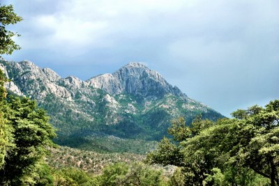
Mountains of Southern Arizona
Hike the high mountains on the miles trails around the Tucson Basin of Southern Arizona and experience its unique and varied landscapes, outstanding views, dramatic diversity of flora, fauna, and world-class birding. The trails are easily accessed from camps and hotels in the Tucson metro area, making it a day-hiker's paradise.
About the Area
Less than an hour from the city of Tucson in Southern Arizona are the Santa Catalina, Rincon, Santa Rita, Tucson, and Tortolita Mountains. The region is a hiking enthusiast’s paradise with over 120 national, state, and local parks, peaks up to 9,500 ft and hundreds of miles of trails. Large parts of these ranges are within Saguaro National Park and the Coronado National Forest.
Besides very few rainy days, the area features incredible flora, unusual fauna, and world class birding in the Santa Ritas—250 species of birds, including 15 hummingbird species. The "sky islands," the tall peaks that are cooler and wetter than the lower elevations, have some of the most diverse ecosystems in the world. Visit Tucson in early spring to see the wildflower show and early summer to see the Saguaro cacti blooming.
- Suitable Activities: Day Hiking
- Seasons: January, February, March, April, May, June, September, October, November, December
- Weather: View weather forecast
- Difficulty: Strenuous
- 9,500 ft
- Land Manager: Saguaro National Park
- Parking Permit Required: None
- Recommended Party Size: 12
- Maximum Party Size: 12
- Maximum Route/Place Capacity: 12
- Green Trails Santa Rita Mountains No. 2962S
- Green Trails Saguaro No. 2910S
- Green Trails Santa Catalina Mountains No. 2886S
There are no resources for this route/place. Log in and send us updates, images, or resources.
