Mount Storm King/North Route
A challenging 12-mile scramble with 3,900 feet of elevation gain in the Olympics near Lake Crescent. The route starts at Lake Sutherland and ends with a fun rock scramble along the summit ridge. From the summit, enjoy views of the Strait of Juan de Fuca, Lake Crescent, the Olympic Mountains, and beyond.
Getting There
Drive US-101 to Lake Suhtherland west of Port Angeles and turn south onto South Shore Road that heads west along the lake's south shore. Turn left onto the first dirt road, Forest Road 3050 on the left and park.
Approach & Ascent
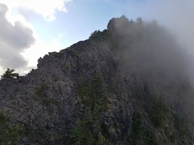
Walk Forest Road 3050 west to Forest Road 011 on the right hand side ~30 feet before the hair pin turn. It is overgrown but not hard to walk. Leave Forest Road 011 and climb the first unnamed drainage west of Falls Creek. It's currently marked with a pink ribbon. Ascend along the east side of the creek to old growth forest. Continue ascending through the forest turning back toward the creek at ~2,500 ft. At ~3,100 ft, leave the creek and head southwest to a col on the ridge at 4,000 ft. Turn west and follow the ridge to the summit (4,537 ft), staying on the north side and slightly off the ridge for easier travel. The final ascent to the peak looks daunting and exposed, but it is straightforward with good rock.
Notes
- An ice ax is helpful for anchoring on the slippery scree and climbing over stumps and downed trees.
- Suitable Activities: Scrambling
- Seasons: June, July, August, September, October
- Weather: View weather forecast
- Difficulty: Strenuous 4, Technical 4
- Length: 12.0 mi
- Elevation Gain: 3,900 ft
- 4,537 ft
-
Land Manager:
Olympic National Forest
Hood Canal Ranger District (ONF)
- Parking Permit Required: Northwest Forest Pass
- Recommended Party Size: 12
- Maximum Party Size: 12
- Maximum Route/Place Capacity: 12
- Custom Correct Lake Crescent - Happy Lake Ridge
There are no resources for this route/place. Log in and send us updates, images, or resources.
