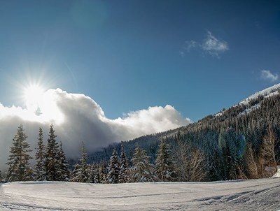
Mount Spokane Cross-country Ski Park
A network of almost 37 miles (60 km) of nordic ski trails ranging from easy to difficult near Mount Spokane.
Getting there
Take Exit 287 off of I-90 just east of Spokane and drive north on N Argonne Rd continuing north as it becomes N Bruce Rd. Turn right onto SR-206 (N Mt Spokane Park Drive) and continue for 16 miles. Turn right onto N Summit Rd and follow it 0.2 mile to the Selkirk Lodge parking area (4,600 ft). Note that the road leading to the Selkirk Lodge and ski trails is at the back of the large overflow parking lot.
notes
- Visit the Spokane Nordic Ski Association's website for a trail map of groomed nordic ski trails, including distances. Pocket trail maps are also available in the Selkirk Lodge and the Fitness Fanatics rental trailer.
INFORMATION FOR LEADERS
scheduling
- If you are scheduling this as a non-course related activity, please limit your group size to the default party size. The maximum party size is for use by course field trips only, and includes both students and instructors. Group size maximums do not reflect how course field trips are run (in smaller groups of students and instructors), but allow for course leaders to register the course in our system.
- This is a big area and many groups may be there at the same time. Please be sure to coordinate with other leaders going the same time as you to be sure we are not over-crowding or over-using any one area.
- If you are scheduling a course field trip, please contact our Member Services Team to confirm the field trip and any permitting regulations.
permits
- The Mountaineers has a commercial use permit with Washington State Parks for all free and fee-based outings at state parks. Leaders should carry a print or digital copy of our commercial use permit to show rangers they may encounter.
- Suitable Activities: Cross-country Skiing
- Seasons: January, February, March, December
- Weather: View weather forecast
- Difficulty: G-XC 3 Intermediate Groomed
- Land Manager: Spokane Nordic Ski Association
- Parking Permit Required: SnoPark Pass
- Recommended Party Size: 12
- Maximum Party Size: 100
- Maximum Route/Place Capacity: 12
- see Land Manager
There are no resources for this route/place. Log in and send us updates, images, or resources.
