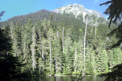
Mount Pugh
A very strenuous 11 mile hike to the top of a craggy peak off the Mountain Loop Highway. The final mile of the route is exposed and takes on a scrambling character as a very rough trail. It can be dangerous in poor conditions and to those who are unprepared for the technical challenges.
getting there
from Darrington
Drive to Darrington on SR 530 and turn right (south) onto the Mountain Loop Highway at the three-way stop. Continue for 12.7 mi and turn left onto Forest Road 2095. Drive 2 miles to the Mount Pugh Trailhead (1,900 ft). Parking is limited.
from barlow pass
Drive SR 92 thru Granite Falls and turn left (north) onto the Mountain Loop Highway and drive it to Barlow Pass. Continue driving 10.6 miles and take the right fork onto Forest Road 2095. Drive 2 miles to the Mount Pugh Trailhead (1,900 ft). Parking is limited.
approach & ascent
Hike the Mount Pugh Trail to Stujack Pass. From here the trail is rough and heads south along the ridge around the head of a small glacier. The final mile of the route takes on a scrambling character as a very rough trail which eventually mellows into an easy trail with some exposure up the west side to the summit.
NOTEs
- The final mile to summit is Class 2 climbing/scrambling with exposure. It can be dangerous in poor conditions and to those who are unprepared for the technical challenges.
- Suitable Activities: Day Hiking, Scrambling
- Seasons: July, August, September, October
- Weather: View weather forecast
- Difficulty: Strenuous 5, Technical 2, Rock Scramble, Very Strenuous
- Length: 11.0 mi
- Elevation Gain: 5,300 ft
- 7,201 ft
-
Land Manager:
Mount Baker-Snoqualmie National Forest
Glacier Peak Wilderness, Darrington Ranger District (MBSNF)
- Parking Permit Required: Northwest Forest Pass
- Recommended Party Size: 12
- Maximum Party Size: 12
- Maximum Route/Place Capacity: 12
- USGS Pugh Mountain
- USGS White Chuck Mtn
- Green Trails Sloan Peak No. 111
- Green Trails Mountain Loop Highway No. 111SX
There are no resources for this route/place. Log in and send us updates, images, or resources.
