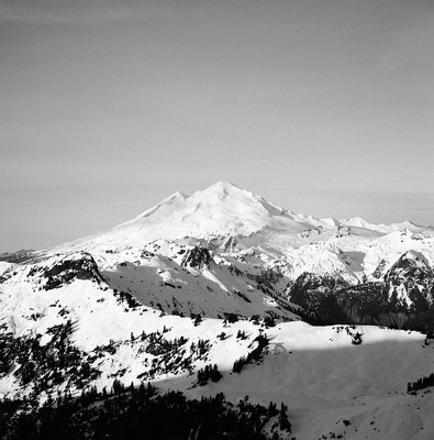
Mount Baker/North Ridge
A Grade II glacier ice climb with one step section.
getting there
From I-5 just north of Bellingham, drive east on SR-542 (Sunset Highway) to 1 mile east of Glacier. Turn right (south) on Forest Road 39 (Glacier Creek Road) and continue 9 miles to head of Mount Baker Trailhead (3,700 ft).
APPROACH
Follow well-established trail to Heliotrope Ridge, then traverse Coleman Glacier to bivy sites at 6,800 ft.
ASCENT ROUTE
From Coleman Glacier campsite, travel as directly to North Ridge as crevasses will allow. Avoid passing directly beneath Roman Nose and Coleman Headwall. Gain North Ridge by ascending its west slope, then continue up ridge as it steepens below ice wall at 9,600 ft. This ice wall is the steepest, most technical part of the climb. Above ice wall, the ridge lays back to an easy gradient. Near the top, make a leftward traverse at the final ice formation to reach summit plateau.
DESCENT ROUTE
Descend standard route via Roman Wall and Coleman Glacier.
TRIP PROFILE
| SEGMENT | TIME (HR) | ELEVATION GAIN (FT) | Distance (MI) |
|---|---|---|---|
| Seattle to Trailhead | 3 | 133 | |
| Trailhead to Camp | 4-6 | 3,100 | 5 |
| Camp to Summit | 7-10 | 4,000 | 3 |
| Summit to Trailhead | 5 | 8 |
EQUIPMENT
Ice tools, pickets, ice screws and crampons.
NOTES
- This climb is quite popular and bottlenecks sometimes occur on the ice wall.
- Suitable Activities: Climbing
- Climbing Category: Intermediate Alpine
- Seasons: June, July
- Weather: View weather forecast
- Difficulty: Intermediate Ice Climb
- Length: 16.0 mi
- Elevation Gain: 7,100 ft
- 10,778 ft
-
Land Manager:
Mount Baker-Snoqualmie National Forest
Mount Baker Wilderness, Mount Baker Ranger District (MBSNF)
- Parking Permit Required: Northwest Forest Pass
- Recommended Party Size: 12
- Maximum Party Size: 12
- Maximum Route/Place Capacity: 12
- USGS Mt Baker
- Green Trails Mount Baker Wilderness Climbing No. 13SX
- Green Trails Mt Baker No. 13
There are no resources for this route/place. Log in and send us updates, images, or resources.
