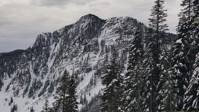
Mount Kent
A scramble of 9 miles with 4,200 feet of gain near McClellan Butte in the Snoqualmie Pass area.
getting there
Take Exit 42 off of I-90 and head east on Forest Road 55 to the McClellan Butte trailhead (1,600 ft).
approach & ascent
Begin at the McClellan Butte Trailhead (or the upper trailhead located at 47.4079, -121.6033). From Forest Road 9020. Hike ~2.5 miles to a hair pin turn. In winter this is a great spot to leave the trail to minimize encroachment on the Cedar River Watershed. Otherwise, stay on the trail for about another 0.5 mile and descend a very well maintained climber’s path to a decommissioned road. (If taking the route on snow, you eventually may want to make your way to this road). Follow the “road” for ~0.75 miles (staying to the left at an intersection). Leave the road and bushwhack to Alice Lakes (~0.25 miles). Ascent the right side of the area with rocks, in a slightly forested area in between rock fields. Then travel the ridge line to the summit.
Alternate Route: This route stays completely out of the Cedar River Watershed, but only one known trip report exists for a trip done in January of a low snow year. For the most part it avoids avalanche danger in winter, it is unknown how the route would fare in the summer, and it could make for a good “loop” route. Where Forest Road 9020 intersects the McClellan Butte Trail, travel on Forest Road 9020 until the blockade. Travel ~0.25 mile, crossing a creek, and turn right onto Forest Road 9020-110. This road is heavily decommissioned, but has been passable without the need for bushwhacking. Follow Forest Road 9020-110 to its the end, and continue to hook around to approach Mount Kent from the south.
notes
- WARNING: Some route variations will take you along the edge of the Cedar River Watershed via well established climber’s routes. Navigation skills are of utmost importance so that you will know exactly where you are and can avoid entering the watershed.
- WARNING: In winter this area generally has high avalanche danger and there are several avalanche paths that may be encountered.
information for leaders
Permit information
As of 2017, the Snoqualmie Ranger District considers Mountaineers trips and courses to be "nominal use." Leaders should print and copy this designation letter to show rangers they may see on trail or carry a digital copy on their phone.
- Suitable Activities: Scrambling
- Seasons: Year-round
- Weather: View weather forecast
- View avalanche forecast.
- Difficulty: Winter Scramble, Strenuous 3, Technical 3
- Length: 9.0 mi
- Elevation Gain: 4,200 ft
- 5,087 ft
-
Land Manager:
Mount Baker-Snoqualmie National Forest
Snoqualmie Ranger District (MBSNF)
- Parking Permit Required: Northwest Forest Pass
- Recommended Party Size: 12
- Maximum Party Size: 12
- Maximum Route/Place Capacity: 12
- USGS Bandera
- Green Trails Bandera No. 206
- Green Trails Mount Si NRCA No. 206S
There are no resources for this route/place. Log in and send us updates, images, or resources.
