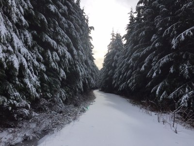
Mallardy Ridge
A strenuous, 10 mile round trip snowshoe with 1,900 feet of elevation gain. The trail follows old roads up the ridge.
getting there
From Granite Falls drive East on the Mountain Loop Highway about 7.4 miles past the Verlot Ranger Station. Turn right into the wide parking area near the unction with the Mallardy Ridge Road (Forest Road 4030). This turnoff is just before Red Bridge.
- Suitable Activities: Snowshoeing
- Snowshoeing Category: Basic
- Seasons: January, February, March
- Weather: View weather forecast
- View avalanche forecast.
- Difficulty: Strenuous
- Length: 10.0 mi
- Elevation Gain: 1,900 ft
- 3,500 ft
- Land Manager: Mount Baker-Snoqualmie National Forest
- Parking Permit Required: Northwest Forest Pass
- Recommended Party Size: 12
- Maximum Party Size: 12
- Maximum Route/Place Capacity: 12
- Green Trails Silverton No. 110
There are no resources for this route/place. Log in and send us updates, images, or resources.
