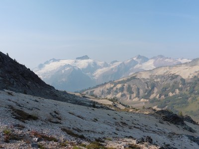
Luahna Peak/Pilz Glacier
A glacier climb to the less-visited neighbor of Clark Mountain in the Dakobed range. There are multiple routes to the summit. This one includes an approach into the magnificent Napeequa Valley. The summit offers and expansive panorama view, including a close up view of the East side of Glacier Peak. Luahna is a top 100 peak in Washington State.
Getting There
Drive SR-2 to Coles Corner and take SR 207 North. Turn onto Chiwawa River Road (County Road 22) N and continue on it for about 19 miles to the trailhead for Little Giant Pass.
APPROACH
Find a log crossing near the trailhead and continue about 4.5 miles to Little Giant Pass. Drop from the pass to Napeequa Valley and continue up the valley about 2 miles to Louis Creek. Continue north a few hundred feet and find an open way down to the Napeequa River and find a safe crossing. From the other side, climb up about 1,100 ft to Butterfly Butte and good camping (5,850 ft). Optionally continue up to 6,500 ft to a small tarn and camp.
ASCENT ROUTE
Ascend to the toe of the Pilz Glacier and rope up. Ascend the glacier to the col northwest of the summit block. Scramble to the summit (Class 2-3).
DESCENT ROUTE
Descend the climbing route.
TRIP PROFILE
| SEGMENT | TIME (HR) | ELEVATION GAIN (FT) |
|---|---|---|
| Trailhead to Camp | 6-8 | 5,500,-200 |
| Camp to Summit | 3-4 | 2,600 |
| Summit to Camp | 2-3 | -2,600 |
| Camp to Trailhead | 5-7 | 2,000,-5,500 |
EQUIPMENT
Standard glacier travel gear.
- Suitable Activities: Climbing
- Climbing Category: Basic Alpine
- Seasons: June, July, August
- Weather: View weather forecast
- Difficulty: Basic Glacier Climb
- Length: 16.0 None
- Elevation Gain: 10,300 ft
- 8,400 ft
-
Land Manager:
Okanogan-Wenatchee National Forests
Glacier Peak Wilderness
- Parking Permit Required: Northwest Forest Pass
- Recommended Party Size: 6
- Maximum Party Size: 12
- Maximum Route/Place Capacity: 12
- USGS Clark Mountain
- USGS Trinity
- Trails Illustrated Glacier Peak Wilderness
- Green Trails Holden No. 113
- Green Trails North Cascades Lake Chelan No. 114SX
There are no resources for this route/place. Log in and send us updates, images, or resources.
