Loowit Trail
A strenuous backpack that circumnavigates Mount St. Helens.
on the trail
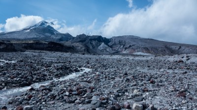
Many people climb Mount Saint Helens, but how many circumnavigate it? This is a scenic and challenging backpack around Mt. St. Helens volcano at elevations ranging from 3,200 ft to 4,800 ft with views of Mount Hood, Mount Rainier, Mount Adams and the Goat Rocks Wilderness. It also allows views into Mount St. Helens crater on the north side. Hike through old growth forests, cross remnants of lava flows, lahars (mudflows), and pyroclastic flows, as well as fording stream gullys and the South Fork of the Toutle River. Enjoy wildflower meadows, the effects of the 1980 eruption, and the recovery of native plants and wildlife. Camp at South Fork Toutle River camp and on the Plains of Abraham. Route conditions include rough and steep terrain, exposed slopes, loose rock and soil (scree), stream crossings, and potential volcanic hazards.
- Suitable Activities: Backpacking
- Seasons: July, August, September, October
- Weather: View weather forecast
- Difficulty: Strenuous
- Elevation Gain: 6,300 ft
- 4,800 ft
- Land Manager: Mount Saint Helens National Volcanic Monument
- Parking Permit Required: Northwest Forest Pass
- Recommended Party Size: 12
- Maximum Party Size: 12
- Maximum Route/Place Capacity: 12
- Green Trails Mt St Helens NW No. 364S
- Trails Illustrated Mt Saint. Helens/Mount Adams
There are no resources for this route/place. Log in and send us updates, images, or resources.
