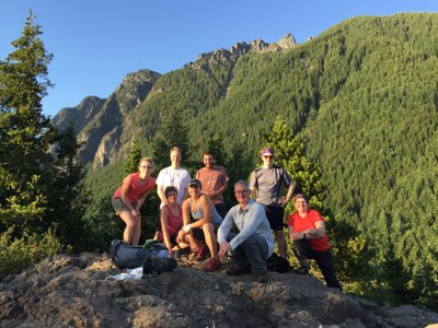
Little Si
An easy to moderate 5-mile day hike or scramble with 1,200 feet of elevation gain. The trail winds through second growth forest with plenty of rock faces and boulders. Consider including the Boulder Garden Loop Trail. Hikers are treated to a grand view of the Upper Snoqualmie Valley and North Bend. This trailhead also provides access to Meditation Rock, a good high-angle rescue training area.
getting there
Take Exit 32 off of I-90 near North Bend. Turn left, crossing over I-90, and follow 468th Ave NE to SE North Bend Way and turn left. Turn right onto SE Mount Si Road and then left into the Litte Si/Exit 32 Parking Lot shortly after crossing the bridge across the Middle Fork Snoqualmie River.
on the trail
Little Si
Hike the Little Si Trail 2.1 miles and 1,076 feet of elevation gain from the parking lot.
meditation rock
Look for climber's trail on left hillside just before an old camp. Ascend through dirt, brush, rock, skirting small cliffs moving occasionally right until cliffed out. Head through trees on faint trail left along the wall. When the wall ends ends, ascend a small chimney (10 feet, good hand holds and foot holds but dicey when wet). At its top is small grassy ledge. Climb another short pitch a little more difficult than first (grassy and slippery with no holds). There is a good rest stop and views at top of this section. Then move right over rock slabs, gravel and brush following cliff wall closely. There is a lot of brief exposure between chimney and end of this section. After climbing through trees, the route becomes clear. Move left up through rock, then right up over good rock to summit.
boulder garden loop
A trail that forks right ~0.3 miles from the start of the Little Si Trail and leads to the Mount Si Old Trail and loops back to the the Little Si Trail. Done by itself, it is 2.5 miles and 900 feet of elevation gain. Done with the Little Si Trail, it adds ~1.5 miles and 600 feet of elevation gain.
Information for Leaders
Scheduling & Permits
- If you are scheduling this as a non-course related activity, please limit your group size to the recommended party size. The maximum party size is for use by course field trips only, and includes both students and instructors. Group size maximums do not reflect how course field trips are run (in smaller groups of students and instructors), but allow for course leaders to register the course in our system.
- Permits are required in this area for all fee-based (course-related) activities, regardless of group size, and all free activities involving 13 or more people. Leaders may list trips at this route/place with the understanding that they need to verify that a permit has been obtained before running the trip (if required as outlined above). Permit applications are submitted to WA Department of Natural Resources annually in December. Please contact info@mountaineers.org with any additional questions. More details about permitting on WA DNR land as it applies to Mountaineers trips, as well as our current year Land Use License, can be found here.
- Suitable Activities: Day Hiking, Scrambling, Trail Running
- Seasons: Year-round
- Weather: View weather forecast
- Difficulty: Easy/Moderate, Strenuous 1, Technical 4
- Length: 5.0 mi
- Elevation Gain: 1,200 ft
- 1,576 ft
- Land Manager: Mount Si NRCA
- Parking Permit Required: Discover Pass
- Recommended Party Size: 12
- Maximum Party Size: 36
- Maximum Route/Place Capacity: 36
- Green Trails Mount Si NRCA No. 206S
This is a list of titles that represent the variations of trips you can take at this route/place. This includes side trips, extensions and peak combinations. Not seeing a title that fits your trip? Log in and send us updates, images, or resources.
- Boulder Garden Loop
- Little Si & Boulder Garden Loop
- Little Si/Meditation Rock
There are no resources for this route/place. Log in and send us updates, images, or resources.
