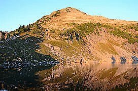
Lime Mountain
A strenuous scramble northwest of Glacier Peak to the high point on Lime Ridge overlooking several lakes.
getting there
From SR-530 turn east on Forest Road 26 (Suiattle River Road), right 7.5 mils north of Darrington or left 11 mils south of Rockport. Continue to the road's end just past the Sulphur Creek Campground.
approach & ascent
Cross the river on a log to the south bank and travel 1 mile up stream to the Milk Creek Trailhead--the bridge here was washed out in the storm of 2003. About 0.25 mile and before crossing the stream from Rivord Lake leave the trail then find a fisherman's path up the steep slope towards Box Mountain Lakes. The path is very difficult to follow initially, but at ~3,600 ft, it becomes more apparent. The summit (6,772 ft) can be easily approached either from the south end or north of Upper Rivord Lake (5,698 ft).
- Suitable Activities: Scrambling
- Seasons: April, May, June, July, August, September, October, November
- Weather: View weather forecast
- Difficulty: Technical 3, Strenuous 5
- Length: 8.0 None
- Elevation Gain: 5,200 ft
- 6,772 ft
-
Land Manager:
Mount Baker-Snoqualmie National Forest
Glacier Peak Wilderness, Darrington Ranger District (MBSNF)
- Parking Permit Required: Northwest Forest Pass
- Recommended Party Size: 12
- Maximum Party Size: 12
- Maximum Route/Place Capacity: 12
- Green Trails Mountain Loop Highway No. 111SX
- Green Trails Glacier Peak No. 112
- USGS Lime Mountain
There are no resources for this route/place. Log in and send us updates, images, or resources.
