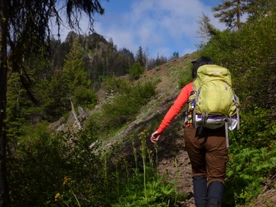
Jungle Creek Loop
An 8.5 mile loop hike with 2,100 feet of elevation gain in the Teanaway near Malcolm Mountain, Johnson Mountain, and Teanaway Butte. The ridge dividing the North and Middle Forks of the Teanaway River offers solitude and views of the peaks along the county line and the Stuart Range behind them. It is just far enough east to escape west-side rain and relatively low enough to offer snow free hiking in the spring.
Getting There
From SR-970 turn onto Teanaway River Road bearing right as it becomes North Fork Teanaway River Road. Turn left at 29 Pines Campground onto Jungle Creek Road and follow it ~3 miles to the Jungle Creek Trailhead (3,000 ft) or another ~2 miles to the Way Creek Trailhead ( 3,600 ft).
On the Trail
Combine the Jungle Creek, Johnson-Medra, Middle Fork Teanaway, and Way Creek Trails as desired to make a loop trip.
- Suitable Activities: Day Hiking
- Seasons: May, June, July, August, September, October
- Weather: View weather forecast
- Difficulty: Moderate
- Length: 8.5 mi
- Elevation Gain: 2,165 ft
- 4,876 ft
-
Land Manager:
Okanogan-Wenatchee National Forests
Cle Elum Ranger District (OWNF)
- Parking Permit Required: Northwest Forest Pass
- Recommended Party Size: 12
- Maximum Party Size: 12
- Maximum Route/Place Capacity: 12
- Green Trails Mt Stuart No. 209
- Green Trails Alpine Lakes East (Stuart Range) No. 208SX
There are no resources for this route/place. Log in and send us updates, images, or resources.
