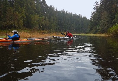
Oak Bay, Irondale & Chimacum Creek
Sea kayak from Irondale, near Port Hadlock, up Chimacum Creek.
Launch Points
- Irondale Beach Park. There is a portable toilet and no parking permits are required.
- Oak Bay County Park. There is a portable toilet and no parking permits are required.
Launch from Irondale Beach Park and paddle north and into the Chimacum Creek outlet.
Oak Bay to
Launch from Oak Bay and paddle north to Irondale and into to Chimacum Creek.
Notes
- Port Townsend tide levels of 8 feet or higher are needed to paddle well up the Chimacum creek.
- Current at Port Townsend Canal can be strong if paddling from or to Oak Bay Park County Park.
- Suitable Activities: Sea Kayaking
- Seasons: Year-round
- Weather: View weather forecast
- Difficulty: *Varies*, Sea Kayak II, Sea Kayak III
- Length: 6.0 nm
- Land Manager: Jefferson County Parks & Recreation
- Parking Permit Required: None
- Recommended Party Size: 12
- Maximum Party Size: 12
- Maximum Route/Place Capacity: 12
- MapTech Puget Sound Chart No. 100
- NOAA Puget Sound: Northern Part No. 18441
This is a list of titles that represent the variations of trips you can take at this route/place. This includes side trips, extensions and peak combinations. Not seeing a title that fits your trip? Log in and send us updates, images, or resources.
- Irondale to Chimacum Creek
- Oak Bay to Irondale
- Oak Bay to Chimacum Creek
There are no resources for this route/place. Log in and send us updates, images, or resources.
