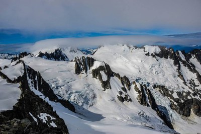
Inspiration-McAllister-Klawatti Ice Cap Traverse
This glacier excursion offers several summits to tag along the way, including Klawatti, Austera, and Primus, stunning views, and peace an quite in the remote North Cascades.
getting there
From I-5 just north of Mount Vernon, drive east on SR-20 (North Cascades Highway) to Marblemount. At Marblemount, turn right onto Cascade River Road and follow it to a large parking area on the right at about Mile 20 (2,100 ft).
Approach
From the parking area backtrack downstream about 90 feet down the road (look for possible flagging), looking for a clump of three trees crossing the river, or one large log. Cross river and walk about 100 feet perpendicular to the river until running into a climber's trail.
Go right (east) upstream on trail. Proceed up and slightly right in open timber following climbers' trail. Stay to right (east) of large windfall and traverse up so that Eldorado Creek is within earshot. After about 1,500 ft gain, talus slopes are reached. Ascend talus (cairns and flags) (do not cross Eldorado Creek) with large cliffs on the left. Go up in center of talus field to break in cliffs with climbers trail to upper boulder field.
Ascend up and right (east), picking up segments of fair-to-good way trails into large basin at about 5,500-5,800 ft. Move up onto ridge on left. Look for a gully to drop down into Roush Creek Basin (best spot found north along ridge). Rope up in Roush Creek Basin, and proceed up snowfields and Eldorado Glacier just left (west) of rocky ridge. Follow this to broad flat area of Inspiration Glacier at about 7,500 ft. Traverse Inspiration Glacier around to north to the base of the East Ridge of Eldorado. From here make a traverse along the Inspiration Glacier to Klawatti col, contouring at about 7,800 ft. Good campsites are found here.
Ascent Route
From Klawatti col continue east on the McAllister glacier and traverse under Klawatti to a small notch at the base of Klawatti's north ridge. From here downclimb (early season) or rappel onto the Klawatti glacier. Traverse below the rocky summit (Point 8200) and continue upwards towards Austera Peak. Ascend snow to rock and scramble to the ridge just to climber's right of the summit. Scramble carefully towards the false summit (loose Class 3). From here either ascend the chockstone gully (low 5th class) or scramble to the right (exposed Class 3-4) to the notch between the summit and false summit. Climb upwards a few feet to the true summit (low 5th class).
Optionally, after climbing Austera continue on to Primus Peak, or return to camp and climb Klawatti.
Descent Route
Retrace the climbing route.
Trip Profile
| Segment | Time (hr) | Elevation Gain (ft) |
|---|---|---|
| Trailhead to Klawatti Col | 7-9 | 5600 |
| Klawatti Col to Klawatti | 2-3 | 600 |
| Klawatti to Camp | 1.5 | -600 |
| Klawatti Col to Austera | 2 | 530 |
| Austera to Primus | 4 | -1500, +1500 |
| Primus to Austera | 3 | -1600, +1600 |
| Austera to Klawatti Col | 1.5 | -530 |
| Klawatti Col to Trailhead | 5-6 | -5600 |
Equipment
Standard glacier travel gear and a small alpine rack.
information for LEADERS
Scheduling
This traverse occasionally includes climbing Eldorado, if you are climbing Eldorado as part of the traverse please check Eldorado Peak/Inspiration Glacier route/place listing to ensure another group is not climbing Eldorado on the same day.
- Suitable Activities: Climbing
- Climbing Category: Intermediate Alpine
- Seasons: May, June, July, August
- Weather: View weather forecast
- Difficulty: Intermediate Mountaineering Climb
- Length: 15.0 mi
- Elevation Gain: 6,000 ft
- 8,334 ft
- Land Manager: North Cascades National Park
- Parking Permit Required: Northwest Forest Pass
- Recommended Party Size: 6
- Maximum Party Size: 6
- Maximum Route/Place Capacity: 6
- USGS Eldorado Peak
- USGS Forbidden Peak
- USGS Cascade Pass
- USGS Sonny Boy Lakes
- Trails Illustrated North Cascades National Park
This is a list of titles that represent the variations of trips you can take at this route/place. This includes side trips, extensions and peak combinations. Not seeing a title that fits your trip? Log in and send us updates, images, or resources.
- Klawatti/S Face and Eldorado Peak/Inspiration Glacier
There are no resources for this route/place. Log in and send us updates, images, or resources.
