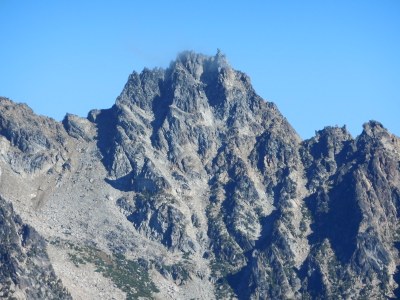
Sherpa Peak/West Ridge
Sherpa Peak via the West Ridge is a Grade II, 5.4 climb.
Getting There
Drive I-90 to exit 85, turn left to SR-970. Drive 6.6 mi and turn left on Teanaway River Road. Follow north fork road approximately 23 miles to end of road at 4,243 ft.
APPROACH
Take Longs Pass Trail over Longs Pass, 6,200 ft, and drop down to Ingalls Creek, 4,800 ft. Cross creek to Ingalls Creek Trail (good log in ‘97) and go right about a mile to the Beverly-Turnpike Trail junction, 4,700 ft.
Leave the trail and ascend rightward across the meadow to where the slope begins to steepen at about 5,000 ft. Cross the stream and ascend the ridge, staying left of the crest. Around 5,800 ft traverse right, cross over the ridge and contour into the basin. Camp available at 6,200 ft or continue up left of cliffband and waterfall to an upper basin camp at 7,400’ on a big, flat rock amidst a boulder field.
ASCENT ROUTE
From high camp climb to Stuart-Sherpa col at about 8,100 ft. Aim for the notch closest to Sherpa. Climb ridge staying close to ridge crest for about 200 ft to a small notch, (class 4). Cross over to south side of ridge crest. Traverse big sandy benches and easy rocks to steep southwest face. Readily ascend broken rock to a small cave (one-third the way up face). The next section is the crux (5.4) of the climb. From here either move right to a jam crack on a flake which leads to a chimney thence to the summit ridge, or move left on small face holds and mantle into a gully that leads to summit ridge.
DESCENT ROUTE
Rappel the ascent route. Two single rope rappels from the top leads to a scramble to another single rope rappel followed by a final double rope rappel. Some single rope rappels can be combined into double with difficult pulls. Some parties also make a rappel down the dirty gully from the notch.
TRIP PROFILE
| SEGMENT | TIME (HR) | ELEVATION GAIN (FT) | Elevation Loss (ft) |
|---|---|---|---|
| Seattle to Trailhead | 2-3 | ||
| Trailhead to Camp | 5-7 | 4,700 | 1,500 |
| Camp to Climb | 1 | 700 | |
| On Climb | 4-6 | 500 | |
| Summit to Trailhead | 6-10 | 1,500 |
EQUIPMENT
Small rack to 1-1/2 in, ice ax in early season.
NOTES
Best done in early season when snow covers talus and water is plentiful. Variations are possible to accommodate greater levels of exposure and difficulty. Rock is solid and easy to protect. Slow parties may need a third day.
- Suitable Activities: Climbing
- Climbing Category: Intermediate Alpine
- Seasons: May, June, July, August, September
- Weather: View weather forecast
- Difficulty: Intermediate Rock Climb
- Elevation Gain: 7,400 ft
- 8,600 ft
-
Land Manager:
Okanogan-Wenatchee National Forests
Alpine Lakes Wilderness
- Parking Permit Required: Northwest Forest Pass
- Recommended Party Size: 12
- Maximum Party Size: 12
- Maximum Route/Place Capacity: 12
- Green Trails Mt Stuart No. 209
- USGS Mount Stuart
There are no resources for this route/place. Log in and send us updates, images, or resources.
