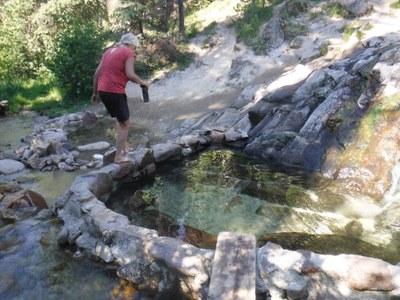
Idaho Hot Springs Mountain Bike Route
A strenuous 180 mile gravel bike route with 12,000 feet of elevation gain. The proximity to hot springs makes this area unique and rewarding at the end of a long day of bicycling.
Getting There
This route starts and ends at Lowman Mercantile, located in Lowman, ID. Paid parking is available. Average driving time from Seattle is 9 hours, or 10 hours from Olympia.
On the Trail
This is a strenuous 180 mile gravel bike route with 12,000 feet of elevation gain. The proximity to hot springs makes this area unique and rewarding at the end of a long day of bicycling. Nightly camping is available near a hot springs, lake, river, or creek. Camping is mostly a mix of dispersed and Forest Service campsites; Warm Lake is a developed campground and charges $15/night. Campsites can vary depending on weather, how many visitors are on the road and at the campsites, and which roads you take. The route includes many hot springs, rivers, lakes, creeks, steep summits with gentle downhills, long flower-filled valleys, and views of craggy peaks.
Suggested Bikepacking Route (6 days/6 nights)
- Start at Lower Mercantile. Ride north on Middle Fork Road towards Cascade, Idaho. Camp before Trail Creek Summit.
- Resupply in Cascade. Go east on Warm Lake Rd. Camp at Warm Lake, which is a developed campground and charges $15 per night. Good burgers at the lodge on the lake. Lovely swimming. Watch for moose - they travel through the campground to the lake. Stock up a full 2 days of food, the town of Lowman is the only grocery store in this area (unless you go about 30 miles off route to Stanley - then 30 miles back to route).
- Go east of Warm Lake on Road 579. Road 579 heads south after approximately 10 miles. Warm Lake Summit is 7290' and the road is steep up to it. Deadwood Outfitters at about 20 miles. Only had potato chips available in 2021, but they are friendly and will let you fill water bottles. Camp near Bear Valley. Fir Creek campground may/may not be maintained, but it is a flat area near creek to camp.
- Take the Lowman Cutoff (Highway 21) south. The cutoff is approximately 60 miles in length without a lot of elevation (one 7,000 foot summit). There are hot springs on this road, some are off route a few miles. There are 2 lodges that offer meals and a few restaurants in Lowman. Camp three nights along this road before returning to cars.
This itinerary incorporates one day of biking that the group may or may not choose to ride. Extra side trips to visit additional hot springs are available.
Notes
Parts of this route can be dusty so bring a mask. A few areas have ATVs on the roads, but they are very courteous and slow down when passing bicyclists.
Bears are frequent in the area, so food will need to be hung or put in bear cannisters.
- Suitable Activities: Bikepacking
- Seasons: June, July, August, September
- Weather: View weather forecast
- Avalanche Terrain Rating Simple
- Difficulty: Bikepacking Gravel III
- Length: 180.0 mi
- Elevation Gain: 12,000 ft
- Land Manager: Land Manager Varies
- Parking Permit Required: see Land Manager
- Recommended Party Size: 6
- Maximum Party Size: 6
- Maximum Route/Place Capacity: 6
There are no resources for this route/place. Log in and send us updates, images, or resources.
